1 m away
North East Simkin

A relatively featureless and faceless area, providing a nice gentle pitch rolling into steeper terrain towards Leatherbarrel creek
Moderate Freeride Skiing
- Distance
- 1 km
- Ascent
- 0 m
- Descent
- 153 m

Your choice of one of two gullies heading east from Simkin Peak
Freeride Skiing Moderate

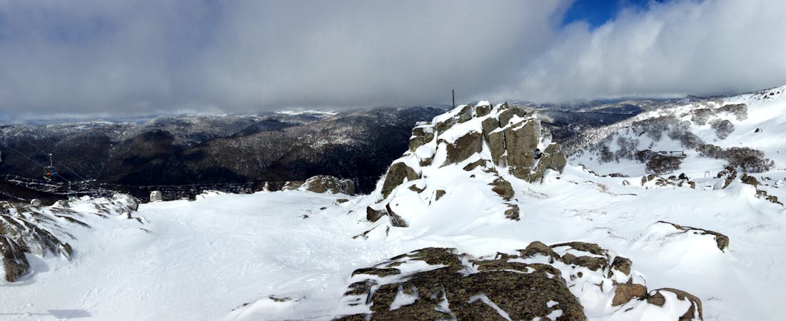
From Simkin Peak, head eastwards, and you will have a rocky area to your right, as the gradient begins to steepen. From here you have a choice of two gullies (as shown on the map) with the northerly being generally steeper, with a steep section around the middle before dropping into a nicely gladed area, meanwhile the southerly gully maintains a slightly mellower gradient down to Leatherbarrel Creek commonly holding better snow conditions. From the top, the two gullies are distinguished fairly easily, for the southerly gully, at the beginning you will have a rocky area to the right as you head eastwards off Simkin, follow the rocky line towards the south, and you will soon see the gully begin to form below you on the more shaded southerly face, the area below features some nicely spaced trees, before meeting the main drainage line to the south, keep to the left of the creek as it can often open up throughout the season. For the northern gully, as you head eastwards off the peak, you will see a knoll in front of you on the way down, the gully then follows the drop off this, sometimes corniced, knoll. After this knoll, the run steepens down to the tree line, from here follow the drainage lines down to Leatherbarrel Creek through the trees. As stated above the knoll on the northerly gully can hold a cornice, so take care with it and avoid when warmer temperatures in spring hit, as it will be more prone to collapse. Snow conditions here are generally pretty good, with the southern gully holding fresh snow and the base better than the northern gully, with the top section for both, often being scoured by the wind. For the return, either head up the slope again, taking care of the cornice on the northern gully, I would say by keeping to the ridge line on the left on the way up to avoid them, or head up Golden Gully for a return to Dead Horse Gap. If you're heading back to Thredbo, follow the Leatherbarrel Creek return, as shown on the map.
Moderate
Slopes become slightly steeper at around 25-30 degrees.
1 m away

A relatively featureless and faceless area, providing a nice gentle pitch rolling into steeper terrain towards Leatherbarrel creek
Moderate Freeride Skiing
459 m away

Dropping sharply towards the north east of the Northern Twin Hump, this rolls down and mellows before hitting Leatherbarrel Creek.
Difficult Freeride Skiing
459 m away

Dropping Eastwards down towards Leatherbarrel Creek
Difficult Freeride Skiing
555 m away

Providing a steep entry then into sheltered gladed terrain, this area can hold some surprisingly good skiing
Moderate Freeride Skiing
1.7 km away

Starting on the summit of the Ramshead and heading the major drainage gully to the north, dropping down to Leatherbarrel Creek
Difficult Freeride Skiing
1.8 km away

Further south down the valley from the likes of The Spur, this run provides some nice turns amongst the trees down to Leatherbarrel Creek
Difficult Freeride Skiing
1.8 km away

The most vertical you will find in the valley, following the western spur from the Ramshead.
Moderate Freeride Skiing
1.9 km away

Steep and rocky, leading into a more open bowl down to Leatherbarrel Creek
Severe Freeride Skiing
1.9 km away

Golden rocks at the top of a continuous fall line down to Leatherbarrel Creek, provides some fantastic skiing with options from the Ramshead into the gully.
Difficult Freeride Skiing
1.9 km away

A great entry run into the backcountry with a relatively gentle gradient, above and below the tree line, featuring nicely spaced gums lower down for some tree skiing.
Moderate Freeride Skiing

34 routes · Freeride Skiing · Ski Touring