477 m away
The Couloir

Starting on the summit of the Ramshead and heading the major drainage gully to the north, dropping down to Leatherbarrel Creek
Difficult Freeride Skiing
- Distance
- 1 km
- Ascent
- 0 m
- Descent
- 360 m
Steep and rocky, leading into a more open bowl down to Leatherbarrel Creek
Freeride Skiing Severe

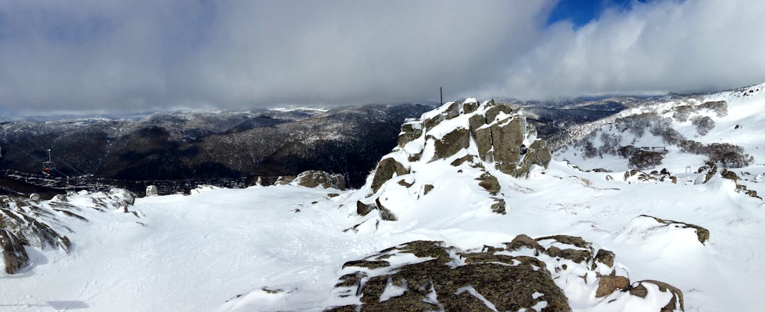
The Corrie begins approximately 500 metres north of the Ramshead and follows a major gully westward into Leatherbarrel Creek. The beginning of the run is typified with a steep entry between two rounded rocky outcrops, and funnels into a relatively narrow chute, before leading to the rider's right, opening out wide and mellowing out slightly. Cover needs to be good to negotiate the initial rock bands of the chute, whilst the lower more sheltered parts of the run fill in thick and fast. There can also be plenty of sharks in early season, so really assess the base and cover from using a scoping/warm up run to the north, possibly following the line of the Leatherbarrel Creek Return marked on the map, to give a clear indication of what condition the rocky area is in. When conditions are icy, this run can be treacherous, but in spring when cover is deep and the snow is soft, it can be absolutely fantastic. Lines either side of this chute are possible, but again, really assess the conditions and scope carefully, this is serious terrain. Take care of avalanches here, as there has been debris in the area fairly often. To return back to Ramshead, the easiest way is to follow the Leatherbarrel Creek Return route noted on the map.
Severe
Steep skiing at 38-45 degrees. This requires very good technique and the risk of falling has serious consequences.

As well as the slope itself, there are some obstacles (such as rock outcrops) which could aggravate injury.

Little chance of being seen or helped in case of an accident.
477 m away
Starting on the summit of the Ramshead and heading the major drainage gully to the north, dropping down to Leatherbarrel Creek
Difficult Freeride Skiing
588 m away

The most vertical you will find in the valley, following the western spur from the Ramshead.
Moderate Freeride Skiing
1.1 km away

Golden rocks at the top of a continuous fall line down to Leatherbarrel Creek, provides some fantastic skiing with options from the Ramshead into the gully.
Difficult Freeride Skiing
1.3 km away

A great entry run into the backcountry with a relatively gentle gradient, above and below the tree line, featuring nicely spaced gums lower down for some tree skiing.
Moderate Freeride Skiing
1.5 km away

A local favourite, dropping 400 vertical metres not too far from Thredbo dropping down to Dead Horse Gap car park.
Moderate Freeride Skiing
1.8 km away

Further south down the valley from the likes of The Spur, this run provides some nice turns amongst the trees down to Leatherbarrel Creek
Difficult Freeride Skiing
1.9 km away

A relatively featureless and faceless area, providing a nice gentle pitch rolling into steeper terrain towards Leatherbarrel creek
Moderate Freeride Skiing
1.9 km away

Your choice of one of two gullies heading east from Simkin Peak
Moderate Freeride Skiing
2.2 km away

Dropping sharply towards the north east of the Northern Twin Hump, this rolls down and mellows before hitting Leatherbarrel Creek.
Difficult Freeride Skiing
2.2 km away

Dropping Eastwards down towards Leatherbarrel Creek
Difficult Freeride Skiing

10 routes · Freeride Skiing
34 routes · Freeride Skiing · Ski Touring
4 routes · Freeride Skiing · Hiking · Ski Touring