667 m away
The Cleft Rock Run

Further south down the valley from the likes of The Spur, this run provides some nice turns amongst the trees down to Leatherbarrel Creek
Difficult Freeride Skiing
- Distance
- 1.3 km
- Ascent
- 20 m
- Descent
- 387 m
The rocky peak drops into mellow gladed terrain, which holds the snow tremendously well
Freeride Skiing Moderate

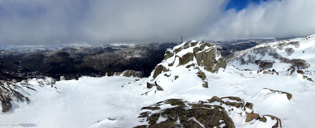
The South Ramshead is often overlooked in favour of it's northerly counterparts, but in fact the area holds some, short, yet good quality skiing, with the area holding some great quality snow when other areas are either tracked out or iced over. The initial steep drop over the craggy summit holds a steep pitch for the first 150 metres or so of vertical gives way slightly in pitch but gains some really nice gladed terrain, which continues to drop at a nice grade, allowing you to cruise through the trees soaking up spring sun, or pick up speed and get some nice dry slashes in winter. This area is definitely a pick and mix in terms of lines, there are obvious lines of rocks, which can easily be avoided by simply looking at where you are going, and with creeks often popping up in gullies, the spur lines are the best pick. The area fills in fairly quickly, and holds well, just take care with the rocks up on the eastern and southern face of the summit. The best return, is simply hiking up the way you came, and if you are heading back to Dead Horse Gap, hike back up, and traverse over to Bogong Creek.
Moderate
Slopes become slightly steeper at around 25-30 degrees.

As well as the slope itself, there are some obstacles (such as rock outcrops) which could aggravate injury.

Little chance of being seen or helped in case of an accident.
667 m away
Further south down the valley from the likes of The Spur, this run provides some nice turns amongst the trees down to Leatherbarrel Creek
Difficult Freeride Skiing
1.2 km away

A great entry run into the backcountry with a relatively gentle gradient, above and below the tree line, featuring nicely spaced gums lower down for some tree skiing.
Moderate Freeride Skiing
1.4 km away

Golden rocks at the top of a continuous fall line down to Leatherbarrel Creek, provides some fantastic skiing with options from the Ramshead into the gully.
Difficult Freeride Skiing
1.9 km away

The most vertical you will find in the valley, following the western spur from the Ramshead.
Moderate Freeride Skiing
2 km away

Starting on the summit of the Ramshead and heading the major drainage gully to the north, dropping down to Leatherbarrel Creek
Difficult Freeride Skiing
2 km away

Providing a steep entry then into sheltered gladed terrain, this area can hold some surprisingly good skiing
Moderate Freeride Skiing
2 km away

Dropping Eastwards down towards Leatherbarrel Creek
Difficult Freeride Skiing
2 km away

Dropping sharply towards the north east of the Northern Twin Hump, this rolls down and mellows before hitting Leatherbarrel Creek.
Difficult Freeride Skiing
2.3 km away

Your choice of one of two gullies heading east from Simkin Peak
Moderate Freeride Skiing
2.3 km away

A relatively featureless and faceless area, providing a nice gentle pitch rolling into steeper terrain towards Leatherbarrel creek
Moderate Freeride Skiing
34 routes · Freeride Skiing · Ski Touring