222 m away
Tobel Trees
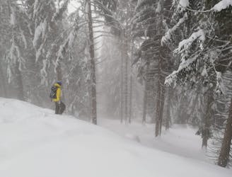
A fun adventure with a bit of everything from open slopes to tight trees.
Difficult Freeride Skiing
- Distance
- 1.9 km
- Ascent
- 5 m
- Descent
- 749 m
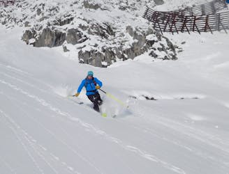
A brilliant journey into some amazing tree skiing and big terrain.
Freeride Skiing Difficult

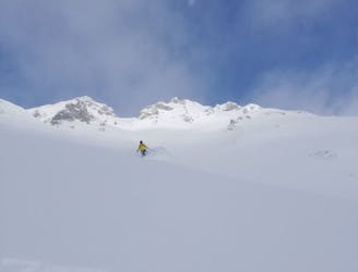
Although not difficult, this line feels wild and takes you onto some huge south facing slopes. As such, pick your days carefully because the avalanche danger can be significant here. In good conditions, this is a fantastic ski line. Start at the top of the Frau-Hitt-Warte chairlift and traverse west onto the huge open face immediately in front of you as you get off the chairlift. Ski across the top of one gully to reach a second one. Drop into this wherever looks best and enjoy the ride through open trees followed by a narrow gully below. All too soon you will reach an established track leading back left onto the lower pistes of the Nordkette area.
Difficult
Serious gradient of 30-38 degrees where a real risk of slipping exists.

As well as the slope itself, there are some obstacles (such as rock outcrops) which could aggravate injury.

In the high mountains or remote conditions, all individuals must be completely autonomous in every situation.
222 m away
A fun adventure with a bit of everything from open slopes to tight trees.
Difficult Freeride Skiing
788 m away

A great extension which is possible only in the snowiest of conditions.
Difficult Freeride Skiing
922 m away

A true classic of Innsbruck and a good introduction to steeper freeride lines.
Severe Freeride Skiing
936 m away
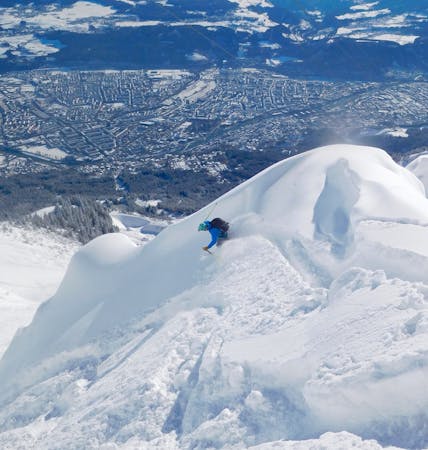
A steep and incredibly well positioned line perched high above Innsbruck city.
Severe Freeride Skiing
937 m away

A good place to start at Nordkette, this line is easier than its neighbours but still shouldn't be underestimated.
Difficult Freeride Skiing
990 m away
A truly epic ski descent through some huge terrain.
Severe Freeride Skiing

10 routes · Freeride Skiing

7 routes · Freeride Skiing

50 routes · Freeride Skiing · Ski Touring
8 routes · Freeride Skiing · Ski Touring

10 routes · Freeride Skiing