15 m away
Seilbahnrinne Hafelekar
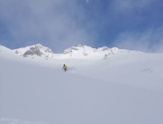
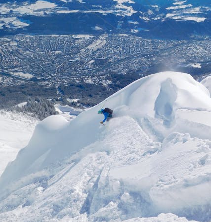
A steep and incredibly well positioned line perched high above Innsbruck city.
Severe Freeride Skiing
- Distance
- 697 m
- Ascent
- 0 m
- Descent
- 397 m

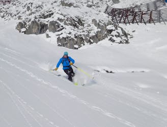
A brilliant steep freeride couloir with some great rip-able terrain below.
From the Hafelekar cable car station, at the top of the Nordkette ski area, hike west along a signposted path for 10 minutes to reach a col overlooking a stone hut. Put skis on here and zip across the shallow bowl immediately north of the hut to reach the wide col at the top of this line. Drop into the line, which is 40 degrees and 10 metres wide at the top and gradually opens into a wide, fun slope below. Rip down this, making sure you always drift right in order to reach the Übungshang piste. If you ski straight down towards the Seegrubbe lift station (instead of drifting right to the piste) you will end up in the big dip to the north of the Seegrubbe and will have to hike out. It's only a 3 minute hike but it will reduce your "cool points" with the tourists who watch people ski this line!
Severe
Steep skiing at 38-45 degrees. This requires very good technique and the risk of falling has serious consequences.

As well as the slope itself, there are some obstacles (such as rock outcrops) which could aggravate injury.

Little chance of being seen or helped in case of an accident.
15 m away
A steep and incredibly well positioned line perched high above Innsbruck city.
Severe Freeride Skiing
17 m away

A good place to start at Nordkette, this line is easier than its neighbours but still shouldn't be underestimated.
Difficult Freeride Skiing
68 m away
A truly epic ski descent through some huge terrain.
Severe Freeride Skiing
773 m away
A fun adventure with a bit of everything from open slopes to tight trees.
Difficult Freeride Skiing
922 m away

A brilliant journey into some amazing tree skiing and big terrain.
Difficult Freeride Skiing
1.7 km away

A great extension which is possible only in the snowiest of conditions.
Difficult Freeride Skiing

10 routes · Freeride Skiing

7 routes · Freeride Skiing

50 routes · Freeride Skiing · Ski Touring
8 routes · Freeride Skiing · Ski Touring

10 routes · Freeride Skiing