534 m away
8er Jet ride

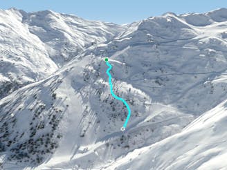
Nice route under the 8er Jet, OK in bad conditions
Moderate Freeride Skiing
- Distance
- 549 m
- Ascent
- 0 m
- Descent
- 257 m
Short and steep section with trees and woods, fun in bad weather.
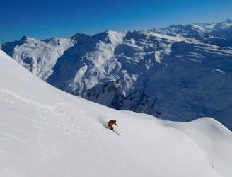
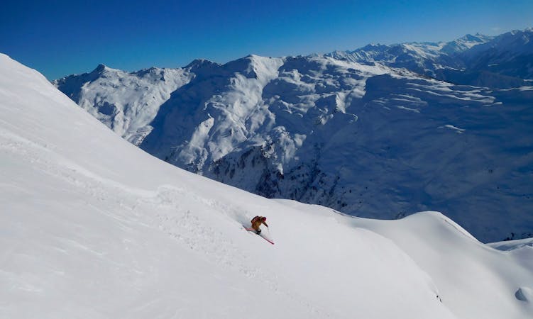
Freeride Skiing Difficult

This route is a good addition to the runs on the east side, when you want to go back to the bottom of the valley or if the weather conditions aren't that good. Take the 8er Jet to the top and follow piste number 13, past the 2000er chairlift bottom station, here the piste turns more to the left, follow it for 200 more metres. There is a wide open slope appearing on the left side, ski into it, before the red piste here gets steeper. At the beginning of the slope you have some steep small couloirs with some trees around here at the top. It's better to stay more on the right side here, because there it's easier to get down these couloirs. After them you find a steep slope with a 250 metre descent. There are some small rocks about 2 metres high on the slope, here you can take every single one if you choose to. Try to gain some speed at the end and follow the tracks back to the piste number 14, to go back to 8er Jet or to do some runs at the Pfaffenbühel T-Bar. This route is a good one for days with bad vis, when it's a little secret spot.
Difficult
Serious gradient of 30-38 degrees where a real risk of slipping exists.

As well as the slope itself, there are some obstacles (such as rock outcrops) which could aggravate injury.

Close to help in case of emergency.
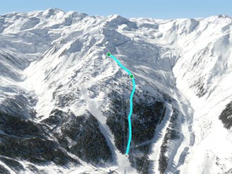
534 m away
Nice route under the 8er Jet, OK in bad conditions
Moderate Freeride Skiing
590 m away

Short route with steep parts and cliffs underneath the 8er Jet gondola.
Difficult Freeride Skiing
803 m away
Nice tree run with bumps, good on bad days
Difficult Freeride Skiing
913 m away

Secret tree run, ideal line on bad days.
Moderate Freeride Skiing
922 m away

Bumpy classic ride with a long descent, often crowded
Difficult Freeride Skiing
948 m away
Tree run for bad days
Difficult Freeride Skiing
949 m away

Wide slope in the woods, nice run for bad weather days.
Difficult Freeride Skiing
1.2 km away

Beautiful route with a long descent and a breathtaking panorama
Difficult Freeride Skiing
1.2 km away
Long joyful route in a big area without any lifts and a kind of Alaska feeling.
Difficult Freeride Skiing
1.2 km away

Long joyful descent in a winder wonderland
Difficult Freeride Skiing
6 routes · Freeride Skiing

50 routes · Freeride Skiing · Ski Touring

10 routes · Freeride Skiing

10 routes · Freeride Skiing