820 m away
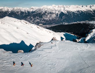
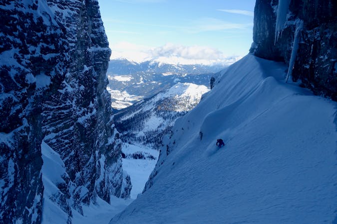
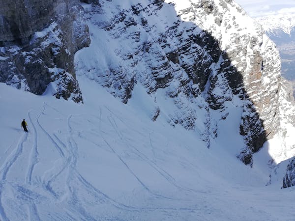
Niederer Rinne
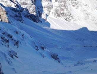
A beautiful freeride couloir.
Moderate Ski Touring
- Distance
- 588 m
- Ascent
- 183 m
- Descent
- 183 m
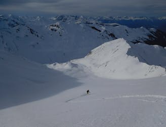
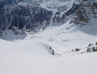
A short, narrow couloir followed by a powder-filled face.
Ski Touring Difficult

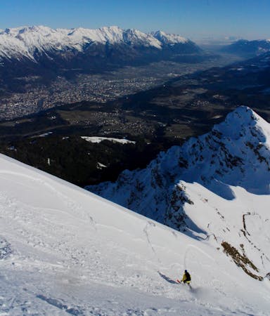
Ride the Zirmachbahn chairlift and from the top (2240 metres), make a 500 metre descending traverse, holding as much height as possible, to reach the large bowl to the north of the Hoher Burgstall peak. Put skins on and climb up the bowl, heading for the narrow couloir just looker's right of the Hoher Burgstall peak. The final 100 metres of the ascent (in the couloir itself) is narrow and quite steep (35 degrees+) so you may need to bootpack. The whole ascent takers around an hour and deposits you on a lovely little col with a view down the Stubai Valley. From the col, strip your skins off and enjoy the ride down! Carry on down past where you put skins on a final few hundred metres of nice mellow tree skiing will lead you to the Burgstall Abfahrt piste.
Difficult
Serious gradient of 30-38 degrees where a real risk of slipping exists.

Exposure is limited to that of the slope itself. Getting hurt is still likely if the slope is steep and/or the snow is hard.

Away from help but easily accessed.
820 m away
A beautiful freeride couloir.
Moderate Ski Touring
1.2 km away
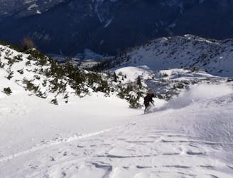
A brilliant journey that begins in a lift system and ends in a wild and peaceful valley.
Difficult Ski Touring
1.3 km away
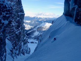
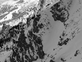
A steep, narrow and other-worldly line in amongst the towering walls of the Kalkogel peaks.
Difficult Ski Touring
1.3 km away
A lovely ski tour which takes in some fine scenery.
Moderate Ski Touring
4.2 km away

A wide and beautiful couloir.
Difficult Ski Touring
4.6 km away

3 cracking couloirs which lead straight to a pub!
Difficult Ski Touring
4.7 km away
A narrow and exciting gully.
Difficult Ski Touring
5 km away
An awe inspiring journey around the Kalkogel range, home to some of Tirol's most dramatic peaks.
Difficult Ski Touring
5.2 km away

An amazing peak that manages to feel wild despite its proximity to the ski area.
Moderate Ski Touring
5.3 km away
A very "out there" feeling line which is undeniably serious and takes you through some extraordinary mountain terrain.
Severe Ski Touring
5 routes · Ski Touring

50 routes · Freeride Skiing · Ski Touring
6 routes · Ski Touring

25 routes · Ski Touring
6 routes · Ski Touring