698 m away
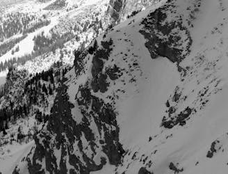
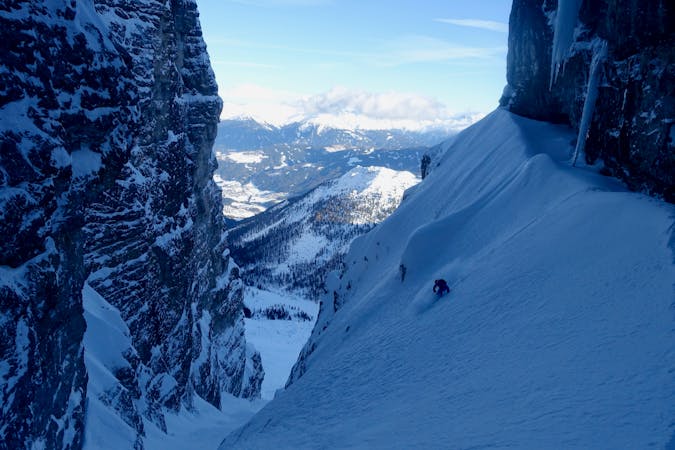
Nockspitze West Face
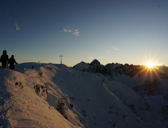
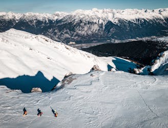
One of the most classic views over Innsbruck and a great ski descent
Moderate Ski Touring
- Distance
- 2.6 km
- Ascent
- 376 m
- Descent
- 375 m
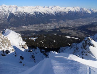
A narrow and atmospheric line from an iconic summit.
Ski Touring Difficult

From the top of the Birgitzköpfl chairlift, put skins on and make a rising traverse south-east for 100 horizontal metres towards a wide gully descending from a col. Skin up the gully (which narrows and steepens at the top but should be skin-able all the way) to the col. This ascent should take about 30 - 40 minutes and the terrain is 35 degrees maximum. Once at the col, continue climbing, slowly swinging round to the left, following natural shape of the ridge you've just reached, and climb easily to the summit of Saile (the name of the Nockspitze's higher of 2 summits). Take skins off and ski north for 50 metres to the col which separates the 2 summits of the Nockspitze. From the col, the line is on the left. The entry is steep at around 35 - 40 degrees for 20 metres, and the line then funnels and narrows but also becomes slightly less steep. Follow the couloir, which at times is just a couple of metres wide, to the wide triangular slope beneath it. Put the pedal to metal and blast down this then either skin for 10 minutes back to the Birgitzköpfl chairlift or turn right and head down to the Götzens Linkup and on down to the village of Götzens.
Difficult
Serious gradient of 30-38 degrees where a real risk of slipping exists.

As well as the slope itself, there are some obstacles (such as rock outcrops) which could aggravate injury.

Little chance of being seen or helped in case of an accident.
698 m away
One of the most classic views over Innsbruck and a great ski descent
Moderate Ski Touring
699 m away
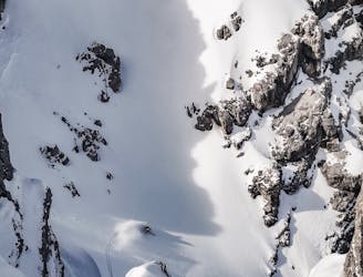
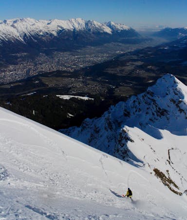
An exciting ski line which is visible from virtually all of Innsbruck city centre.
Severe Ski Touring
1.7 km away
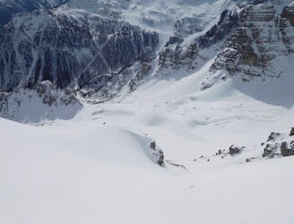
The most famous couloir in Kalkkögel!
Difficult Ski Touring
1.9 km away

A great little lift assisted ski tour which begins at the top of the Olympiabahn lift and finishes at the bottom of it.
Moderate Ski Touring
2.4 km away
An exposed traverse leads to a lovely hanging face.
Difficult Ski Touring
2.4 km away
A very "out there" feeling line which is undeniably serious and takes you through some extraordinary mountain terrain.
Severe Ski Touring
3 km away

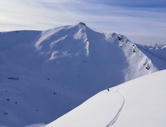
An amazing peak that manages to feel wild despite its proximity to the ski area.
Moderate Ski Touring
3.3 km away

3 cracking couloirs which lead straight to a pub!
Difficult Ski Touring
3.5 km away
A narrow and exciting gully.
Difficult Ski Touring
3.6 km away
An awe inspiring journey around the Kalkogel range, home to some of Tirol's most dramatic peaks.
Difficult Ski Touring
5 routes · Ski Touring

50 routes · Freeride Skiing · Ski Touring
6 routes · Ski Touring

25 routes · Ski Touring