1.8 km away
Ochsenboden / Flexenmulde

Superb long run with often deep powder.
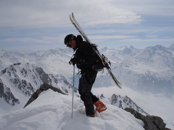
Difficult Freeride Skiing
- Distance
- 2.3 km
- Ascent
- 4 m
- Descent
- 611 m
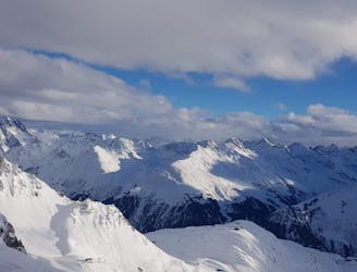
An enjoyable south facing run over St.Christoph.
Also in Tirol, Austria
Freeride Skiing Moderate

From the top of the Valfagehrbahn chairlift either follow route18 back under the lift, or head directly over onto the east face and bear right to connect with the other route below the rock band. The first option can be less tracked, take a left turn off route18 through a U-shaped passage, this first section is fairly steep and one must eventually navigate through the rock band onto the gentle south facing slopes. Its a nice alternate way down from the Valfagehrbahn chairlift, however, the traverse back to the chair can be long and tiring, but its away from the crowds.
Moderate
Slopes become slightly steeper at around 25-30 degrees.

As well as the slope itself, there are some obstacles (such as rock outcrops) which could aggravate injury.
Away from help but easily accessed.
1.8 km away
Superb long run with often deep powder.
Difficult Freeride Skiing
2.3 km away

Challenging terrain for the experienced on leeside slopes.
Severe Freeride Skiing
2.4 km away
Freeride tour for skiers & split-boarders
Difficult Freeride Skiing
3.9 km away

A classic Albona long wide open run finishing in the town of Stuben.
Moderate Freeride Skiing
4 km away

An Arlberg classic run for experienced skiers and riders.
Difficult Freeride Skiing
4.7 km away

A great run in powder and spring snow.
Difficult Freeride Skiing
5.5 km away

A superb wide open run with great views. A classic Zurs freeride.
Difficult Freeride Skiing
5.6 km away

A good run for dry powder in the Zurs front country.
Moderate Freeride Skiing
5.6 km away

A nice moderate open run down to Zurs-worth the traverse.
Moderate Freeride Skiing
5.8 km away

Wide slopes and not too challeging in the Zurs front country.
Easy Freeride Skiing
10 routes · Freeride Skiing