240 m away
Geisleger

A classic Albona long wide open run finishing in the town of Stuben.
Moderate Freeride Skiing
- Distance
- 3.9 km
- Ascent
- 50 m
- Descent
- 1 km
An Arlberg classic run for experienced skiers and riders.
Freeride Skiing Difficult

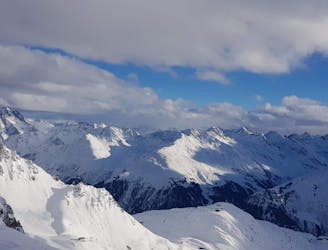
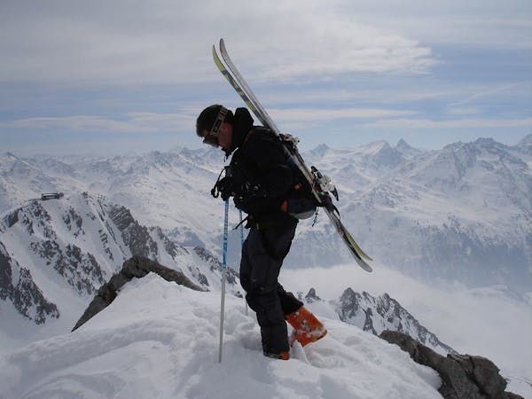
From top station, the Albonagrat chairlift, head west towards the restaurant then turn left to start the climb to the Mariokopfe summit. Skins or snowshoes are highly recommended for this ascent which can take approximately 30minutes. After enjoying spectacular views from the summit, head west over the saddle which will take you to an awe-inspiring wide bowl called Krachel. From here decisions will have to be made if to drop directly into the bowl or traverse a bit further, either way fabulous terrain exist wherever one decides to drop into this large stupendous bowl. The first section being moderately steep, then the bowl levels out enabling the skier/rider to enjoy some large open turns in often superb deep powder. The valley then narrows where there is a waterfall which is a steep narrow section which may require sideslipping. Once through this section the slope levels and opens out again towards a mountain hut. From here the track snakes its way through the trees eventually finishing up at Langen railway station where a bus can take you back to Stuben or the train to St.Anton. The lower section can become quite rutted as this is a popular run with ski guides.
Difficult
Serious gradient of 30-38 degrees where a real risk of slipping exists.

As well as the slope itself, there are some obstacles (such as rock outcrops) which could aggravate injury.

Little chance of being seen or helped in case of an accident.
240 m away
A classic Albona long wide open run finishing in the town of Stuben.
Moderate Freeride Skiing
821 m away

A great run in powder and spring snow.
Difficult Freeride Skiing
4 km away

An enjoyable south facing run over St.Christoph.
Moderate Freeride Skiing
4.4 km away

Superb long run with often deep powder.
Difficult Freeride Skiing
4.9 km away
Freeride tour for skiers & split-boarders
Difficult Freeride Skiing
4.9 km away

Challenging terrain for the experienced on leeside slopes.
Severe Freeride Skiing
5.2 km away

A superb wide open run with great views. A classic Zurs freeride.
Difficult Freeride Skiing
5.4 km away

A nice moderate open run down to Zurs-worth the traverse.
Moderate Freeride Skiing
5.6 km away

A good run for dry powder in the Zurs front country.
Moderate Freeride Skiing
6.9 km away

A nice moderate run with options of steep terrain and small trees. Possible in poorer visibility.
Moderate Freeride Skiing
10 routes · Freeride Skiing