821 m away
Mariokopfe-Langen.

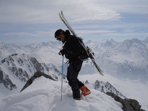
An Arlberg classic run for experienced skiers and riders.
Difficult Freeride Skiing
- Distance
- 7.4 km
- Ascent
- 244 m
- Descent
- 1.4 km
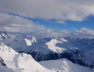
A great run in powder and spring snow.
Freeride Skiing Difficult

From the top station, Albonagrat, head towards the restaurant and continue along passing alongside to the left of the restaurant over the Maroijochle as though you were to head down the Geisleger slope. Keep left here then traverse onto a north west facing shoulder. This traverse is difficult on a snowboard, therefore snowshoes or a splitboard is recommended. This an official hiking path in summer, the route should become clear and the hut will come into view at a slightly lower elevation where the first section of the run commences over a gentle slope. Keeping left of the hut then proceed over amazing open terrain all the way to the treeline. Once at the treeline traverse left to join a steeper slope which then leads down to the valley where it connects with the Maroikopfe freeride route. Head towards a hut and the track through the trees to Langen railway station. The final section through the trees can become tracked and rutted as it is busy with ski guides.
Difficult
Serious gradient of 30-38 degrees where a real risk of slipping exists.

As well as the slope itself, there are some obstacles (such as rock outcrops) which could aggravate injury.

Little chance of being seen or helped in case of an accident.
821 m away
An Arlberg classic run for experienced skiers and riders.
Difficult Freeride Skiing
1 km away

A classic Albona long wide open run finishing in the town of Stuben.
Moderate Freeride Skiing
4.7 km away

An enjoyable south facing run over St.Christoph.
Moderate Freeride Skiing
4.9 km away

Superb long run with often deep powder.
Difficult Freeride Skiing
5.1 km away

A superb wide open run with great views. A classic Zurs freeride.
Difficult Freeride Skiing
5.3 km away

A nice moderate open run down to Zurs-worth the traverse.
Moderate Freeride Skiing
5.4 km away
Freeride tour for skiers & split-boarders
Difficult Freeride Skiing
5.4 km away

Challenging terrain for the experienced on leeside slopes.
Severe Freeride Skiing
5.5 km away

A good run for dry powder in the Zurs front country.
Moderate Freeride Skiing
7 km away

A nice moderate run with options of steep terrain and small trees. Possible in poorer visibility.
Moderate Freeride Skiing
10 routes · Freeride Skiing