31 m away
Antenne

Challenging terrain for the experienced on leeside slopes.
Severe Freeride Skiing
- Distance
- 4.1 km
- Ascent
- 168 m
- Descent
- 676 m
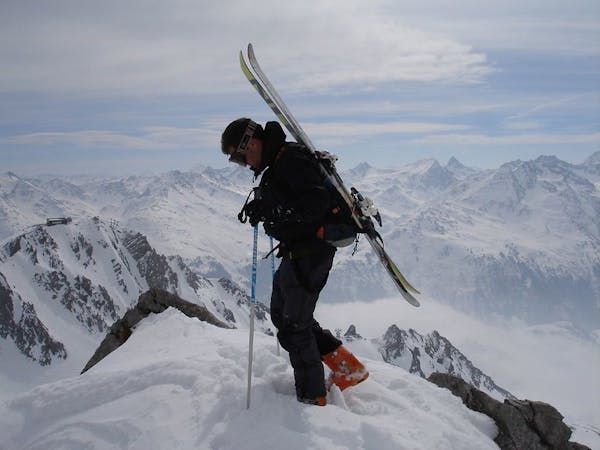
Freeride tour for skiers & split-boarders
Freeride Skiing Difficult

Take the gondola Trittkopf I/II. From here, it will take about 45 minutes with skins to the Trittkopf peak. Sometimes it is easiest to first put the skis on the pack and hike straight up, following an often broken trail along the ridge to Noerdlicher Trittkopf.
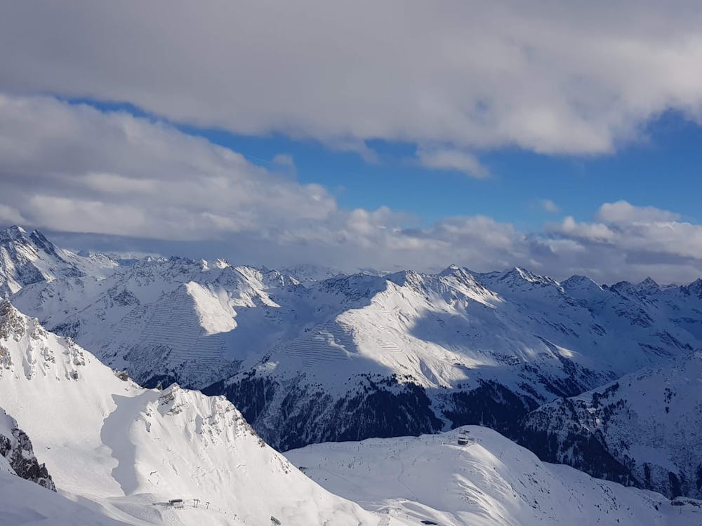
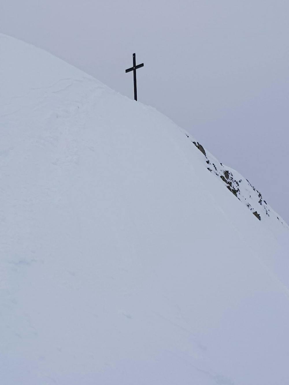
Once reaching the peak, or slightly before, the terrain gets less steep. Put your skins on and turn lookers right along the ridge towards the main peak of Trittkopf. Be careful. Do not go too far left since the ridge often has a huge cornice which can collapse. The last meters to the cross can be slightly funny depending on conditions, you essentially turn left from the right, crampons can come handy at times. The peak has a beautiful cross on the top.
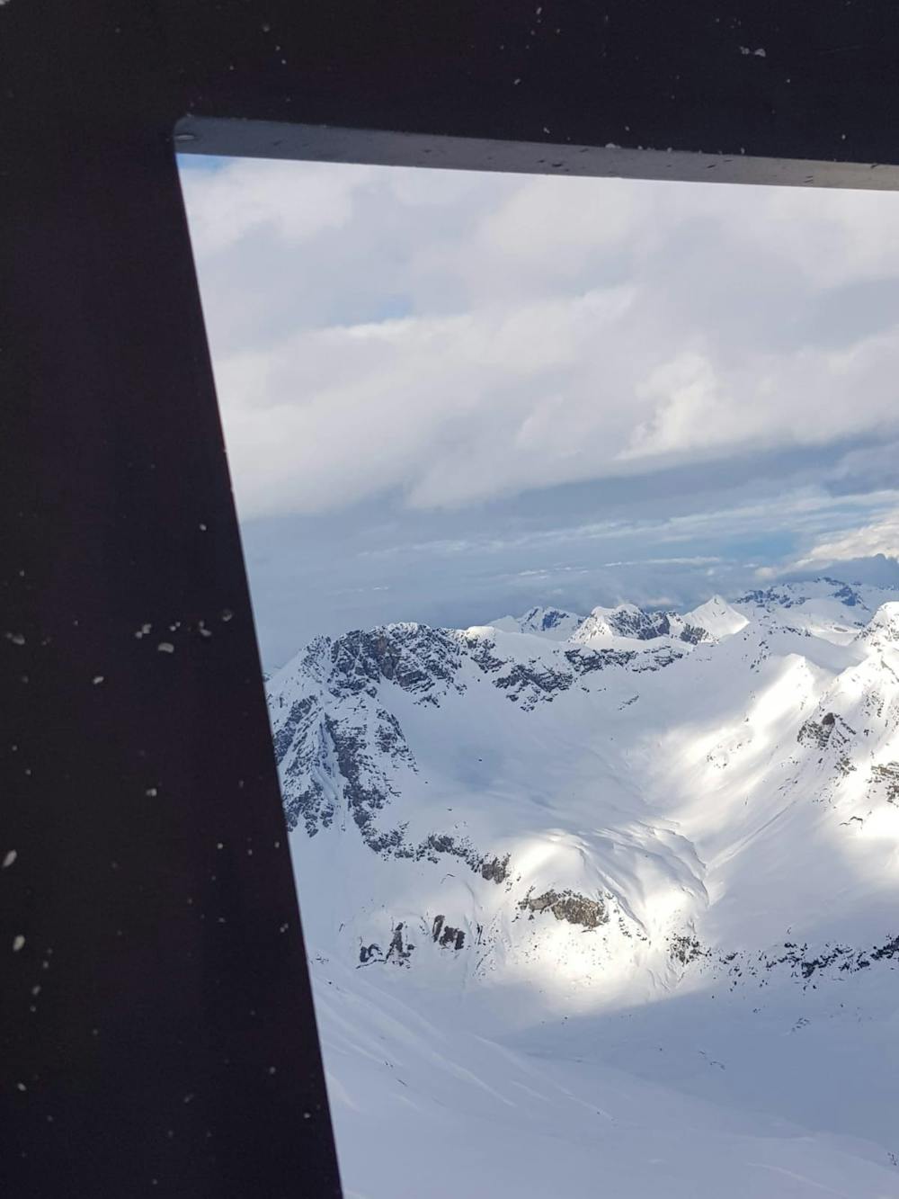
There are two obvious runs: One starts right from the cross north facing down into Pazieltal (this Fatmap route). Conditions can be amazing even two weeks after a storm, the face has only been getting skied more regularly in the recent years. To get back follow the shallow valley to the resort. If you go with your snowboard, consider a split otherwise the return can be painful with a board.
The other one is west facing through an obvious couloir: https://fatmap.com/routeid/2739420/trittkopf-bunny-hill
Difficult
Serious gradient of 30-38 degrees where a real risk of slipping exists.

As well as the slope itself, there are some obstacles (such as rock outcrops) which could aggravate injury.
Away from help but easily accessed.
31 m away
Challenging terrain for the experienced on leeside slopes.
Severe Freeride Skiing
596 m away

Superb long run with often deep powder.
Difficult Freeride Skiing
2.4 km away

An enjoyable south facing run over St.Christoph.
Moderate Freeride Skiing
3.5 km away

Wide slopes and not too challeging in the Zurs front country.
Easy Freeride Skiing
3.7 km away

A good run for dry powder in the Zurs front country.
Moderate Freeride Skiing
3.7 km away

A superb wide open run with great views. A classic Zurs freeride.
Difficult Freeride Skiing
3.8 km away

A nice moderate run with options of steep terrain and small trees. Possible in poorer visibility.
Moderate Freeride Skiing
3.8 km away

A nice moderate open run down to Zurs-worth the traverse.
Moderate Freeride Skiing
4.9 km away

A classic Albona long wide open run finishing in the town of Stuben.
Moderate Freeride Skiing
4.9 km away

An Arlberg classic run for experienced skiers and riders.
Difficult Freeride Skiing
10 routes · Freeride Skiing