1.3 km away
Pfannenkopf

An enjoyable south facing run over St.Christoph.
Moderate Freeride Skiing
- Distance
- 3.1 km
- Ascent
- 29 m
- Descent
- 617 m
Classic for the local ski guides, starting out exposed with a cliff below and continuing with a scenic long run and some flat sections.
Also in Tirol, Austria
Freeride Skiing Difficult

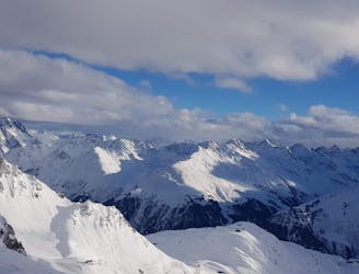
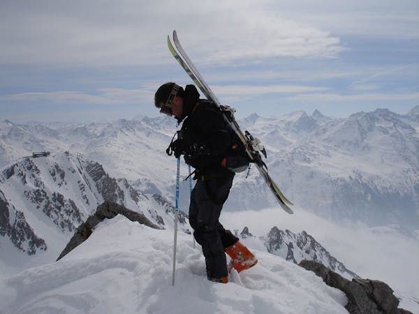
This one is a classic for the local mountain guides. With a guide, they take you up with skis/board with Valluga II. If you are without a guide, you have to earn it. Time for heroes, put your gf into the gondola and hike carrying your and her skis/board. First climbing up west, then along the ridge. The ascent takes 30-40 minutes depending on how deep the snow is (the classic West face has a FatMap entry already, just drop over once you reach the ridge - and only if you haven't put your gf into the gondola to the peak :)). From the ridge there is a variety of options if the snow is good.
A beautiful one starts almost at the peak under the bridge, steep, but nothing crazy - needs good snow.
The classic north face starts actually right behind the peak. Find the route at: https://fatmap.com/routeid/2751492/valluga-north?fmid=cp You have to keep skiers left to reach a prominent ridge which spits you out eventually into Pazieltal (boarders disadvantaged, the traverse out is a little tedious). The first patch of the Valluga North is exposed with a cliff below. The rumour has it that they closed the second part for non-guide accompanied skiers due to accidents. Prior to the opening of the Flexen Gondola this (and Valluga West) used to be the way to get over to Lech/Zuers.
Now, with Warth/Schroecken connected, you can actually ski the entire north face of the Valluga as well down towards Kaisers and the Steeg and back to Warth. But - the exit is long. Only recommended if you don't mind long flat sections and get a kick out of purely nice scenery.
Difficult
Serious gradient of 30-38 degrees where a real risk of slipping exists.

In case of a fall, death is highly likely.

Away from help but easily accessed.
1.3 km away
An enjoyable south facing run over St.Christoph.
Moderate Freeride Skiing
2 km away

Superb long run with often deep powder.
Difficult Freeride Skiing
2.3 km away

Challenging terrain for the experienced on leeside slopes.
Severe Freeride Skiing
2.3 km away
Freeride tour for skiers & split-boarders
Difficult Freeride Skiing
5.2 km away

Wide slopes and not too challeging in the Zurs front country.
Easy Freeride Skiing
5.2 km away

A classic Albona long wide open run finishing in the town of Stuben.
Moderate Freeride Skiing
5.3 km away

An Arlberg classic run for experienced skiers and riders.
Difficult Freeride Skiing
6 km away

A superb wide open run with great views. A classic Zurs freeride.
Difficult Freeride Skiing
6 km away

A good run for dry powder in the Zurs front country.
Moderate Freeride Skiing
6 km away

A nice moderate run with options of steep terrain and small trees. Possible in poorer visibility.
Moderate Freeride Skiing
10 routes · Freeride Skiing