2.9 km away
Rundumadum: Stage 13
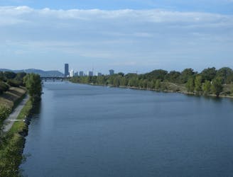
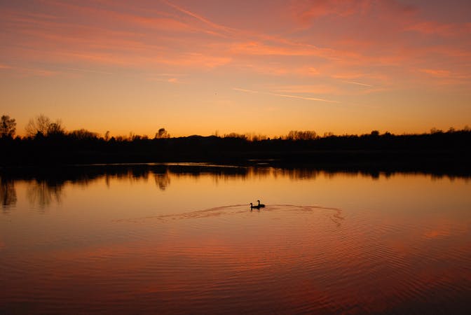
A wide variety of experiences in only a short distance walking, from one side of the Danube to the other.
Easy Hiking
- Distance
- 4.4 km
- Ascent
- 40 m
- Descent
- 47 m
Hike through Donau-Auen National Park, experiencing Vienna’s native flora and fauna as well as wild swimming spots in the river and forest ponds.
Hiking Easy

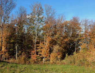
Stages 14-16 of the Rundumadum go through Vienna’s national park, Donau-Auen. The landscape is an abandoned floodplain of the Danube, cut off from water supply by channelization projects in the late 19th century. Today, isolated waterways and wetlands remain, as well as forests and dry fields that teem with life. All are now preserved for native habitat and public recreation, and the Rundumadum explores a great variety of these environments in the national park. Entrance is free for private use, and guided tours are also available for purchase. You must remain on marked paths in order to protect the fragile ecosystem, and dogs are allowed but must be on a leash.
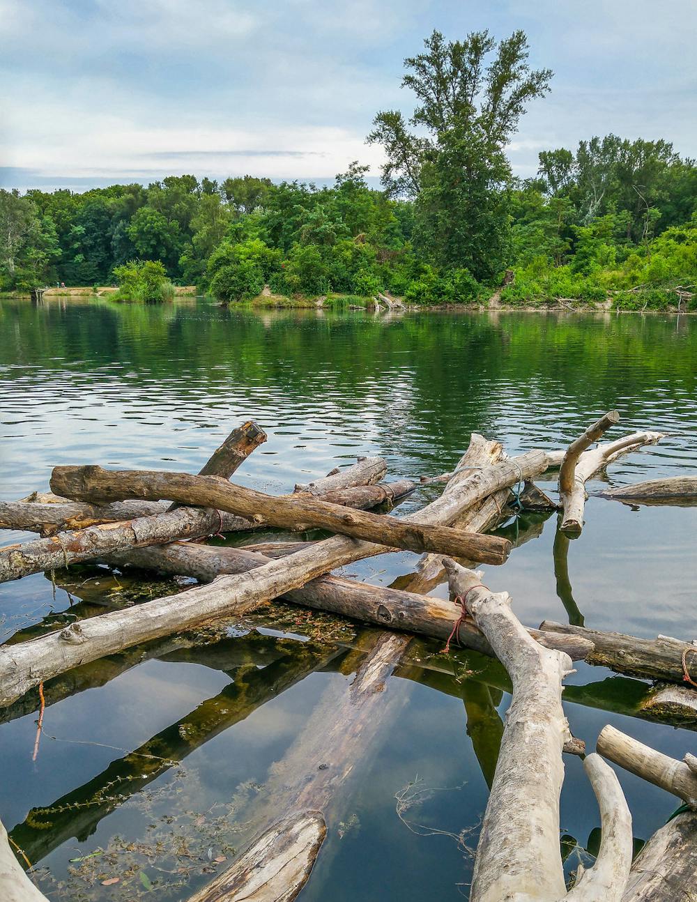
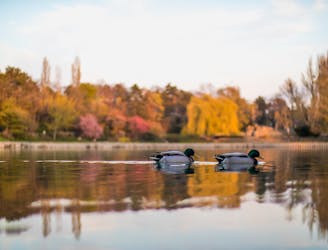
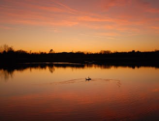
While walking through Danube-Auen, look and listen for the abundant bird life that frequents these marshes, including fowl like swan, heron, and egret, plus songbirds like warbler and cuckoo. Watch the ponds closely for turtles, perch, carp, beaver, and other aquatic residents. In the spring you can enjoy blooms of wild orchids, and witness the colors of diverse foliage in autumn. You can also spot historic relics like war bunkers and water works infrastructure. Other places of interest are the numerous swimming areas. Some are easily accessible while others are remote and therefore uncrowded. In general the park is great for families, but keep in mind that nudity is allowed at most swimming spots.
Stage 14 begins at the Lobau entrance on Biberhaufenweg, where the visitor center offers information, activities, food, and additional maps. This stage has the highest concentration of swimming areas and also a suitable dose of nature. It ends at Panozzalacke, a minor entrance to the park. From there it’s a short walk to Lobgrundstrasse station of bus 92B, and also restaurants for refreshment.
Stage 15 continues through a patchwork of forest and fields, on a more peaceful stretch of trail where you may see unique wildlife. You can end this stage at National Park Camp, which is a reservation-only facility for educational groups, but it’s quite a walk from there to the closest public transport. Instead, you can simply stop at Uferhaus restaurant for a snack and continue on the next stage.
Stage 16 goes mostly through the forest, but with views over nearby meadows and still water in an old arm of the Danube. It ends at Esslinger Ford and Hansi Guesthouse. From there it’s a short walk to Kaposigasse station of Bus 88B, as well as other transit stations.
Sources: https://www.wien.gv.at/umwelt/wald/freizeit/wandern/rundumadum/etappe14.html https://www.wien.gv.at/umwelt/wald/freizeit/wandern/rundumadum/etappe15.html https://www.wien.gv.at/umwelt/wald/freizeit/wandern/rundumadum/etappe16.html https://www.donauauen.at/der-nationalpark/
Easy
Walking along a well-kept trail that’s mostly flat. No obstacles are present.

The path is on completely flat land and potential injury is limited to falling over.

Away from help but easily accessed.
2.9 km away
A wide variety of experiences in only a short distance walking, from one side of the Danube to the other.
Easy Hiking
4 km away
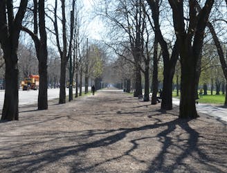
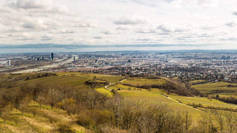
Leaving the national park, the route returns to a suburban environment, but with doses of nature in public parks and farm fields.
Easy Hiking
6.1 km away
A loop with numerous recreation opportunities and a dose of nature in The Prater, a large public park and green space near the city center.
Easy Hiking
6.6 km away

A stroll on the edge of the city–at the nexus of nature, agriculture, and industry in Donaustadt.
Easy Hiking
6.9 km away
A balance of suburban and rural, forest and field, land and sky, on the outskirts of Donaustadt.
Easy Hiking
7.2 km away
A nicely varied path that connects city streets, forest recreation areas, an amusement park, and countryside farms in the southern part of Vienna.
Easy Hiking
9.5 km away
A walk through the varied environments of Favoriten and Simmering districts, which include forest parks, urban farms, the Central Cemetery, and eventually the Danube.
Easy Hiking
12 routes · Hiking
15 routes · Hiking
7 routes · Hiking