66 m away
Emerald Lake Loop
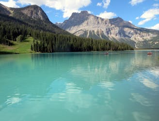
A peaceful stroll around the shore of a stunning alpine lake.
Easy Hiking
- Distance
- 5.2 km
- Ascent
- 98 m
- Descent
- 98 m
Hands-down one of Yoho’s best all-day hikes, this loop combines the scenic shore of Emerald Lake with high-elevation vantage on the Wapta Highline.
Hiking Difficult

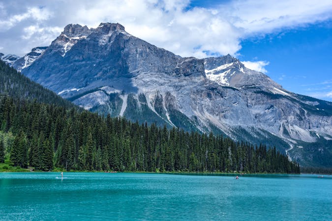
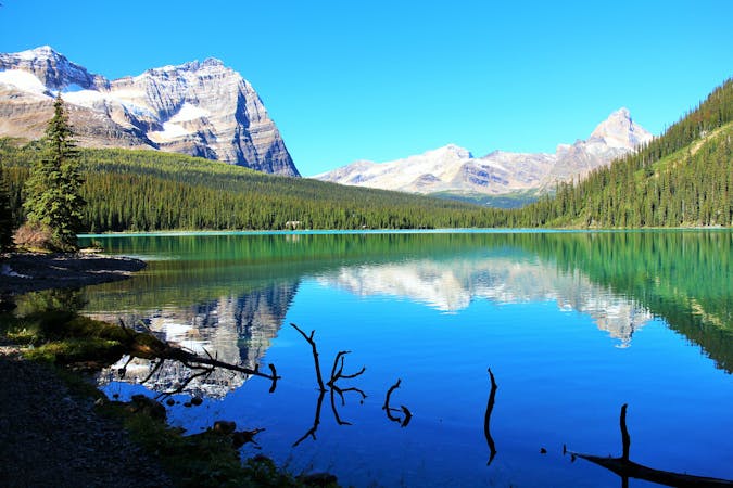
Emerald Lake is a popular destination in Yoho National Park. It’s a classically beautiful glacial lake surrounded by towering peaks, with many trails branching out from its shoreline. One of the more difficult but most rewarding hikes is the “Emerald Triangle” loop, which climbs all the way from the lake to alpine slopes, granting unobstructed views to glaciated peaks. It connects Yoho Pass and Burgess Pass, with the Wapta Traverse in between.
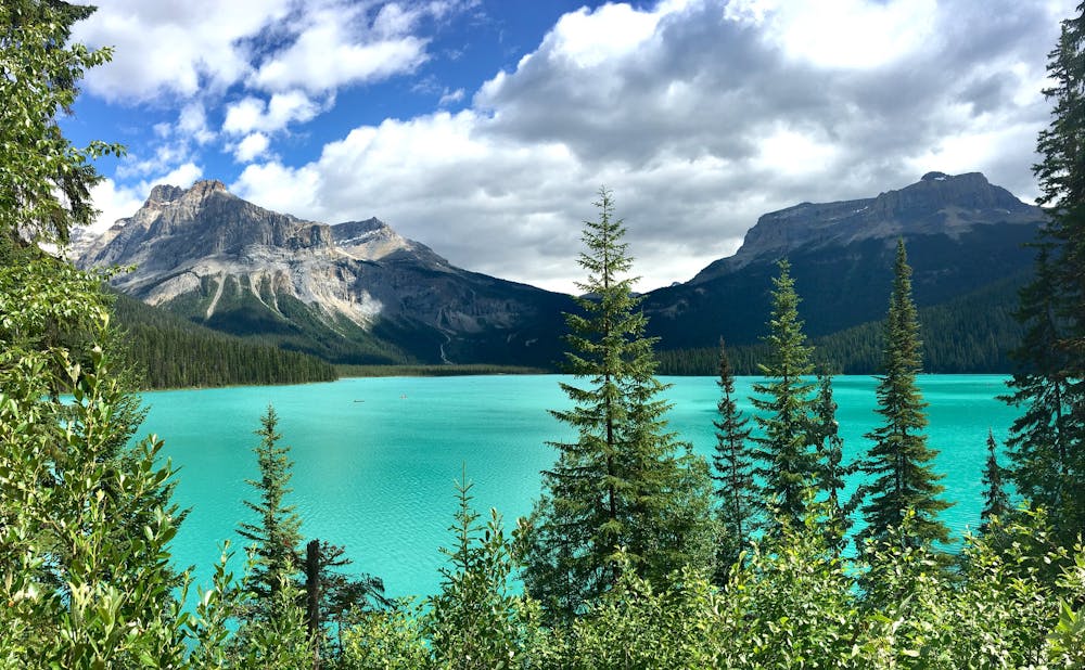
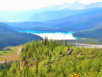
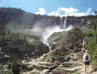
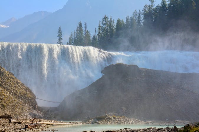
If you want more gradual elevation gain, hike the loop clockwise, going first to Yoho Pass. You’ll begin with a stroll along the scenic shore of Emerald Lake, then gradually ascend the sparsely forested alluvial plan above, with constant eyefuls of the mountains you are about to take on. The climb to Yoho Pass is not too difficult, but it’s long, and on a rocky trail. The forest becomes denser and wetter as you go up, but views from clearings make it apparent how far you’ve come, as the lake shrinks away below. There’s also the refreshing sight of a mighty waterfall plummeting from a glacier on a nearby mountain.
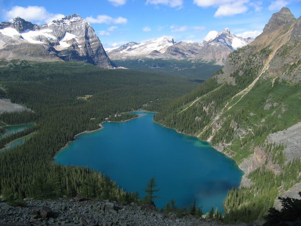
Yoho Pass itself is heavily forested, but you’ll soon leave the trees behind by continuing on the Wapta Highline. This is one of Yoho’s most spectacular sections of trail. It traverses flower-flecked open slopes and rocky avalanche paths, practically at eye level with massive glaciers across the valley, and beneath the imposing cliffs of Wapta Mountain. Nearing Burgess Pass, the trail goes in and out of trees on the rock-strewn slopes, then re-enters the forest for good at the pass. To finish the loop, the trail makes a very determined descent back to Emerald Lake, with many switchbacks and steep sections.
Sources: https://www.pc.gc.ca/en/pn-np/bc/yoho/activ/randonnee-hike/jour-day https://autumnsky.zenfolio.com/rockies/yoho/wapta-highline
Difficult
Hiking trails where obstacles such as rocks or roots are prevalent. Some obstacles can require care to step over or around. At times, the trail can be worn and eroded. The grade of the trail is generally quite steep, and can often lead to strenuous hiking.

The trail contains some obstacles such as outcroppings and rock which could cause injury.

Little chance of being seen or helped in case of an accident.
66 m away
A peaceful stroll around the shore of a stunning alpine lake.
Easy Hiking
139 m away
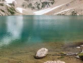
A strenuous hike to a secluded lake, for those who love solitude.
Difficult Hiking
7.6 km away
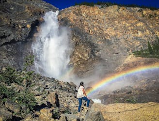
Short walk to a better view of Yoho's tallest waterfall.
Easy Hiking
7.6 km away
Hike over Yoho Pass to link some of the park’s most iconic sights in half a day.
Difficult Hiking
7.6 km away
Yoho’s best trek for waterfall viewing, making a challenging one-day or overnight circuit.
Difficult Hiking
4 routes · Hiking
4 routes · Hiking
7 routes · Hiking
5 routes · Hiking