6.3 km away
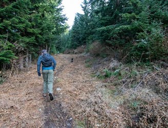
YVR Sunsets: St. Marks Summit
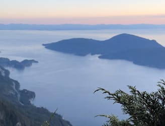
Local classic to take in a beautiful Howe Sound sunset
Moderate Hiking
- Distance
- 9.8 km
- Ascent
- 631 m
- Descent
- 628 m
Beaches, mountain views, trails, cute village
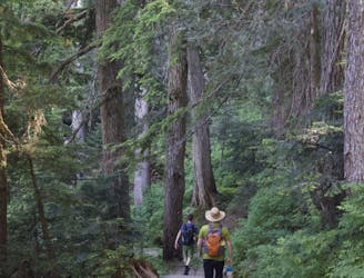
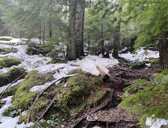
Hiking Moderate

This is a popular hiking route which is generally considered to be moderate. It's not remote, it features medium exposure and is typically done all year round. From a low point of 5 m to the maximum altitude of 112 m, the route covers 5.2 km, 251 vertical metres of ascent and 251 vertical metres of descent.
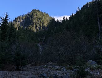
Visit beaches and enjoy mountain views along this easy to moderate route around Horseshoe Bay. Route includes the trail up to the lookout with views of Bowen Island, the Village and out to the Strait of Georgia.
Moderate
Hiking along trails with some uneven terrain and small hills. Small rocks and roots may be present.

The trail contains some obstacles such as outcroppings and rock which could cause injury.

Close to help in case of emergency.
6.3 km away
Local classic to take in a beautiful Howe Sound sunset
Moderate Hiking
6.3 km away
Popular hike with scenic views over Howe Sound
Moderate Hiking
6.4 km away
A full adventure day with a ferry and hike
Moderate Hiking
6.5 km away
Challenging North Shore Hike
Difficult Hiking
6.6 km away
A moderate hike with excellent view over Vancouver and the Salish Sea
Moderate Hiking

7 routes · Hiking · Trail Running

6 routes · Hiking

3 routes · Hiking