317 m away
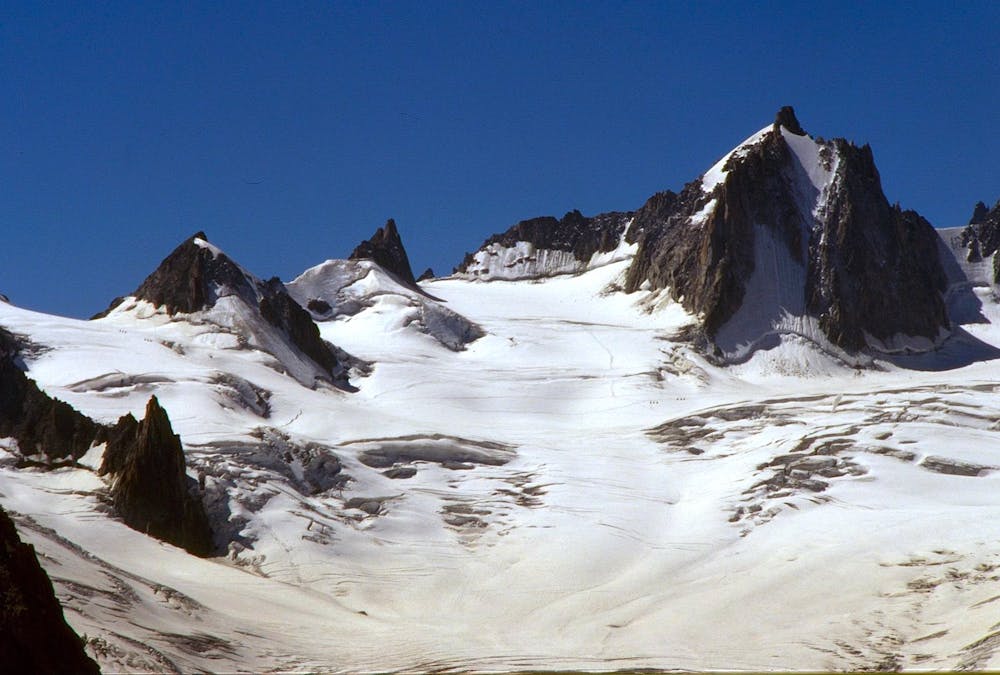
Toula Glacier
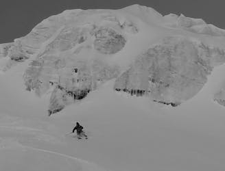
A serious but truly exceptional, long and varied ski descent in breathtaking terrain.
Difficult Freeride Skiing
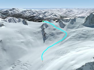
- Distance
- 3.6 km
- Ascent
- 0 m
- Descent
- 1.2 km
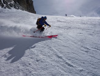
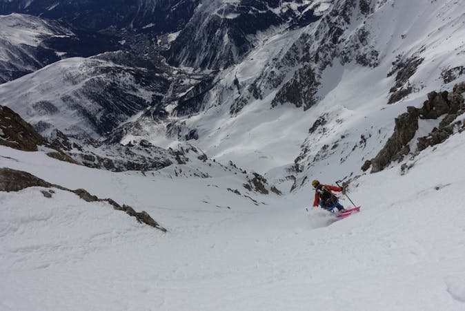
A short hike leads to this serious but incredible run. Steep up high and open in the lower it simply begs you open up full throttle.
Also in Aoste, Italy
Freeride Skiing Severe

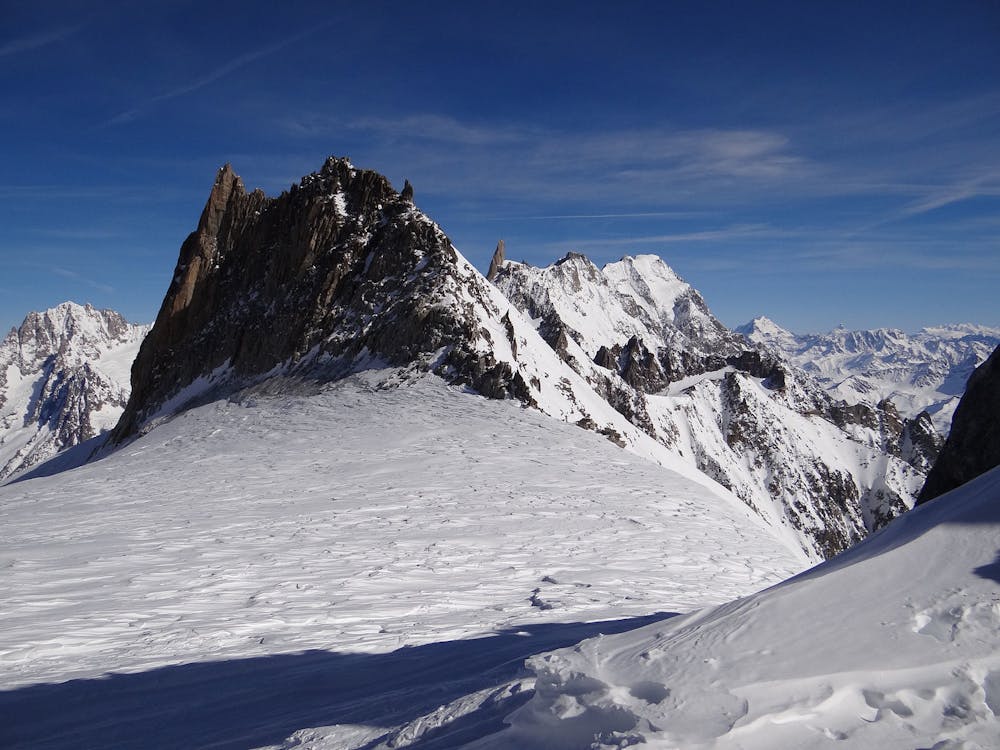
A short hike leads to this incredible run. Steep up high and open in the lower it simply begs you open up full throttle. Start as for the Vallee Noire via Glacier du Geant - From the Helbronner head out left along to the Col des Flambeaux. From the col traverse left towards the Aiguille de Toule and down the steeper pitch to its right. The Line starts here. On the plateau below the north side of the Aiguille de Toule put on you skins etc and head up left to the Col d'Entreves. Here you usually need to put on crampons and get your axe to climb the first section of the south ridge. When you meet a steep rock step traverse this on the right, rope sometimes useful. Traverse at this height further right until the whole east face opens out below you. Get your skis back on and ski the steep face below pulling to the left as ridge divides the terrain below. The second half of the face opens back out to your left is slightly lower angled and with a more NE aspect often holds exceptional snow. Ski down onto the glacier below and rejoin the Toule Glacier line. Beware the approach requires skins and covers crevassed terrain.
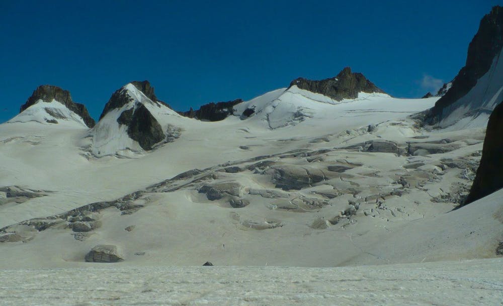
You are on a glacier so make sure you are equipped, prepared and have practised crevasse rescue, however unlikely you think falling in a crevasse is- it is possible! A minimum would be each person to have harness, axe, crampons, an ice screw, 3 prussiks, several screwgates, a pulley/DMM Revolver karabiner, a couple of slings and 2 30m ropes in the group. A more modern simple solution substituting for many of the above might be 2 Petzl RAD systems in the group. If you have any doubts about this ski with an IFMGA Mountain Guide.
Severe
Steep skiing at 38-45 degrees. This requires very good technique and the risk of falling has serious consequences.

As well as the slope itself, there are some obstacles (such as rock outcrops) which could aggravate injury.

In the high mountains or remote conditions, all individuals must be completely autonomous in every situation.
317 m away
A serious but truly exceptional, long and varied ski descent in breathtaking terrain.
Difficult Freeride Skiing
397 m away

Another short but steep couloir leading to the Toula Glacier.
Extreme Freeride Skiing
423 m away

A short couloir offering an alternative to taking the stairs to the Toula Glacier.
Extreme Freeride Skiing
645 m away

One for those who like it extreme, this alternative entry to the Dario couloir is both steep and committing.
Extreme Freeride Skiing
657 m away

A steep, serious variation leading in to the classic Passerelle couloir.
Extreme Freeride Skiing
700 m away

Sustained, serious and steep skiing in a fantastic couloir leading to the Toula Glacier below.
Extreme Freeride Skiing
795 m away

Wide to start with, the Cesso narrows in its lower reaches and is exciting as you ski between her steep rock walls.
Extreme Freeride Skiing
795 m away

This narrow, steep and committing couloir offers extreme skiing right off the bridge.
Extreme Freeride Skiing
881 m away
Serious glaciers but great flowing skiing brings you from Italy in to the classic French Vallée Blanche.
Moderate Freeride Skiing
948 m away
A moderate and fun line down some serious glaciated terrain on the Italian side of the Vallée Blanche.
Moderate Freeride Skiing

10 routes · Freeride Skiing

50 routes · Freeride Skiing · Ski Touring
9 routes · Freeride Skiing · Ski Touring