31 m away
Scala couloir

A short couloir offering an alternative to taking the stairs to the Toula Glacier.
Extreme Freeride Skiing
- Distance
- 195 m
- Ascent
- 0 m
- Descent
- 125 m
Another short but steep couloir leading to the Toula Glacier.
Freeride Skiing Extreme

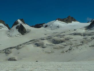
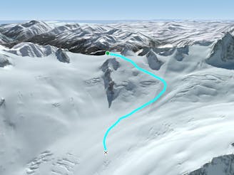
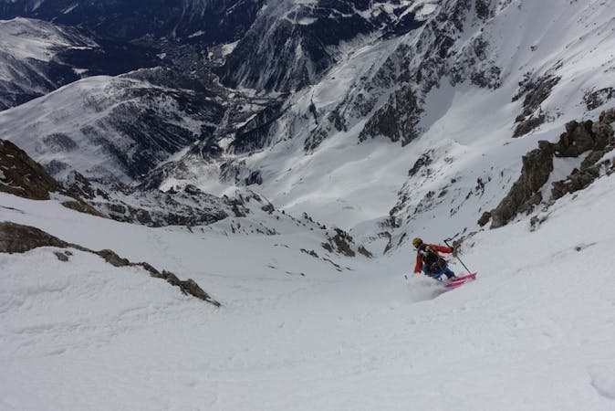
This is a popular freeride skiing route which is generally considered to be extreme. It's extremely remote, it features medium exposure (e2) and is typically done between January and March. From a low point of 3.2 km to the maximum altitude of 3.4 km, the route covers 270 m, 0 vertical metres of ascent and 161 vertical metres of descent. It's graded 5.2 and Labande grade 5. You'll need rope to complete it safely.
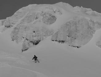
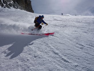
Steep and committing skiing for experts only, this short, steep couloir leads to the Toula Glacier. It lies further left again than the Scala couloir and takes you directly to the glacier below but be warned, it skis beautifully yet is prone to windloading and avalanches.
Extreme
Extreme skiing terrain above 45 degrees. These routes are reserved for experienced experts.

As well as the slope itself, there are some obstacles (such as rock outcrops) which could aggravate injury.

In the high mountains or remote conditions, all individuals must be completely autonomous in every situation.
31 m away
A short couloir offering an alternative to taking the stairs to the Toula Glacier.
Extreme Freeride Skiing
344 m away
A serious but truly exceptional, long and varied ski descent in breathtaking terrain.
Difficult Freeride Skiing
397 m away
A short hike leads to this serious but incredible run. Steep up high and open in the lower it simply begs you open up full throttle.
Severe Freeride Skiing
414 m away

One for those who like it extreme, this alternative entry to the Dario couloir is both steep and committing.
Extreme Freeride Skiing
454 m away

A steep, serious variation leading in to the classic Passerelle couloir.
Extreme Freeride Skiing
545 m away

Sustained, serious and steep skiing in a fantastic couloir leading to the Toula Glacier below.
Extreme Freeride Skiing
578 m away

This narrow, steep and committing couloir offers extreme skiing right off the bridge.
Extreme Freeride Skiing
579 m away

Wide to start with, the Cesso narrows in its lower reaches and is exciting as you ski between her steep rock walls.
Extreme Freeride Skiing
690 m away
Serious glaciers but great flowing skiing brings you from Italy in to the classic French Vallée Blanche.
Moderate Freeride Skiing
741 m away
A moderate and fun line down some serious glaciated terrain on the Italian side of the Vallée Blanche.
Moderate Freeride Skiing

10 routes · Freeride Skiing

50 routes · Freeride Skiing · Ski Touring
9 routes · Freeride Skiing · Ski Touring