53 m away
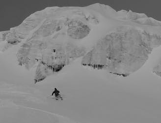
Vecchio Skilift Couloir

One for those who like it extreme, this alternative entry to the Dario couloir is both steep and committing.
Extreme Freeride Skiing
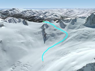
- Distance
- 194 m
- Ascent
- 10 m
- Descent
- 119 m
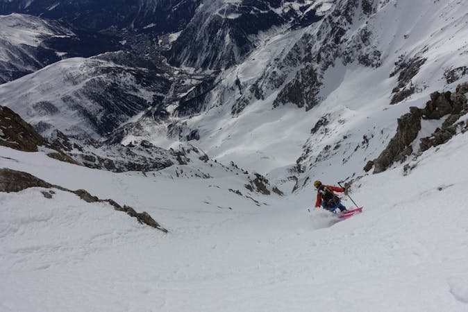
A steep, serious variation leading in to the classic Passerelle couloir.
Freeride Skiing Extreme

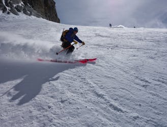
This is a popular freeride skiing route which is generally considered to be extreme. It's extremely remote, it features high exposure (e3) and is typically done between February and April. From a low point of 3.4 km to the maximum altitude of 3.4 km, the route covers 145 m, 4 vertical metres of ascent and 71 vertical metres of descent. It's graded 5.2 and Labande grade 6.
The right hand entrance to the Passerelle offers a wider entrance which tends to be less scraped out due to a bit more space for skiers to enjoy.
Extreme
Extreme skiing terrain above 45 degrees. These routes are reserved for experienced experts.

In case of a fall, death is highly likely.

In the high mountains or remote conditions, all individuals must be completely autonomous in every situation.
53 m away
One for those who like it extreme, this alternative entry to the Dario couloir is both steep and committing.
Extreme Freeride Skiing
105 m away

Sustained, serious and steep skiing in a fantastic couloir leading to the Toula Glacier below.
Extreme Freeride Skiing
139 m away

This narrow, steep and committing couloir offers extreme skiing right off the bridge.
Extreme Freeride Skiing
139 m away

Wide to start with, the Cesso narrows in its lower reaches and is exciting as you ski between her steep rock walls.
Extreme Freeride Skiing
239 m away
Serious glaciers but great flowing skiing brings you from Italy in to the classic French Vallée Blanche.
Moderate Freeride Skiing
299 m away
A moderate and fun line down some serious glaciated terrain on the Italian side of the Vallée Blanche.
Moderate Freeride Skiing
356 m away
A serious but truly exceptional, long and varied ski descent in breathtaking terrain.
Difficult Freeride Skiing
362 m away

A steep variant into the Cesso couloir it is not often in condition but it's good when it is.
Extreme Freeride Skiing
365 m away

Easily accessible, very serious yet excellent steep skiing below the cables on the Helbronner front face.
Severe Freeride Skiing
454 m away

Another short but steep couloir leading to the Toula Glacier.
Extreme Freeride Skiing

10 routes · Freeride Skiing

50 routes · Freeride Skiing · Ski Touring
9 routes · Freeride Skiing · Ski Touring