317 m away
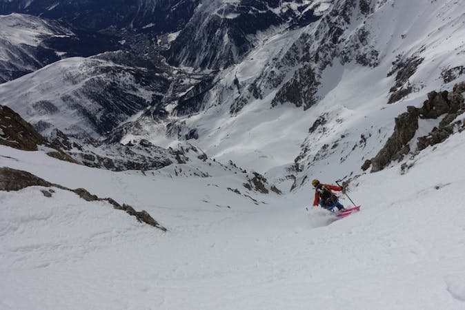
Aiguille D'Entreves
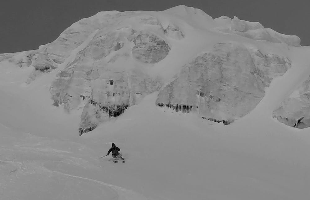
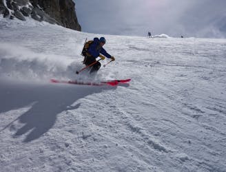
A short hike leads to this serious but incredible run. Steep up high and open in the lower it simply begs you open up full throttle.
Severe Freeride Skiing
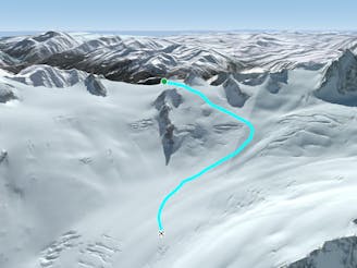
- Distance
- 2.7 km
- Ascent
- 312 m
- Descent
- 733 m
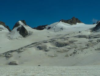
A serious but truly exceptional, long and varied ski descent in breathtaking terrain.
Freeride Skiing Difficult

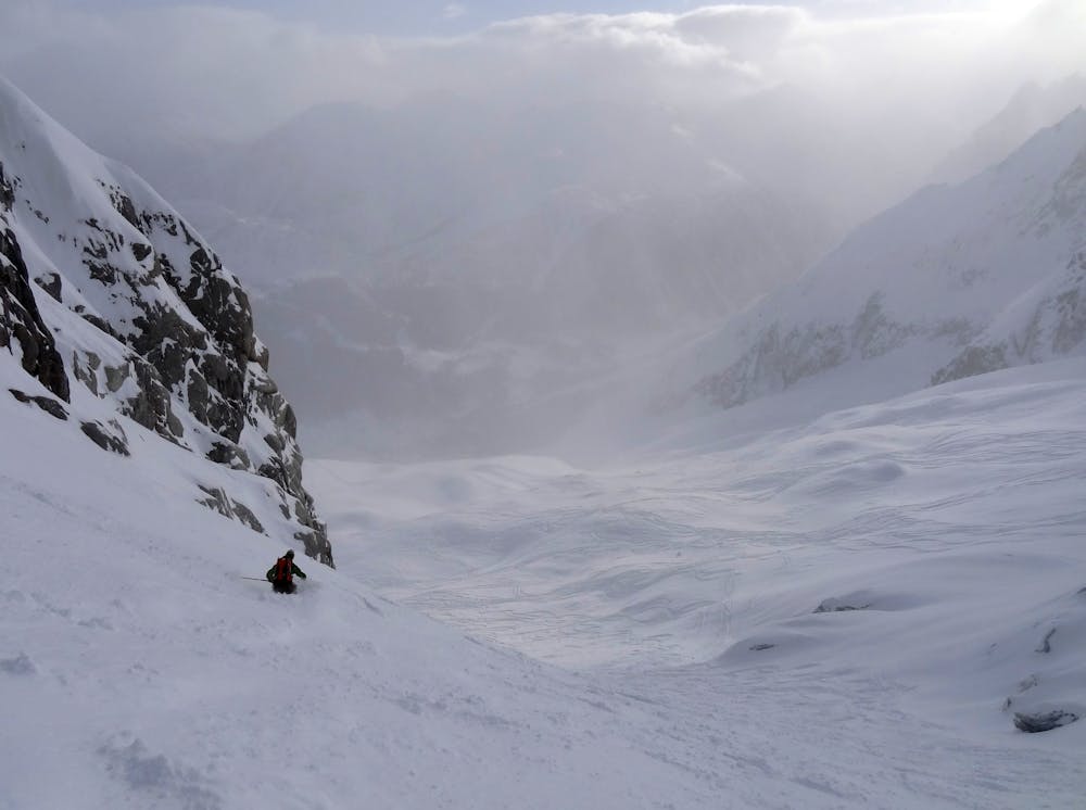
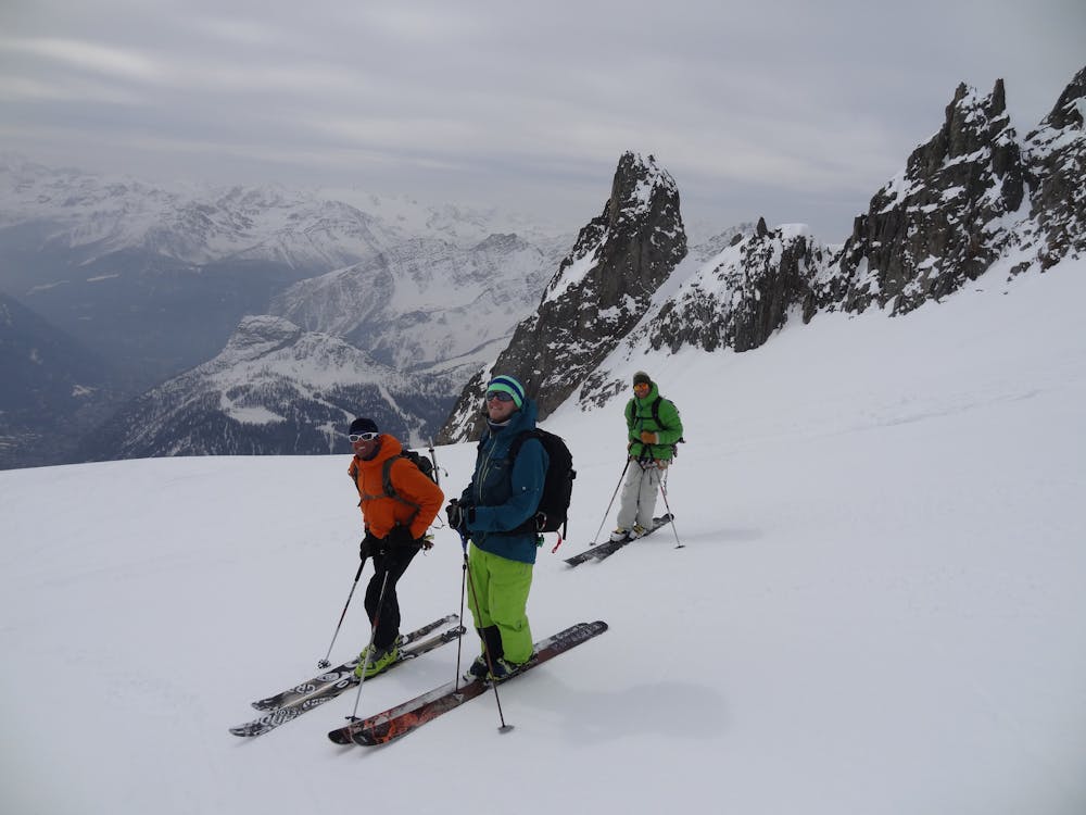
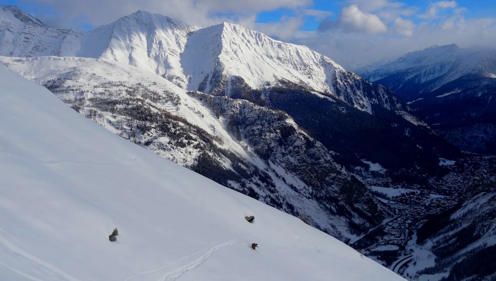
Leaving the Punta Helbronner top station head for the Col des Flambeaux. Traversing left side step through the col and continue to the Col oriental de Toula and take the stairs down onto the glacier from where you start this most amazing ski descent. Ski fall line until the terrain steepens and a crevasse field is passed on your right. After this stay close to the rock and ski ever-widening slopes always tending gently left as you explore this winter wonderland and make your way back to the mid station psyched for another lap. The terrain is glaciated and extremely avalanche prone. The aspect gets lots of sun and don't be tempted to do one lap too many when the conditions start getting dangerous.
Difficult
Serious gradient of 30-38 degrees where a real risk of slipping exists.

As well as the slope itself, there are some obstacles (such as rock outcrops) which could aggravate injury.

In the high mountains or remote conditions, all individuals must be completely autonomous in every situation.
317 m away
A short hike leads to this serious but incredible run. Steep up high and open in the lower it simply begs you open up full throttle.
Severe Freeride Skiing
344 m away

Another short but steep couloir leading to the Toula Glacier.
Extreme Freeride Skiing
356 m away

A steep, serious variation leading in to the classic Passerelle couloir.
Extreme Freeride Skiing
357 m away

One for those who like it extreme, this alternative entry to the Dario couloir is both steep and committing.
Extreme Freeride Skiing
374 m away

A short couloir offering an alternative to taking the stairs to the Toula Glacier.
Extreme Freeride Skiing
385 m away

Sustained, serious and steep skiing in a fantastic couloir leading to the Toula Glacier below.
Extreme Freeride Skiing
490 m away

Wide to start with, the Cesso narrows in its lower reaches and is exciting as you ski between her steep rock walls.
Extreme Freeride Skiing
491 m away

This narrow, steep and committing couloir offers extreme skiing right off the bridge.
Extreme Freeride Skiing
568 m away
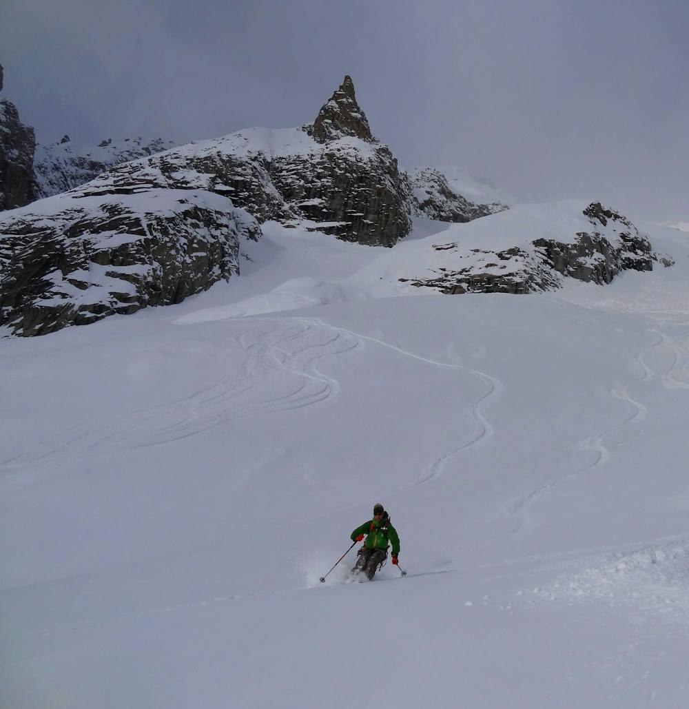
Serious glaciers but great flowing skiing brings you from Italy in to the classic French Vallée Blanche.
Moderate Freeride Skiing
637 m away
A moderate and fun line down some serious glaciated terrain on the Italian side of the Vallée Blanche.
Moderate Freeride Skiing

10 routes · Freeride Skiing

50 routes · Freeride Skiing · Ski Touring
9 routes · Freeride Skiing · Ski Touring