1.9 km away
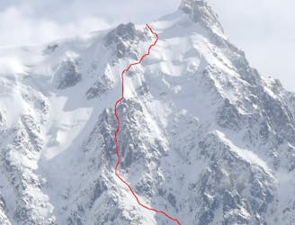
Para Face

A great option for skiing to the valley floor after a descent of any of the W or N face routes off the Aiguille du Midi
Difficult Freeride Skiing
- Distance
- 1.4 km
- Ascent
- 1 m
- Descent
- 746 m
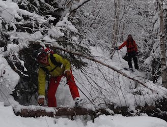
A series of walking trails makes it possible to ski from the tunnel du Mont Blanc back to chamonix if there is enough snow.
Freeride Skiing Moderate

From the exit point of the Bossons Glacier walk across the road and put your skis on at the little green bridge. Ski this first slope and link trails and walking paths until you arrive back at the roundabout just before the town of Chamonix. This route can often times be very rocky and unpleasant and require a lot of walking. You find yourself skiing on the side ot the Mont Blanc Tunnel road at one point
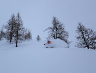
Moderate
Slopes become slightly steeper at around 25-30 degrees.

As well as the slope itself, there are some obstacles (such as rock outcrops) which could aggravate injury.
Away from help but easily accessed.
1.9 km away
A great option for skiing to the valley floor after a descent of any of the W or N face routes off the Aiguille du Midi
Difficult Freeride Skiing
2 km away
A good descent on wide open slopes, but be warned you pay the price with the exit
Severe Freeride Skiing
2 km away
Wild, serious skiing away from the pisted areas in the trees which is often good when visibility is low.
Severe Freeride Skiing
2.8 km away
A serious direct finish to the Rond or Cosmiques couloir this route is great skiing when snow conditions allow.
Severe Freeride Skiing
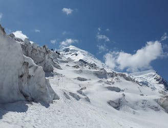
3 km away

Some of the steepest and most serious terrain accessible from a lift anywhere in the world; an undertaking reserved for only the very best skiers.
Extreme Freeride Skiing
3.3 km away
Technical and more serious variation to the classic Rond or Passerelle Couloir
Extreme Freeride Skiing
3.3 km away

Very steep, serious and extreme skiing, accessible with 3 long rappels.
Extreme Freeride Skiing
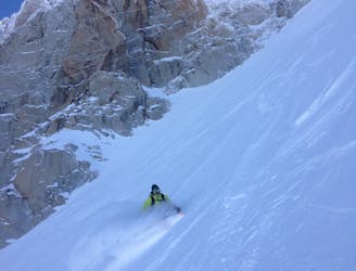
3.3 km away
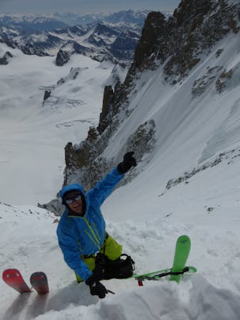
This highly sought after mountaineering line is perhaps the most aesthetic ski line on the North Face of the Midi.
Extreme Freeride Skiing
3.3 km away

Almost never in condition, a short but steep ski through rocks leads to the glacier.
Extreme Freeride Skiing
3.3 km away

Maybe the most coveted line in the Chamonix valley representing the pinnacle in steep and committing skiing, all with a perfect view of the town of Chamonix.
Extreme Freeride Skiing
5 routes · Freeride Skiing · Ski Touring

10 routes · Freeride Skiing