1.1 km away
Bossons glacier exit
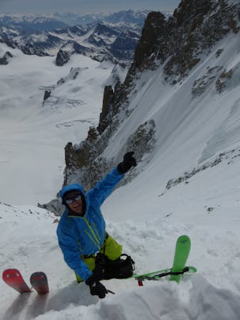
A serious direct finish to the Rond or Cosmiques couloir this route is great skiing when snow conditions allow.
Severe Freeride Skiing
- Distance
- 3.4 km
- Ascent
- 2 m
- Descent
- 1.4 km
A great option for skiing to the valley floor after a descent of any of the W or N face routes off the Aiguille du Midi
Freeride Skiing Difficult

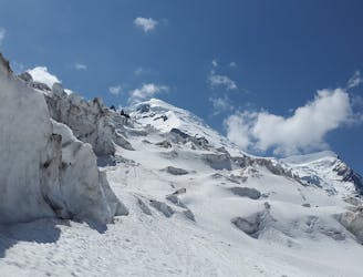
The terrain is serious and avalanche prone and the end usually requires some combat skiing, bushwhacking or at worst some hiking. From the old Station on the ridge take a hard left. Many options exit in this flowing terrain but make sure to traverse back to the old mid station lift before the terrain gets tight, steep and incredibly hard to navigate. From the station take your skis off and take the summer hiking trail which starts on the left of the building down to the valley floor. Allow 30-40 Minutes. In exceptional snow you can ski some or all of this but it is an extremely tight quick footpath you are following
Difficult
Serious gradient of 30-38 degrees where a real risk of slipping exists.

As well as the slope itself, there are some obstacles (such as rock outcrops) which could aggravate injury.

In the high mountains or remote conditions, all individuals must be completely autonomous in every situation.
1.1 km away
A serious direct finish to the Rond or Cosmiques couloir this route is great skiing when snow conditions allow.
Severe Freeride Skiing
1.1 km away

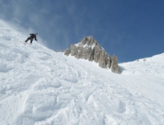
Some of the steepest and most serious terrain accessible from a lift anywhere in the world; an undertaking reserved for only the very best skiers.
Extreme Freeride Skiing
1.4 km away
Technical and more serious variation to the classic Rond or Passerelle Couloir
Extreme Freeride Skiing
1.4 km away

Very steep, serious and extreme skiing, accessible with 3 long rappels.
Extreme Freeride Skiing
1.4 km away
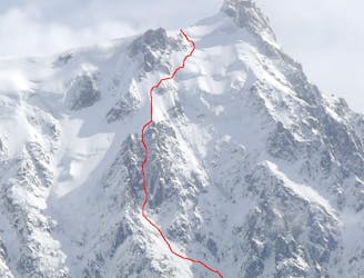
This highly sought after mountaineering line is perhaps the most aesthetic ski line on the North Face of the Midi.
Extreme Freeride Skiing
1.4 km away

Almost never in condition, a short but steep ski through rocks leads to the glacier.
Extreme Freeride Skiing
1.4 km away

Maybe the most coveted line in the Chamonix valley representing the pinnacle in steep and committing skiing, all with a perfect view of the town of Chamonix.
Extreme Freeride Skiing
1.5 km away
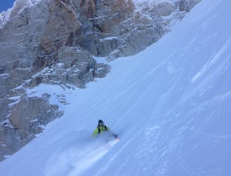
Perhaps the most famous ski descent in the world? Technically moderate but very serious skiing in an absolutely breathtaking setting.
Moderate Freeride Skiing
1.5 km away

A steep south facing slope is a great finishing option to the Petit Envers or Envers du Plan.
Difficult Freeride Skiing
1.5 km away

A traversing section that links the Envers du Plan to the Grand Envers and Requin Hut Couloirs exit.
Difficult Freeride Skiing
5 routes · Freeride Skiing · Ski Touring

10 routes · Freeride Skiing

50 routes · Freeride Skiing · Ski Touring
10 routes · Freeride Skiing