200 m away
Grand Balcon Nord
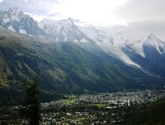
Packed with incredible views—likely the best bang-for-your-buck hike in Chamonix!
Difficult Hiking
- Distance
- 6.2 km
- Ascent
- 186 m
- Descent
- 587 m
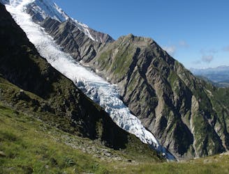
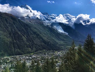
Picturesque does not do this route any justice.
Hiking Difficult

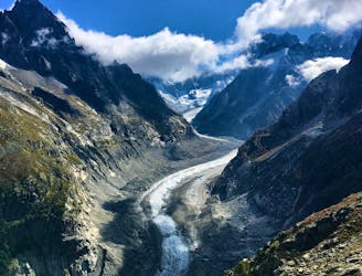
Starting at Plan L'aiguille you venture downwards down to the hill following the yellow markers. These will later on change into painted dots on the rocks.
After a short traversal you will start to climb towards the trail of 'The Grand Mulets'. From this point onwards you will traverse to the old second lift station that will have some history boards. These will prove to be entertaining during your lunch break before descending back to the valley.
The descent is very straight forward and will lead you to the Tunnel du Mont Blanc. This trail lends itself very well to trail runners.
Difficult
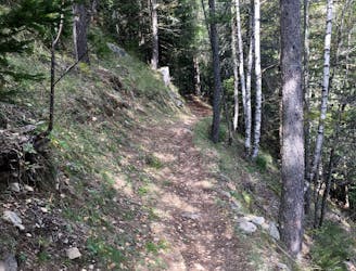
Hiking trails where obstacles such as rocks or roots are prevalent. Some obstacles can require care to step over or around. At times, the trail can be worn and eroded. The grade of the trail is generally quite steep, and can often lead to strenuous hiking.

The trail contains some obstacles such as outcroppings and rock which could cause injury.

Little chance of being seen or helped in case of an accident.
200 m away
Packed with incredible views—likely the best bang-for-your-buck hike in Chamonix!
Difficult Hiking
2.8 km away
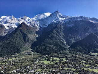
A famous hike which was the starting point for Jacques Balmat and Michel Paccard when they made the first ascent of Mont Blanc in 1786.
Difficult Hiking
3 km away
A short and pleasant hike up to a picturesque little mountain hut.
Moderate Hiking
3.4 km away
The easiest hike in Chamonix.
Easy Hiking
3.5 km away
A classic loop around the Chamonix Valley.
Moderate Hiking
4.4 km away
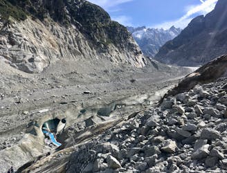
A must-do visit to an ice cave carved in the Mer de Glace glacier.
Easy Hiking
4.7 km away
A short loop on one of the best sections of the Petit Balcon Sud trail.
Moderate Hiking
4.8 km away

Escape the crowds at Lac Blanc by hiking to Lac Cornu instead.
Severe Hiking
5 km away
While one of the less interesting sections of the TMB, this stretch still offers a few hidden trail gems.
Moderate Hiking
5.3 km away

Day 1: A gentle downhill day on the sun-kissed south-facing slopes of the Brévent peak.
Moderate Hiking

14 routes · Hiking

5 routes · Hiking

12 routes · Hiking

10 routes · Hiking