6 m away
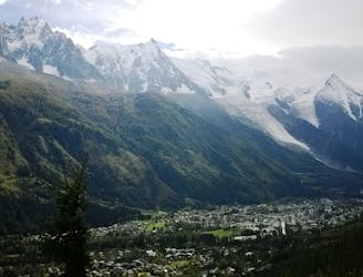
Grand Balcon Nord
Packed with incredible views—likely the best bang-for-your-buck hike in Chamonix!
Difficult Hiking
- Distance
- 6.2 km
- Ascent
- 186 m
- Descent
- 587 m
Wonderful high level historic hike between Plan de l'Aiguille and Montenvers
Hiking Moderate

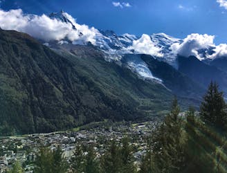
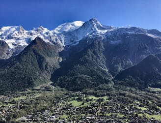
A great traverse across the mountainside below the Mont Blanc Massif with views to the Aiguille Rouge mountains across the valley.

Begin by taking the world famous Aiguille du Midi cable car to the mid station. Descend here and begin your hike towards Montenvers train station where you will take the train back down, saving the knees big time!
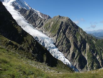
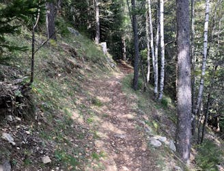
The hike is very pleasant and never too difficult. Leaving the cable car you turn left out of the door, and follow the signs towards Montenvers. At times the trail winds in and out of giant boulders deposited by the glaciers in days gone past. Evidence of the power of nature at a time when the glaciers were more active. Along the route you will often hear Marmots calling with their shrill 'alarm' whistle, and they can often be seen perched on the rocks checking out any threats.
The trail undulates in places and there is some ascent to be done. Eventually you will come to a trail junction with a trail heading steeply up to Signal Forbes. If you do not want to climb you can carry on straight along the traverse via an ancient rock paved trail that ends at the train station at Montenvers.
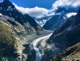
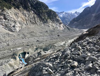
However, we recommend, if you have the energy, to climb to Signal Forbes which is a stunning view point over the Mer de Grace glacier. It is called Signal Forbes after the famous glaciologist James Forbes, from Scotland, who published one of the first every scientific papers on glaciers in the 1800's.
Signal Forbes also makes a great lunch spot and the views really are utterly amazing. From here you descend to the railway station at Montenvers, itself a historic structure.
Moderate
Hiking along trails with some uneven terrain and small hills. Small rocks and roots may be present.

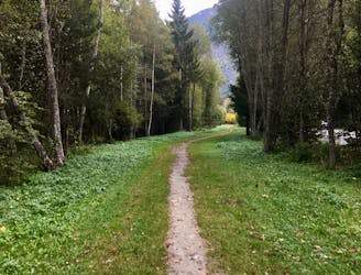
The path is on completely flat land and potential injury is limited to falling over.
Close to help in case of emergency.
6 m away
Packed with incredible views—likely the best bang-for-your-buck hike in Chamonix!
Difficult Hiking
2.8 km away
A short and pleasant hike up to a picturesque little mountain hut.
Moderate Hiking
2.9 km away
A famous hike which was the starting point for Jacques Balmat and Michel Paccard when they made the first ascent of Mont Blanc in 1786.
Difficult Hiking
3.2 km away
The easiest hike in Chamonix.
Easy Hiking
3.3 km away
A classic loop around the Chamonix Valley.
Moderate Hiking
4.2 km away
A must-do visit to an ice cave carved in the Mer de Glace glacier.
Easy Hiking
4.5 km away
A short loop on one of the best sections of the Petit Balcon Sud trail.
Moderate Hiking
4.6 km away

Escape the crowds at Lac Blanc by hiking to Lac Cornu instead.
Severe Hiking
5 km away
While one of the less interesting sections of the TMB, this stretch still offers a few hidden trail gems.
Moderate Hiking
5.2 km away

Circumnavigate the iconic Mont Blanc massif on this epic multi-day route.
Severe Hiking

6 routes · Hiking

14 routes · Hiking

5 routes · Hiking

12 routes · Hiking

10 routes · Hiking