6 m away
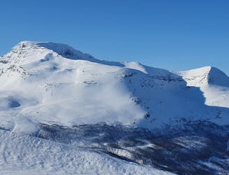
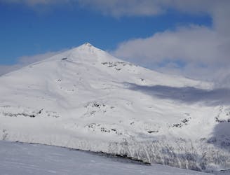
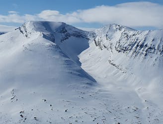
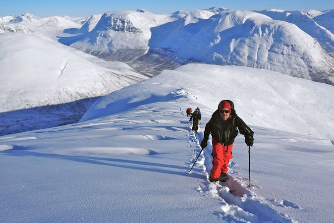
Istinden Northeast Ridge behind Tamokdalen
An eficent way to take advantage of a powder day
Difficult Ski Touring
- Distance
- 22 km
- Ascent
- 3.2 km
- Descent
- 3.2 km
A great sheltered bowl which starts off easy they makes you question if the line even goes.
Ski Touring Difficult

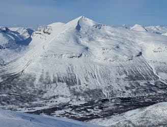
The Northeast bowl of Blåbærfjellet is an elusive line as you can’t see it from the valley but with a quick look at the topographical map it is obvious it is there. While both the South and Northeast faces of Blåbærfjellet are committing I would say this route is a bit more challenging and should be done in low avalanche conditions. Once at the crux it gets a bit sketchy for a few turns and going the wrong way could leave you bootpacking back up over a convex slope hoping that you don’t cause a slab avalanche.
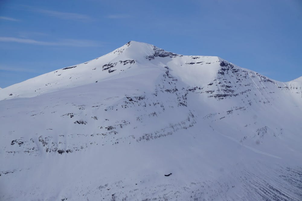
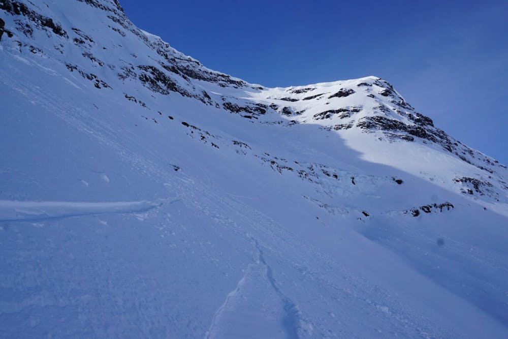
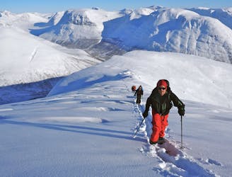
The ascent route on this is the exact same as the Southern Slope with a gradual climb on the small ridges next to the gullies in the trees before you make your way to an obvious gully that makes its way into the alpine. This is the crux of the climb so it needs to be done cautiously with people going one at a time and regrouping on the upper slopes. Once in the alpine area do a low angle traverse over to the Eastern Ridge and make your way up on the high point all the way to the upper face. You will reach a point just below the summit where you need to climb on the Northeast headwall. While it can be ascended on skins if you are quite talented I prefer cramponing and just getting it over with until reaching the summit.
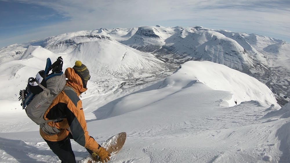
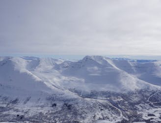
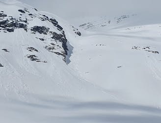
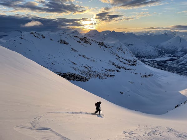
Standing on top there is enough room for a handful of people to transition while you look down at the inviting Northeast face that you are about to descend. Looks can be deceiving as a few hundred meters lower it seems the slopes just drop away and this is the case. Starting your descent you need to head skiers right to avoid a small rock band before heading skiers left into the lower angled gut of the bowl. Riding along you will soon notice that the angle drops off dramatically as you slowly edge your way up to the unknown. The trick to this section is to stay on the skiers left at first and find a small snow covered section to get down into the gully before zig zagging thought the occasional rock band and into the more open slopes.
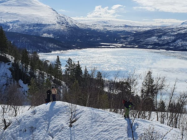
Once you’re enjoying the adrenaline rushing through your blood start riding down but remember that A you have a long ways to go and B below you is a super flat valley. Being a snowboarder we made a long traverse with the occasional powder turn before heading into the flats and starting to skin towards the Jempehaugen Trail head. Once at said trailhead it’s time for a “Choose your own adventure” with the options being walking back up the road towards your car or hitch hiking.
For more photos and information on the route check out this link https://www.whereiskylemiller.com/tamokdalen/blabaerfjellet-northeast/
Difficult
Serious gradient of 30-38 degrees where a real risk of slipping exists.

As well as the slope itself, there are some obstacles (such as rock outcrops) which could aggravate injury.
Away from help but easily accessed.
6 m away
An eficent way to take advantage of a powder day
Difficult Ski Touring
26 m away
A classic in the backyard of Tamok Husset
Moderate Ski Touring
42 m away
Some of - if not the - best storm riding in all of Northern Norway
Easy Ski Touring
406 m away
A big mountain offering fun freeriding with a true alpine touch
Difficult Ski Touring
411 m away

The instant classic line just behind Tamokhuset
Moderate Ski Touring
412 m away
A great sheltered bowl just out of reach from the average ski tourer right behind Tamokhuset.
Difficult Ski Touring
418 m away
A scenic and relatively unexplored corner of the Tamokdalen Backcountry
Difficult Ski Touring
420 m away
Making the most out of the backcountry just behind Tamokhuset
Moderate Ski Touring
423 m away
A long and scenic ski tour from Through Norway, Sweden and Finland
Severe Ski Touring
423 m away
Making the most out of a rare sunny night during the midnight sun.
Difficult Ski Touring
5 routes · Ski Touring
8 routes · Ski Touring
3 routes · Ski Touring