368 m away
Blåbærfjellet Powder Storm Day
Some of - if not the - best storm riding in all of Northern Norway
Easy Ski Touring
- Distance
- 6.7 km
- Ascent
- 819 m
- Descent
- 819 m
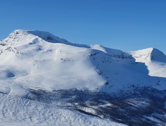
A big mountain offering fun freeriding with a true alpine touch
Ski Touring Difficult

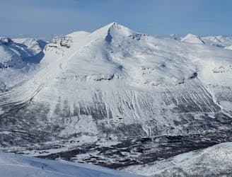
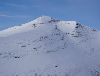
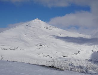
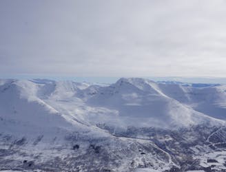
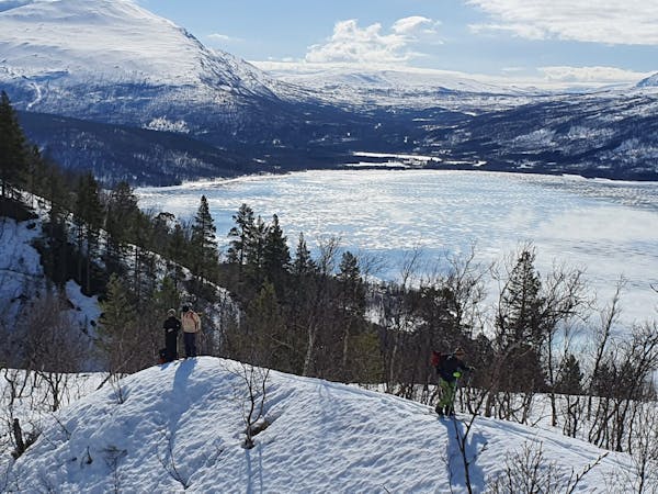
Blåbærtinden is a beautiful ski mountain with some great freeride terrain to discover!
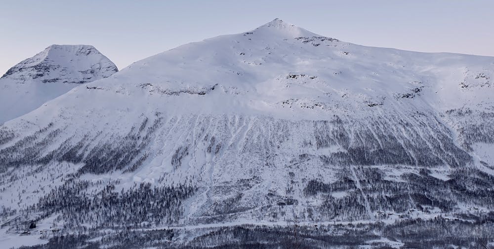
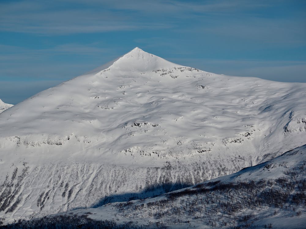
The mountain is one of the true Tamok classics both for the ski quality and the impressive views. Blåbærtinden means blueberry mountain in Norwegian but there is no blue run type of skiing on this tour.
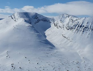
Much of the skiing on Blåbærtinden takes place in avalanche terrain or in avalanche paths. To ski safely here it requires skiers to have great snow assessment skills as well as profound understanding of terrain choices. From the top ridge you will have several options of where to ski down depending on conditions and ski ability. Good skiers will have a lot of fun charging down the top ridge in stable conditions and the small formations offer playful riding on much of the descent.
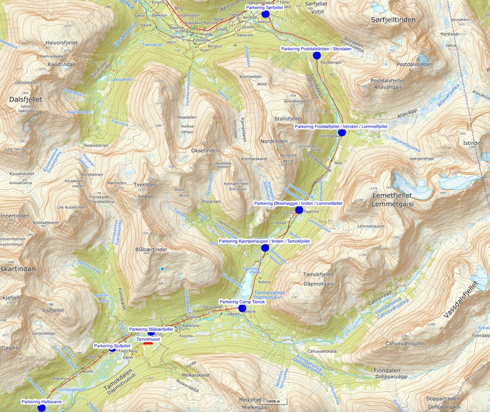
The Blåbærtinden normal route starts by the road underneath the visible avalanche path in the area of Olsrud / Sletta. It is important take care of where you park in the Tamok Valley and to ONLY use the parking areas along the road that are mowed. Do not park on the road where there is no parking as this will cause problems for both the general traffic and the local farmers! Ask the locals if necessary, they are happy to help out.
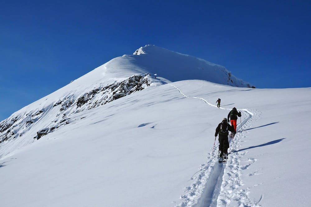
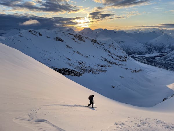
Place the skin track through the scarcely separated birch trees. At around 600m, the slope angle steepens to around 35° as you find your way up through a band of cliffs. Once through, the terrain eases out a bit until you climb up towards the east ridge. From here it is easy to scout line choices for the descent. Again, be aware of the snow conditions! The south face of Blåbærtinden offers amazing skiing but in a terrain formation that can cause huge avalanches when there are weak layers lurking. Make sure to check the local avalanche bulletin for the area.
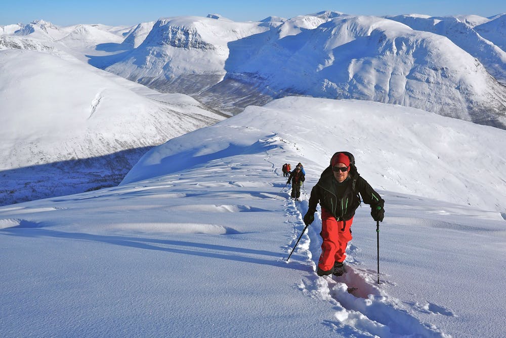
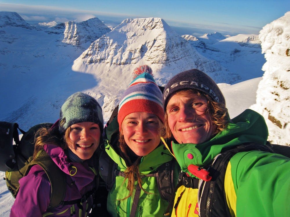
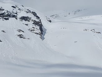
Follow the ridge up to the summit and be prepared to use crampons and an ice axe for the final section. The last 50 vertical meters are steep and require carrying the skis.
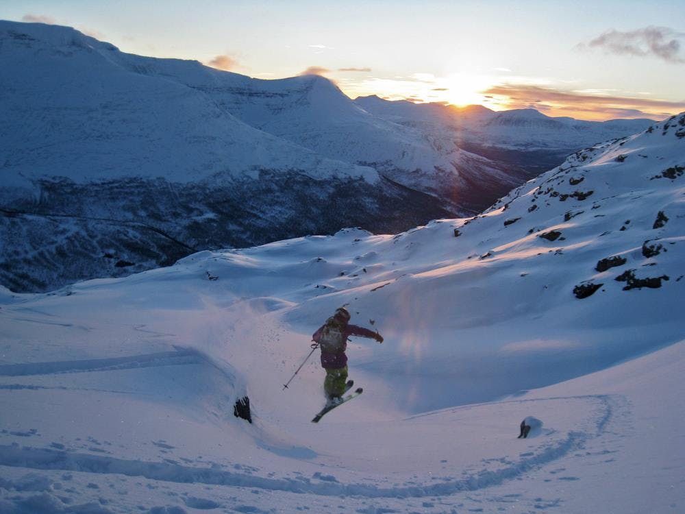
The descent follows the ascent line or alternatively (as shown here) drops into the south face where the first 200 vertical meters of the descent goes in terrain up to around 40°.
Follow the ascent line from around 800m elevation and down back to the parking.
Difficult
Serious gradient of 30-38 degrees where a real risk of slipping exists.

Exposure is limited to that of the slope itself. Getting hurt is still likely if the slope is steep and/or the snow is hard.

Little chance of being seen or helped in case of an accident.
368 m away
Some of - if not the - best storm riding in all of Northern Norway
Easy Ski Touring
406 m away
A great sheltered bowl which starts off easy they makes you question if the line even goes.
Difficult Ski Touring
409 m away
A classic in the backyard of Tamok Husset
Moderate Ski Touring
410 m away
An eficent way to take advantage of a powder day
Difficult Ski Touring
696 m away
A great sheltered bowl just out of reach from the average ski tourer right behind Tamokhuset.
Difficult Ski Touring
704 m away

The instant classic line just behind Tamokhuset
Moderate Ski Touring
706 m away
Making the most out of the backcountry just behind Tamokhuset
Moderate Ski Touring
707 m away
A scenic and relatively unexplored corner of the Tamokdalen Backcountry
Difficult Ski Touring
714 m away
Making the most out of a rare sunny night during the midnight sun.
Difficult Ski Touring
714 m away
A long and scenic ski tour from Through Norway, Sweden and Finland
Severe Ski Touring

5 routes · Ski Touring
8 routes · Ski Touring
3 routes · Ski Touring