7 m away
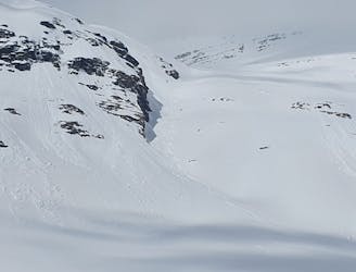
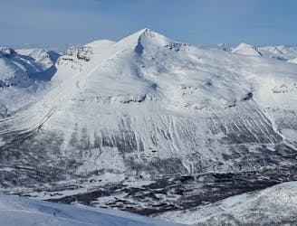
Háhttagáisi Northwest Bowl and South Chute
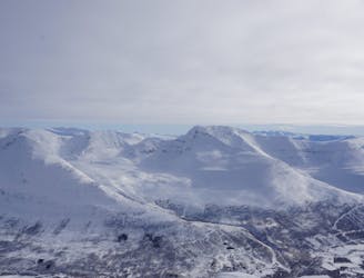
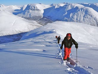
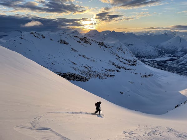
Making the most out of a rare sunny night during the midnight sun.
Difficult Ski Touring
- Distance
- 30 km
- Ascent
- 2.4 km
- Descent
- 2.4 km
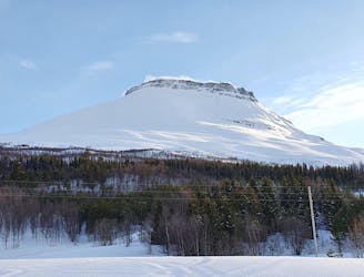
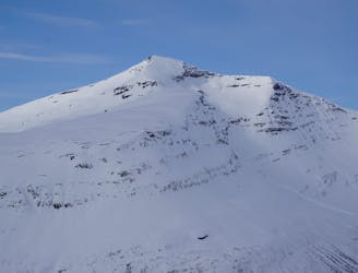
A scenic and relatively unexplored corner of the Tamokdalen Backcountry
Ski Touring Difficult
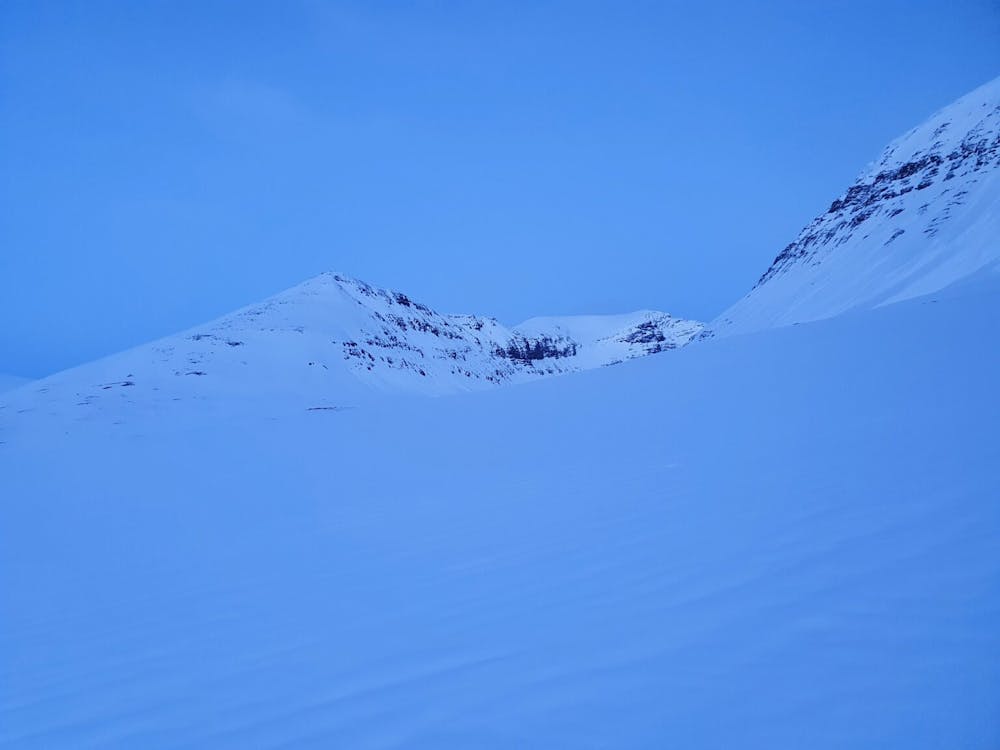
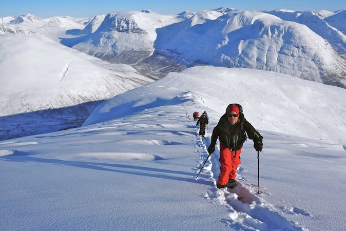
This route was more of an exploratory mission for me as I had seen the mountain on the maps for a while and wanted to see if it was worth a ski tour. To my surprise I found a route where you can skin all the way to the summit while getting great views into the Vasseldalen valley. This tour is great if you are looking to do something different but don’t want to get stressed by complex terrain.
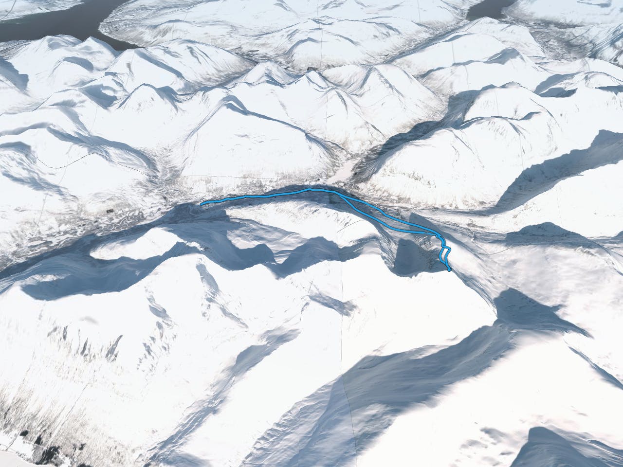
If you look at the map you can see that I started from Tamokhuset but that was because I didn’t have a car so instead I will explain from a perspective as if I was driving.
This tour is best if started via Camp Tamok and following the summer road which should have numerous snowmobile tracks. Before long the road will branch to the left or right and you will want to go via the lookers right. Soon enough you will cross over the bridge of Vassdalselva and start making your way towards the North bowl of Nerotinden. Once on the edge of said bowl start heading lookers left up the ridge making switchbacks up the face. Before long you will hit a nice flat bench and from here on out you can follow a mellow ridge all the way to the summit.
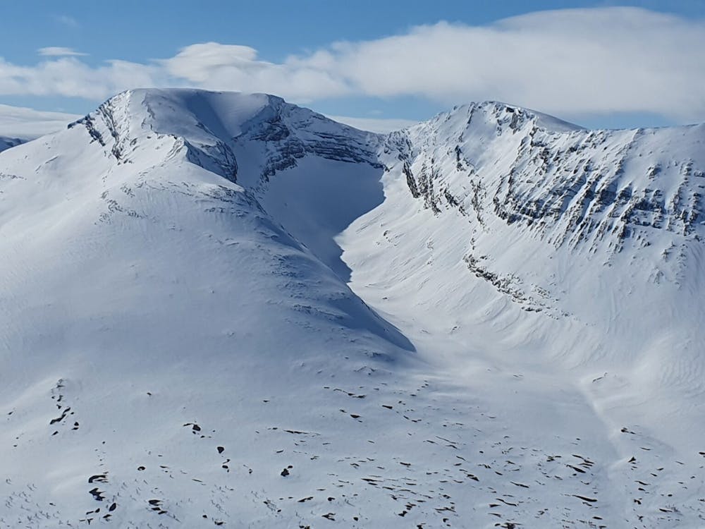
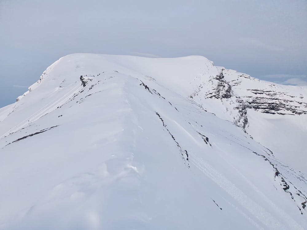
While on the upper ridge there is one small semi complex spot were it is better to drop a few feet to the lookers right before proceeding towards the summit. Standing on the summit you will be able to look into the Northeast bowl which I describe in another route.
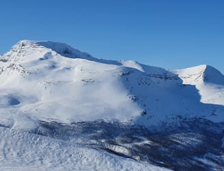
When descending back down the ridge I found it easier to avoid the semi complex ridge section by traversing across the upper South face before taking off my board and bootpacking back up to the ridge. If done right you will be right on top of the North ridge which offers great and wide open steep turns all the way to the valley. Once back down loosely follow your skin track over to the bridge before skinning back on the summer road to Camp Tamok.
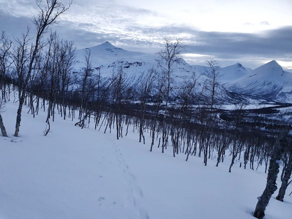
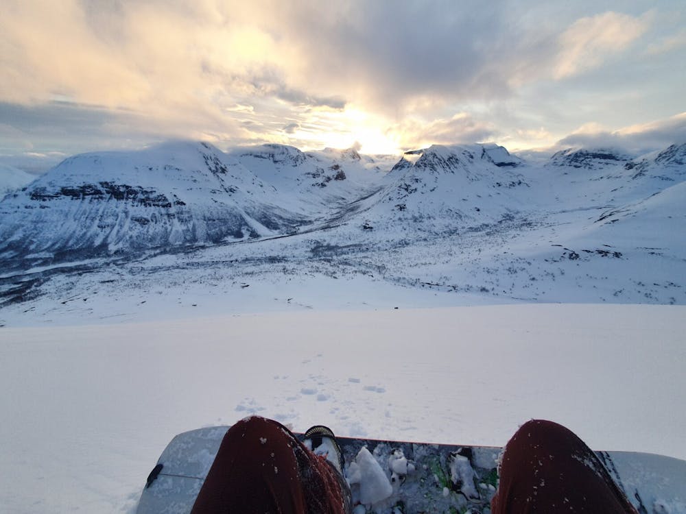
This tour is great in both corn and powder but really is best as a late afternoon ski tour. If timed right you can get the line basking in the sunset/sunrise light.
For more photos and information on the route check out this link https://www.whereiskylemiller.com/tamokdalen/nerotinden-north/
Difficult
Serious gradient of 30-38 degrees where a real risk of slipping exists.

Exposure is limited to that of the slope itself. Getting hurt is still likely if the slope is steep and/or the snow is hard.

Little chance of being seen or helped in case of an accident.
7 m away
Making the most out of a rare sunny night during the midnight sun.
Difficult Ski Touring
8 m away
A long and scenic ski tour from Through Norway, Sweden and Finland
Severe Ski Touring
8 m away

The instant classic line just behind Tamokhuset
Moderate Ski Touring
8 m away
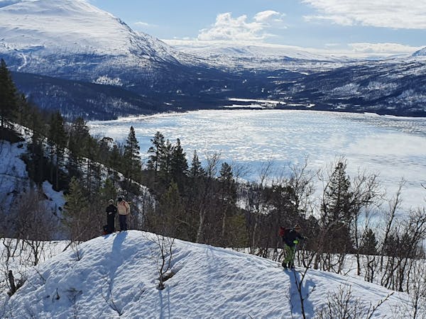
Making the most out of the backcountry just behind Tamokhuset
Moderate Ski Touring
13 m away
A great sheltered bowl just out of reach from the average ski tourer right behind Tamokhuset.
Difficult Ski Touring
394 m away
A classic in the backyard of Tamok Husset
Moderate Ski Touring
418 m away
A great sheltered bowl which starts off easy they makes you question if the line even goes.
Difficult Ski Touring
420 m away
An eficent way to take advantage of a powder day
Difficult Ski Touring
453 m away
Some of - if not the - best storm riding in all of Northern Norway
Easy Ski Touring
707 m away
A big mountain offering fun freeriding with a true alpine touch
Difficult Ski Touring
5 routes · Ski Touring
8 routes · Ski Touring
3 routes · Ski Touring