305 m away
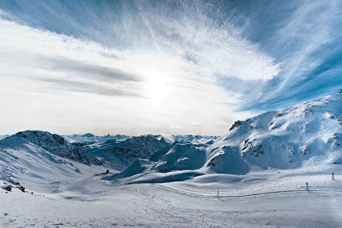
Rinerhorn E face

Rinerhorn (2528m) to Sertig valley (1750m), a full backcountry experience with resort approach.
Severe Freeride Skiing
- Distance
- 2 km
- Ascent
- 0 m
- Descent
- 822 m
Long backcountry experience to Sertig Valley
Freeride Skiing Difficult

From the top of Juonli T-bar go to the other side of the mountain from the pistes. There is a big wide rocky creek a long way down below. From your entry point ride down through this rolling terrain, watching out for the first steep section an then keep riding down starting a traverse to the right leaving the wide rocky creek to your left. Another creek should be visible far down on the right side just below a cliff area where there is a big mountain hut. Ride below the cliffs to the hut, crossing the creek just after the hut. After that you should be just at the tree line where the forest starts. A clear area should lead you down on an easily recognisable slope through the forest. Try to stay on the left side riding down the forest till you get down to the valley. From there you should see the road at Sertig valley. Cross the stream, there are bridges all the way, depending on the snow depth they will be easy to find if the stream its not completely covered by snow. The next step is walk up to the road to get a ride with the Bus back to Davos, then repeat maybe?
Difficult
Serious gradient of 30-38 degrees where a real risk of slipping exists.

As well as the slope itself, there are some obstacles (such as rock outcrops) which could aggravate injury.

Little chance of being seen or helped in case of an accident.
305 m away
Rinerhorn (2528m) to Sertig valley (1750m), a full backcountry experience with resort approach.
Severe Freeride Skiing
560 m away

Classic backcountry into Sertig valley
Difficult Freeride Skiing
1.4 km away

Open terrain freeride area
Difficult Freeride Skiing
3.9 km away

Popular off piste in the resort boundaries
Easy Freeride Skiing
3.9 km away

Gentle wide freeride with stunning views.
Moderate Freeride Skiing
4.2 km away

Easy and safe slope through the forest
Difficult Freeride Skiing
4.3 km away

Rocky steep couloirs at Jakobshorn S face
Severe Freeride Skiing
4.3 km away

Alpine Couloirs with easy access
Severe Freeride Skiing
4.4 km away

Extreme freeride area for experienced riders
Severe Freeride Skiing
4.4 km away

Backcountry route for experienced riders
Severe Freeride Skiing
14 routes · Freeride Skiing