305 m away
Juonli to Sertig valley

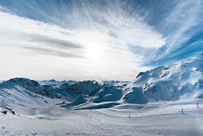
Long backcountry experience to Sertig Valley
Difficult Freeride Skiing
- Distance
- 2 km
- Ascent
- 0 m
- Descent
- 673 m
Rinerhorn (2528m) to Sertig valley (1750m), a full backcountry experience with resort approach.
Freeride Skiing Severe

From Juonli Tbar hike the N ridge of Rinerhorn (2528m) which will be around 1 to 1.5h. Mountaineering equipment such as crampons, ice axe and rope is recommended. Snow conditions my vary on the approach- it can be icy. Once at the top you can ride the NE or the E face. The NE face is quite steep with some serious cliffs, the E face has a very smooth slope to a flatter area with some rocky rollers on your right. Pass by those leaving them on your right and head down to another rolling area which is very ridable. You should be able to see now a big mountain hut just underneath some cliffs. Just after that rolling area the slope gets into a creek where the forest begins. The right entry to the creek its slightly steeper than the left. Keep riding down in this creek till you get to the valley floor where the forest will open up. This last area might have slightly denser vegetation. Once down you should be able to see the Sertig road in the valley. Cross the stream and walk up to the road to get a ride with the bus back to Davos.
Severe
Steep skiing at 38-45 degrees. This requires very good technique and the risk of falling has serious consequences.

As well as the slope itself, there are some obstacles (such as rock outcrops) which could aggravate injury.

In the high mountains or remote conditions, all individuals must be completely autonomous in every situation.
305 m away
Long backcountry experience to Sertig Valley
Difficult Freeride Skiing
856 m away

Classic backcountry into Sertig valley
Difficult Freeride Skiing
1.2 km away

Open terrain freeride area
Difficult Freeride Skiing
4.1 km away

Gentle wide freeride with stunning views.
Moderate Freeride Skiing
4.1 km away

Popular off piste in the resort boundaries
Easy Freeride Skiing
4.5 km away

Easy and safe slope through the forest
Difficult Freeride Skiing
4.5 km away

Rocky steep couloirs at Jakobshorn S face
Severe Freeride Skiing
4.5 km away

Backcountry route for experienced riders
Severe Freeride Skiing
4.5 km away

Alpine Couloirs with easy access
Severe Freeride Skiing
4.6 km away

Extreme freeride area for experienced riders
Severe Freeride Skiing
14 routes · Freeride Skiing