1.3 km away
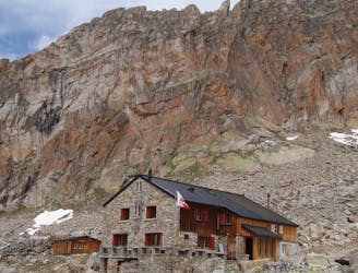
Approach to the Mischabel Hut
A very steep walk, luckily made shorter by the lift from Saas Fee
Extreme Hiking
- Distance
- 3.9 km
- Ascent
- 1.1 km
- Descent
- 66 m
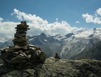
short swiss thru hike
Hiking Difficult

This is a popular hiking route which is generally considered to be difficult. It's remote, it features high exposure and is typically done between March and September. From a low point of 1.1 km to the maximum altitude of 3 km, the route covers 142 km, 9683 vertical metres of ascent and 10000 vertical metres of descent.
thru hike
Difficult
Hiking trails where obstacles such as rocks or roots are prevalent. Some obstacles can require care to step over or around. At times, the trail can be worn and eroded. The grade of the trail is generally quite steep, and can often lead to strenuous hiking.

Some trail sections have exposed ledges or steep ascents/descents where falling could cause serious injury.

Away from help but easily accessed.
1.3 km away
A very steep walk, luckily made shorter by the lift from Saas Fee
Extreme Hiking
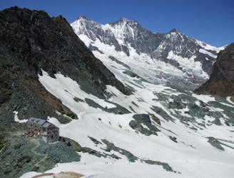
2.5 km away
A scenic hike which puts you in position for further adventures.
Difficult Hiking
4.8 km away
A short trip to a well positioned hut.
Moderate Hiking

9 routes · Alpine Climbing · Hiking

6 routes · Alpine Climbing · Hiking