Tsopu: Top-to-Bottom Run
The best top-to-bottom run combination with Tsopu.
Difficult Mountain Biking
- Distance
- 5.3 km
- Ascent
- 0 m
- Descent
- 674 m
Dip your toes into Verbier's enduro riding scene.
Mountain Biking Severe

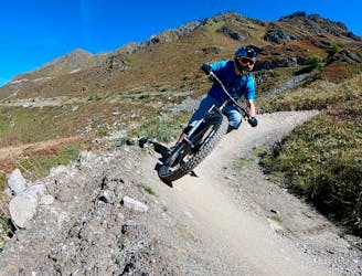
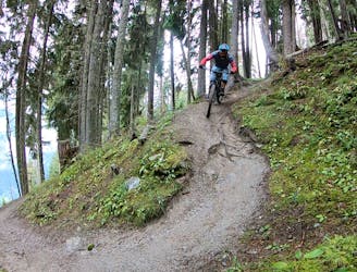
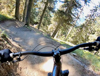
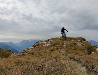
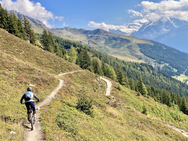
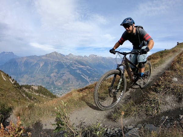
The "Red Trail," also known by some as "EN05," is the perfect way to warm up on the top-to-bottom enduro trails running from the top of Les Ruinettes lift all the way down to Le Chable far below. The Red Trail is one of the easier full-blooded enduro routes, and since it is well-labeled both on the map and out in the mountains with bright red arrows, it's also fairly easy to navigate.
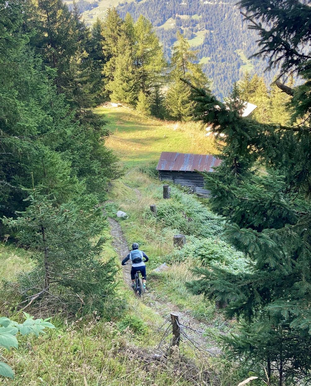
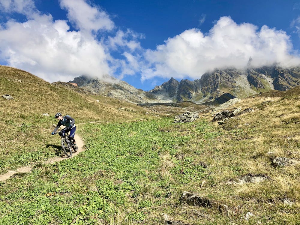

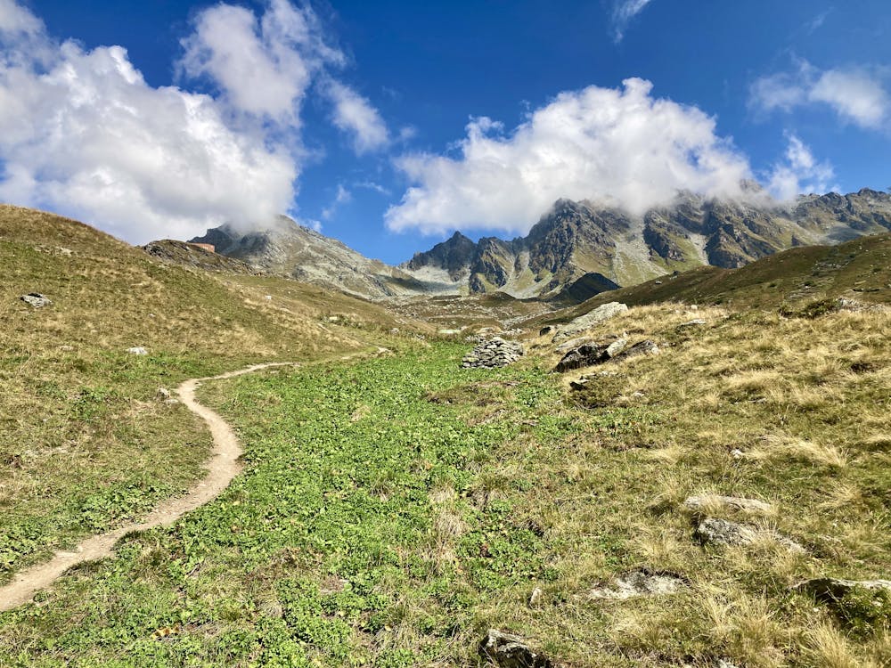
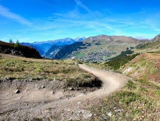
After pedaling from the top of Les Ruinettes across the dirt road, you'll spot the red sign pointing down the mountain. The descent begins fast and furious, ripping down wide-open singletrack through alpine meadows. You'll cross several roads and pass through a few small collections of houses on the mountainside—be sure to slow down when passing between houses.
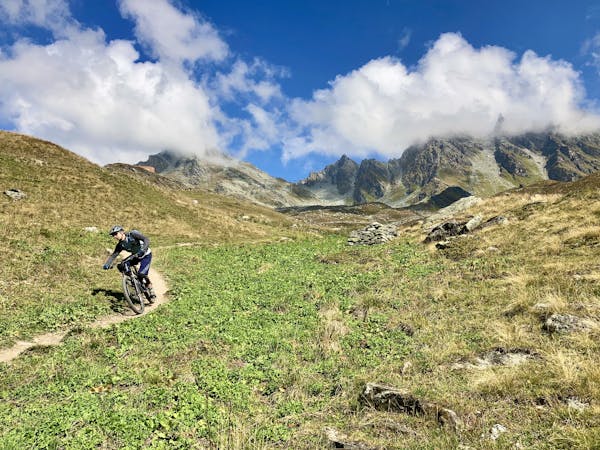
As you descend, the singletrack gets twistier and more technical. Stacks of switchbacks require constant turning, but modern trail maintenance has made these turns eminently more mountain bikeable than they were in the years of yore.
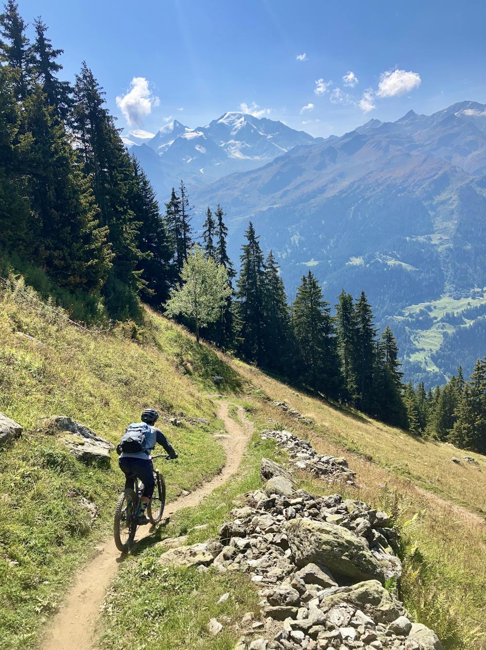
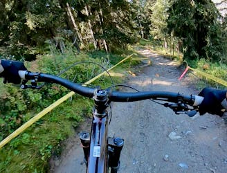
After dropping into the trees, the singletrack gets significantly more technical, with rock gardens, root webs, and a few sections of significant exposure. This is still advanced-level mountain biking and would easily earn a black diamond rating in North America. The FATMAP difficulty rating of "Severe" is well-earned.
Lower down, you'll have to connect several stretches of dirt and paved roads to hit all the bits of singletrack. At times it can be difficult to find all of these various singletrack connectors. The best thing to do is to watch for the red signs and pay close attention to this map. If you miss a section, no worries: just continue downhill and try to grab the next one.
Eventually, you'll wrap up this route in the lift station at Le Chable. A two-lift combination will take you back to the top of Les Ruinettes for your next rip down the mountain!
Severe
Widely variable, narrow trail tread with steeper grades and unavoidable obstacles of 15in/38cm tall or less. Obstacles may include unavoidable bridges 24in/61cm wide or less, large rocks, gravel, difficult root sections, and more. Ideal for advanced-level riders.

Some trail sections have exposed ledges or steep ascents/descents where falling could cause serious injury.

Away from help but easily accessed.
The best top-to-bottom run combination with Tsopu.
Difficult Mountain Biking
1 m away
2,000 metres of extremely technical downhill riding that has been used for European and Swiss Cup downhill races!
Extreme Mountain Biking
1 m away
A fast, wide-open romp down from the hut at Croix de Coeur.
Moderate Mountain Biking
1 m away
A smooth rip down the mountainside.
Moderate Mountain Biking
1 m away
One of the most renowned enduro rides in Verbier.
Extreme Mountain Biking
3 m away
Getting from Verbier to La Tzoumaz Flow Trail and back
Moderate Mountain Biking
3 m away
A mythical descent that should strike fear or excitement into any rider. Very long, very steep, very technical and very exposed. Not for the faint hearted or those with a fear of heights.
Severe Mountain Biking
6 m away
Wouaiy (like the sound you make when you ride this trail) is the most complete 'Bike Park' trail that has a extremely natural feeling to it.
Severe Mountain Biking
7 m away
An epic point-to-point route from the Verbier bike park to Martigny.
Severe Mountain Biking
389 m away
This blue run is fun, flowing, and the easiest marked trail in the resort.
Moderate Mountain Biking

25 routes · Mountain Biking
8 routes · Mountain Biking
7 routes · Mountain Biking
4 routes · Mountain Biking
10 routes · Mountain Biking