Transportation Details
The route as described traverses from the Verbier bike park across the mountainside, crosses the mountain ridge, and then descends all the way into Martigny. Due to the transit system, you can begin this route in Martigny, Le Chable, or Verbier, using the trains and lifts to make the connections. I'll describe this route as beginning in the population center of Martigny.
From Martigny, grab the train one-way to reach Le Chable. Several train stations in town will pick you up and deliver you to Le Chable, but beginning at the main train station is easiest. Le Chable is also the end of this spur line, so there's no way you can miss it. The cost for a ticket is about 11 Swiss Francs one-way.
At Le Chable, you'll transition from the train to the gondola without even leaving the building. What did I tell you about Swiss transit?! You'll need to buy a bike park ticket to legally get uplift for your bike on both of the gondolas, if you don't already have a bike park season pass. Cost of a bike park day pass was 50 Francs at the time of this writing. After riding up the first lift, you'll transition to the second lift—again, without leaving the lift building. At the top of the second lift (Les Ruinettes), it's time to leave the building and begin riding!
Ride Details
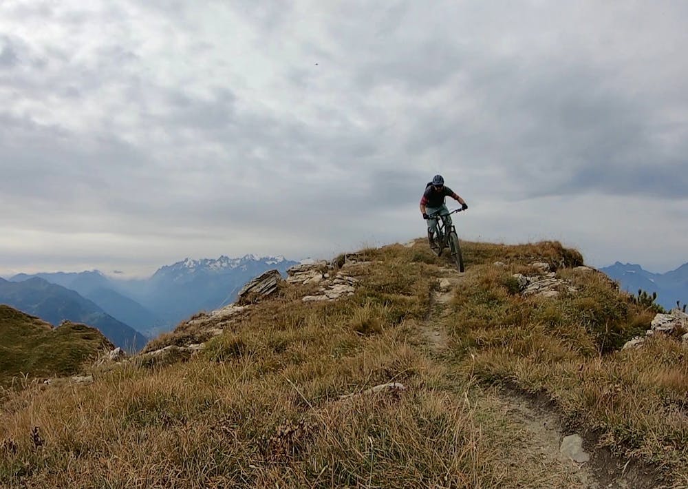
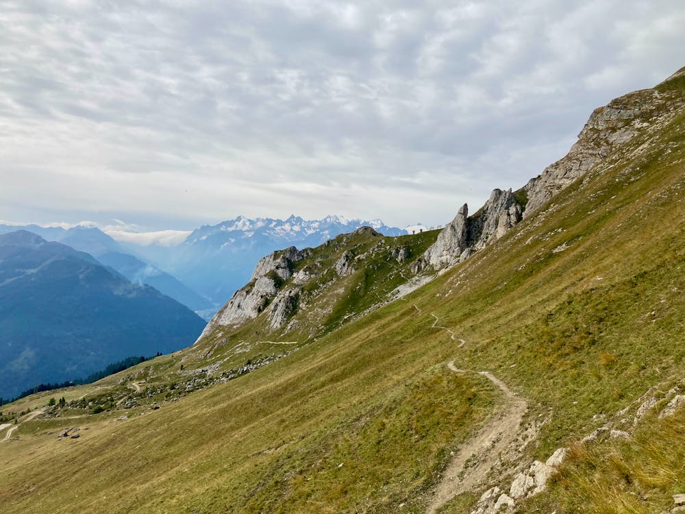
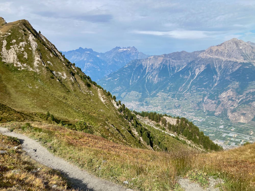
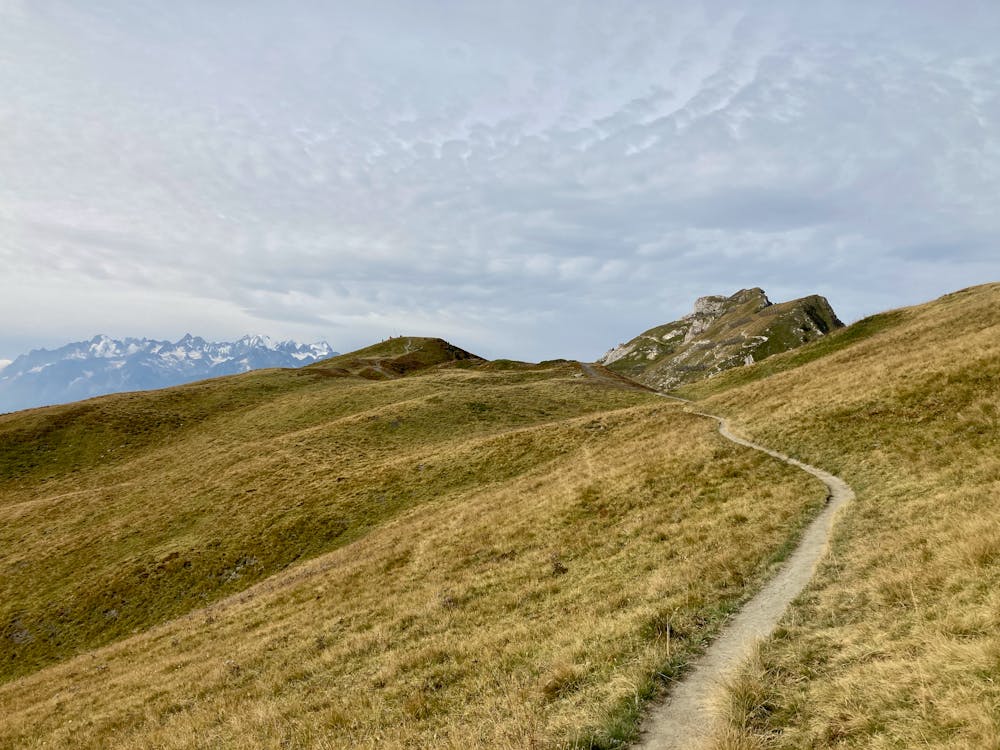
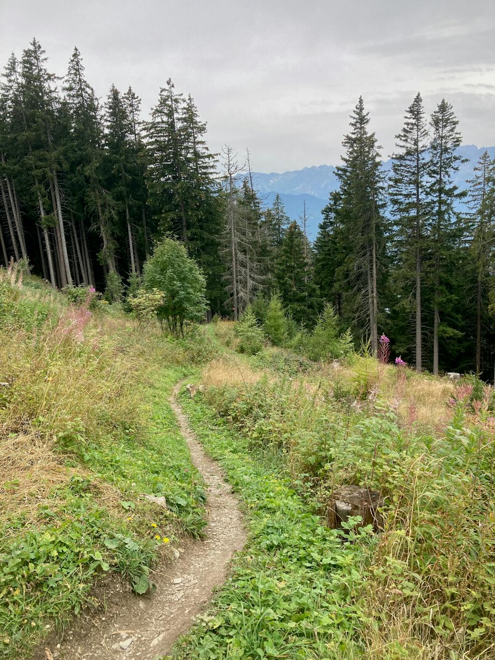
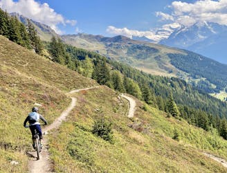
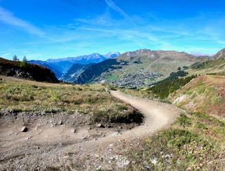
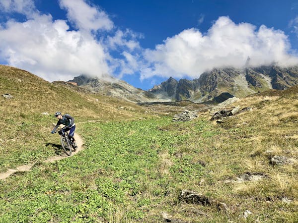
This 15.5-mile route begins by pedaling along the level gravel road above the resort of Verbier, working your way along the ridge to the far end. Once at the far end, the real work of the route comes, with a steep climb to reach the top of the ridge. The Ultimate is a true enduro route that requires a fair bit of climbing: about 457 meters. But that modest amount of climbing yields a whopping 2,185 meters of downhill shredding! You'll pedal up a section of dirt road, then rip down a short but superb stretch of singletrack, before throwing the bike on your shoulders and hike-a-biking to the very top.
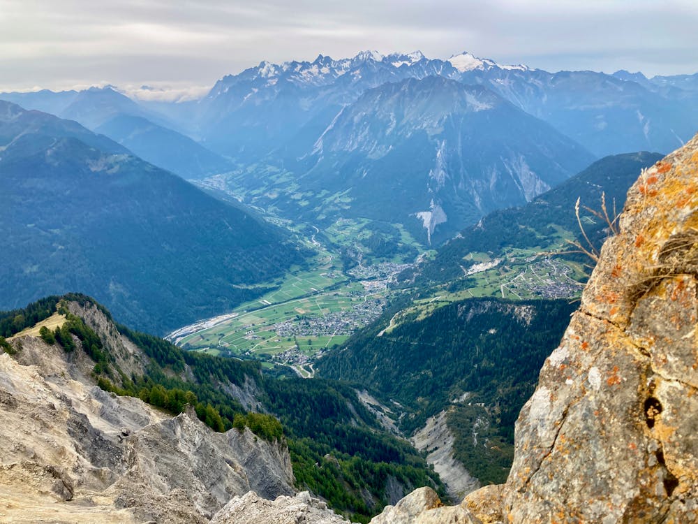
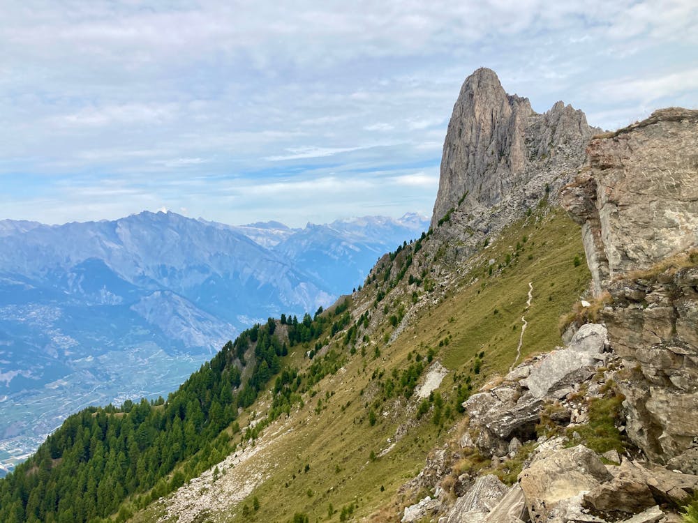
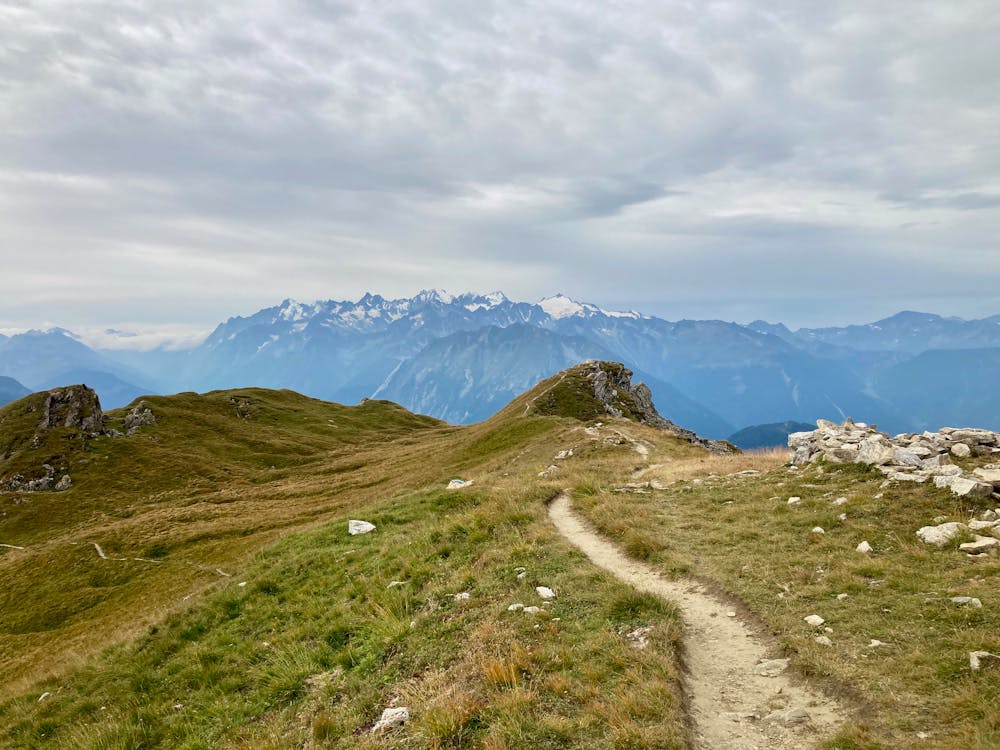
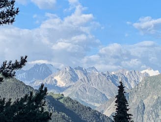
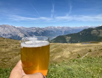
Once on the very top of the ridge, take a break and look around you. The views from this location are stupendous! You can enjoy expansive vistas of the Mont Blanc Massif, Grand Combin Massif, the Four Valleys spread out below you, and much, much more!
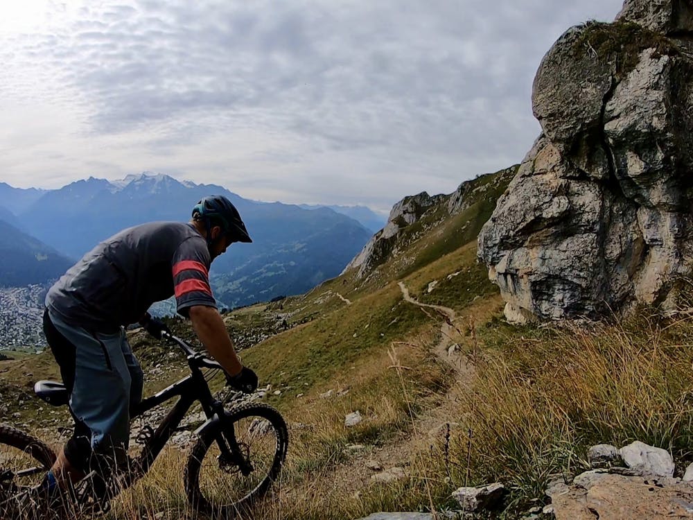
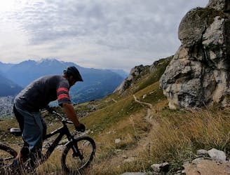
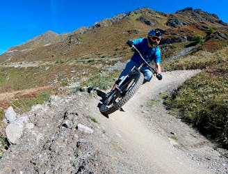
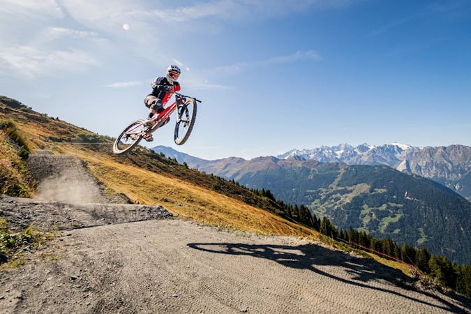
After enjoying a snack and the view, it's time to drop in! The first drop is arguably the most technical section of the entire trail, dropping steeply down a rutted-out, rock-strewn singletrack with no room to avoid any of the obstacles. Some of the obstacles on this stretch of trail could warrant an "Extreme" FATMAP difficulty rating, even though I've only given this route a "Severe" rating overall. Don't feel ashamed if you have to get off and walk a few sections, as that walking will deliver you to the goods down below.
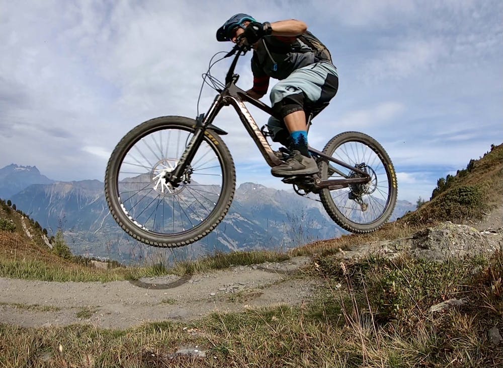
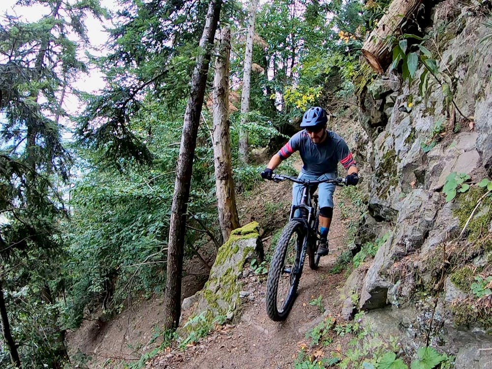
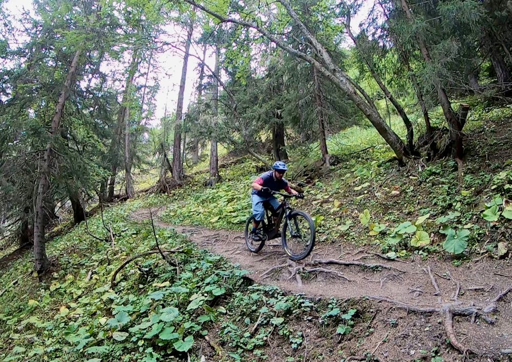
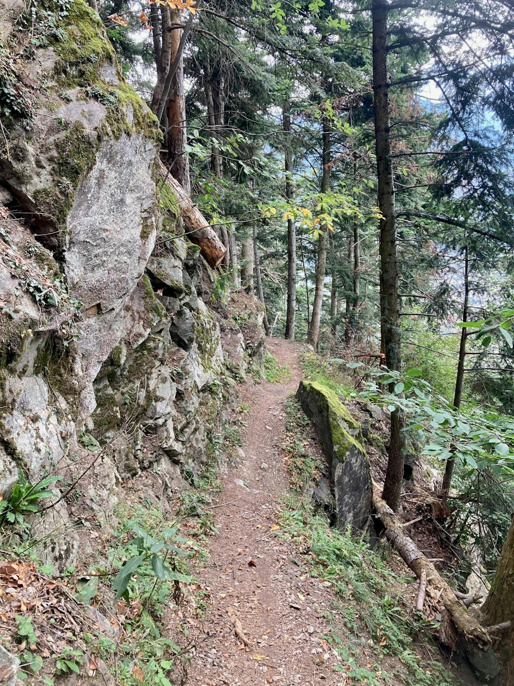
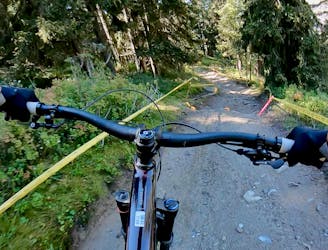
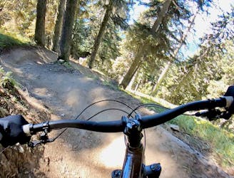
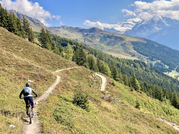
Once you drop into the trees, the grade mellows considerably as the singletrack begins to sidehill along the mountain. With wide-open sightlines and manageable trail, it's time to let off the brakes and start rocking and rolling! The trees whip by as you blast down the mountain, soaring over root webs and ripping into delightfully loamy corners.
The dirt on this north-facing mountainside is superb: dark, loamy goodness. It will definitely get greasy after a rain, but when conditions are prime, the traction and sensation of railing on dark, black dirt cannot be beaten. Compared to the rocky, dry soil found in many areas in the Alps, this loam offers a taste of what riding in the lush rain forests of the Pacific Northwest is like. While you'll encounter some rock gardens along the way, root webs and steep, off-camber turns pose most of the technical threat along this section of the ride.
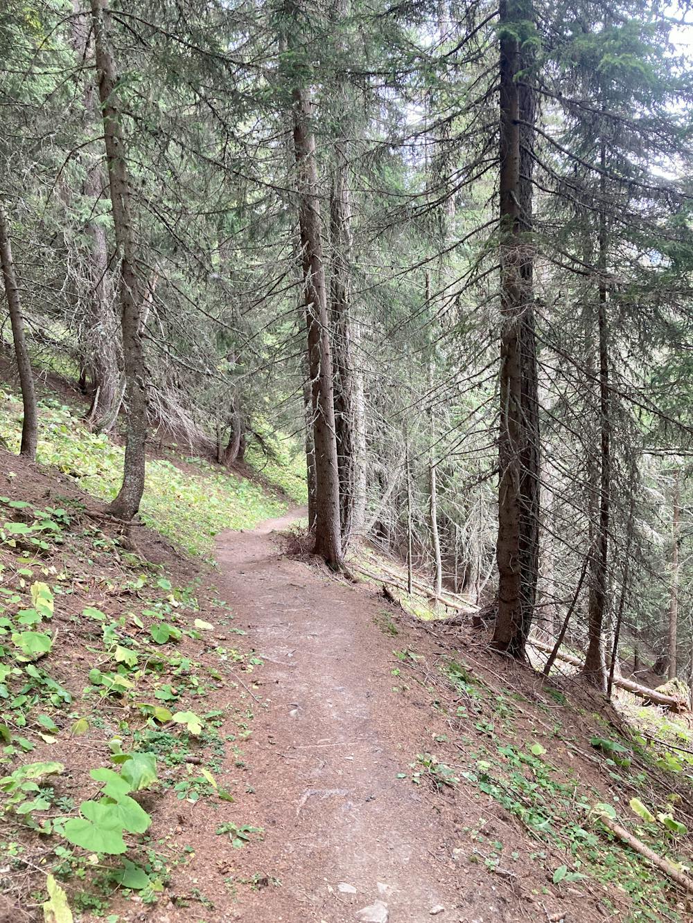
After blasting down the mountain for what seems like ages, the grade will mellow out, and you'll hit a road. The next portion of the route requires some complex navigation—be sure to keep your phone handy so that you can refer to this map. You'll have to navigate through a maze of mountain roads and singletrack to pick up the best chunks of singletrack. There are many alternate routes in this zone, and if you get the chance to ride The Ultimate more than once, you might opt to explore more trails in this area. That said, the route as mapped attempts to maximize the singletrack riding and minimize the road riding.
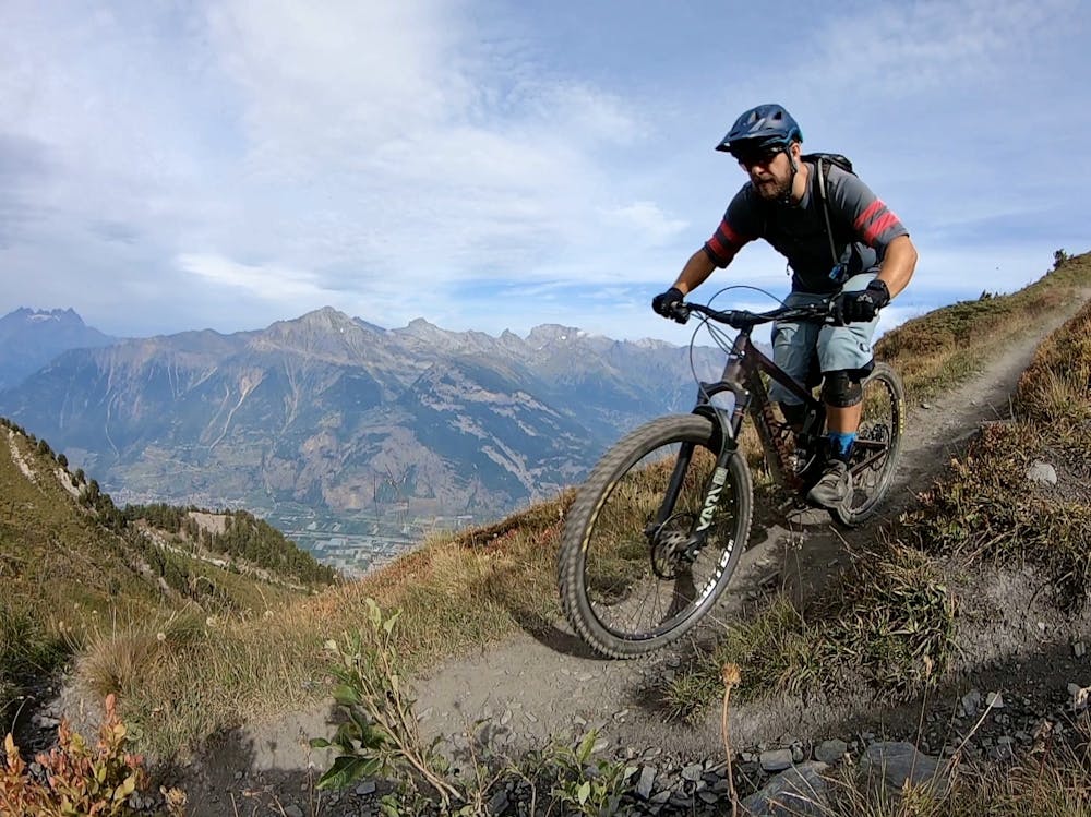
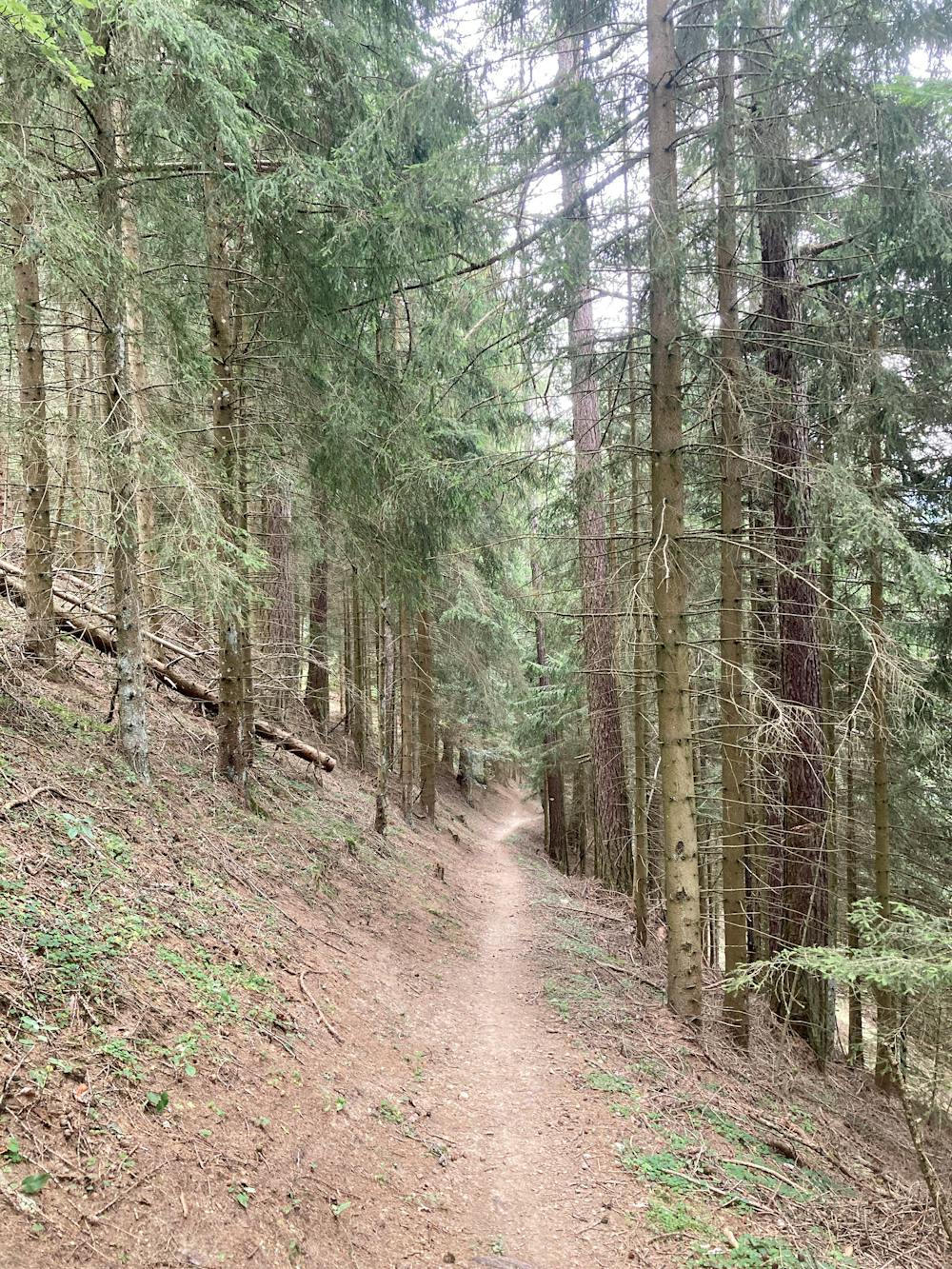
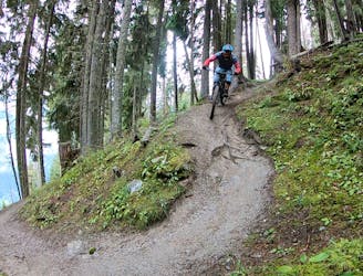
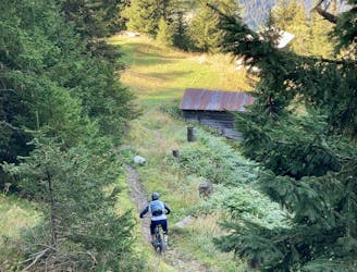
Once you've finished squirreling your way across this flat-topped mountain, the descending begins again in earnest! The next section seems to abandon any pretense at sidehilling, with steep, eroded, fall-line singletrack blasting straight down the mountainside beneath towering pine trees on dark, loamy soil. Some sections have become eroded and very technical as a result of the fall line grades. In some areas, bypasses and reroutes have recently been constructed.
After connecting several trails together, you'll come to the final descent of the ride. This conclusion is just as good as everything that has come before, but with its own unique character. While you'll still enjoy some dark black dirt, this section of trail is dramatically rockier and more technical than the rest of the northside section. The narrow track descends at an angle along a benchcut on the mountainside, sneaking below vertical rock faces and climbing up and over boulders. The narrow trail tread is very exposed the entire time, with a fall to the downhill side promising serious injury (or worse). This dramatic combination of factors helps make the Ultimate a demanding, expert-level mountain bike ride.
This fast, technical, steep final pitch is guaranteed to be a brake-burner, leaving your rotors blazing hot as you finish! Once off the trail, pedal back into downtown Martigny for a burger and a beer. You earned it!