1.2 km away
Moraine Trail
Short trail from Fallen Leaf Lake Campground with views of the lake and Taylor Creek.
Easy Hiking
- Distance
- 1.5 km
- Ascent
- 18 m
- Descent
- 18 m
Stroll through the forest past alpine lakes, then tackle a strenuous climb to the top of the proudest peak on Lake Tahoe's shore.
Hiking Difficult

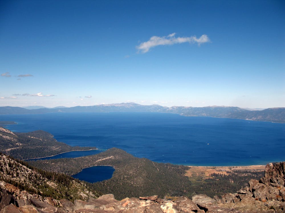
Mount Tallac (9,738 ft) is the prominent, craggy mountain above Lake Tahoe’s southeast shore. The Mount Tallac Trail is the typical route to the summit. Any distance along this trail is rewarding, even if you don’t tackle the final steep miles to the top of the mountain. Within the first two and a half miles are beautiful views over Fallen Leaf Lake and a few smaller lakes perched at the base of the mountain.
The journey to the summit is most popular in summer and fall. Early season warrants snow traction at the higher elevations, and winter ascents are a snowshoeing or skiing mission.
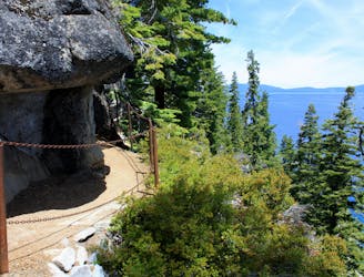
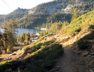
At the Mount Tallac Trailhead you must fill out a free permit to enter the Desolation Wilderness. Begin on an obvious path through open conifer forest and sagebrush meadows up a moderate incline. It climbs onto a broad bench in between Tallac and Fallen Leaf Lake. Views are of rocky slopes above, blue water below, and a horizon full of distant peaks.
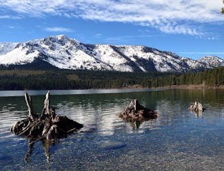
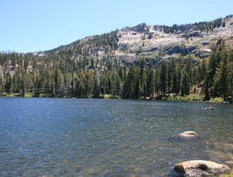
At mile 1.6 is Floating Island Lake, a quiet pond at the foot of Tallac. Look for the small floating grass island that gives the lake its name. Just past here comes the first really great perspective of Mount Tallac. The trail crosses rocky meadows at the base of sweeping talus slopes. The toothy ridge overhead is what you must gain to reach the top.
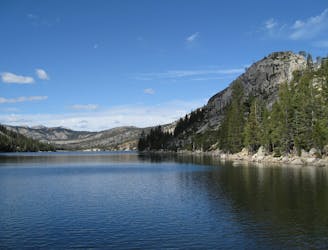
At mile 2.3 you'll pass Cathedral Lake, a smaller but even prettier pond in a bowl placed improbably between the walls of Tallac above and the 1,000-foot hillslope to Fallen Leaf Lake below. This is a nice place to take a dip on a hot day, and to refill bottles if you have water treatment.
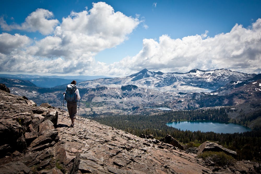
The rest of the hike up the mountain is dry and exposed to the sun. The trail heads steeply upward from Cathedral, earning evermore impressive views over the lakes below.
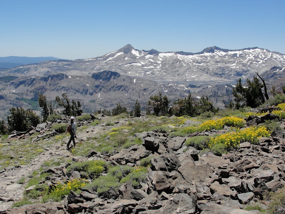
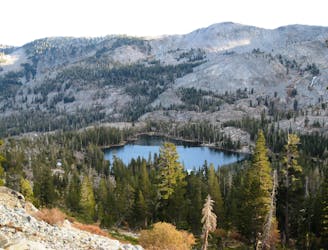
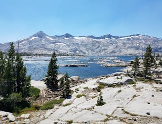
Switchbacks top out on the mountain’s south shoulder, where fields of wildflowers allow broad vantage to the west over the peaks of the Crystal Range and the interior of the Desolation Wilderness. The hulk of Pyramid Peak dominates the skyline, and the circular form of Gilmore Lake rests below.
The steepest section of the hike is behind, but more work lies ahead, so catch your breath and take in the view before continuing up, among wind-warped pines and more flower-filled meadows. One more rocky climb guards the summit, but it is short, and before you know it you’ll be atop the proudest peak on Lake Tahoe’s shore.
Difficult
Hiking trails where obstacles such as rocks or roots are prevalent. Some obstacles can require care to step over or around. At times, the trail can be worn and eroded. The grade of the trail is generally quite steep, and can often lead to strenuous hiking.

The trail contains some obstacles such as outcroppings and rock which could cause injury.
Away from help but easily accessed.
1.2 km away
Short trail from Fallen Leaf Lake Campground with views of the lake and Taylor Creek.
Easy Hiking
4.7 km away
Short hike to a stunning alpine lake with the amenities of day-use or overnight kayak and cabin rentals at Angora Lakes Resort.
Moderate Hiking
5 km away
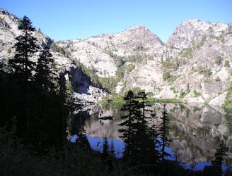
Ascend steeply through intimidating cliff bands to reach a high saddle on Echo Peak, then drop down into a granite basin of sparkling lakes in the Desolation Wilderness.
Difficult Hiking
5 km away
Easy hike past waterfalls, lakes, and a historic springs resort that leads to more strenuous trails in the Desolation Wilderness, including a way to the top of Mount Tallac.
Moderate Hiking
5.2 km away
Easy uphill hike past a waterfall to a lake in the mountains outside Emerald Bay State Park.
Easy Hiking
8.9 km away
A scenic hike along Lake Tahoe's shore that links overlooks, swimming beaches, a waterfall, and a historic mansion in two state parks.
Moderate Hiking
9.8 km away
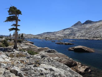
A section shared with the Pacific Crest Trail that tours many alpine lakes and incredible overlooks in the glacier-carved granite valleys of the Sierra Nevada’s Desolation Wilderness.
Difficult Hiking
9.9 km away
Stroll along a portion of the Tahoe Rim Trail beside large alpine lakes.
Easy Hiking
9.9 km away
Miles 1092.3-1124.8 of the northbound PCT: Through the Desolation Wilderness near Lake Tahoe, packed with alpine lakes and prime camping within polished granite basins.
Moderate Hiking

8 routes · Hiking

14 routes · Hiking

5 routes · Alpine Climbing · Hiking

72 routes · Hiking