6 m away
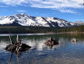
Echo Lakes Trail
Stroll along a portion of the Tahoe Rim Trail beside large alpine lakes.
Easy Hiking
- Distance
- 8.2 km
- Ascent
- 178 m
- Descent
- 178 m
A section shared with the Pacific Crest Trail that tours many alpine lakes and incredible overlooks in the glacier-carved granite valleys of the Sierra Nevada’s Desolation Wilderness.
Hiking Difficult

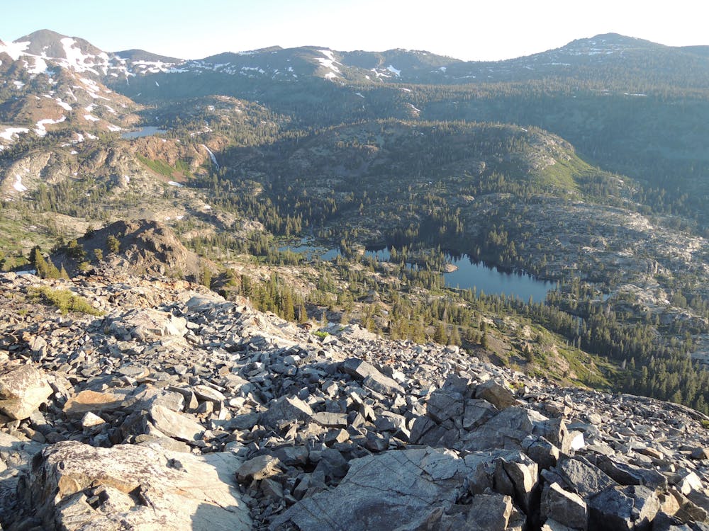
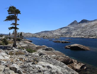
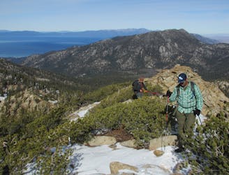
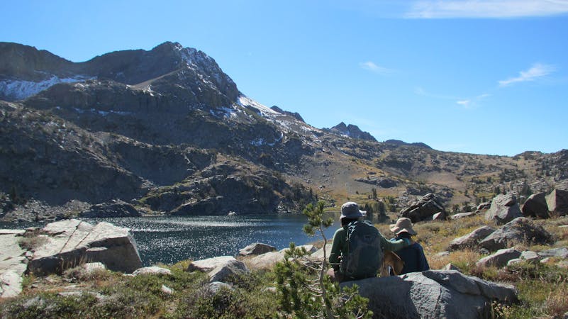
The Desolation Wilderness is a land of sparkling blue lakes in granite basins beneath snowy peaks. It’s a postcard portion of the Tahoe Rim Trail, even though it features few views of Lake Tahoe itself. In a more-than-fair trade, this section swaps vistas over the big lake for the rugged shores of smaller lakes in the alpine.

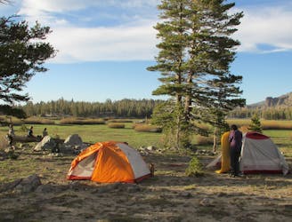
The entirety of this section is shared with the Pacific Crest Trail and intersects many other routes popular with day hikers and backpackers. Therefore, you are likely to encounter more hikers than on other sections, but no bikers because bicycles are not allowed here. The Desolation Wilderness also comes with permit regulations. Day use permits are free and self-issued at the trailhead, but overnight permits must be reserved online. The extra logistics are well worth the remote serenity of this section, however.
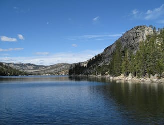
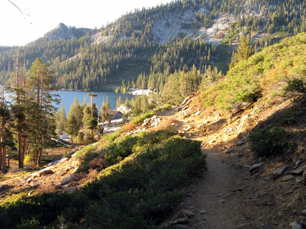
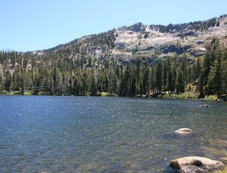
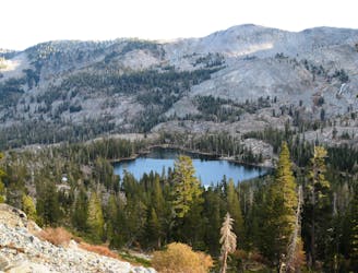
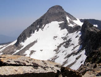
Lower Echo Lake is the first of many alpine waters you will tour. Though this one is lined by private property and popular with boat tours, the rest are in the wilderness area and are much more pristine. Beyond Upper Echo Lake, the trail climbs steadily among bare rock and twisted pines into a glacially-carved valley with lakes and streams below, and the snowy hulk of Pyramid Peak on the horizon above. Tamarack Lake, Ralston Lake, and Lake of the Woods are visible from the main trail and accessible on short side trails where you may find prime, unoccupied camping spots.
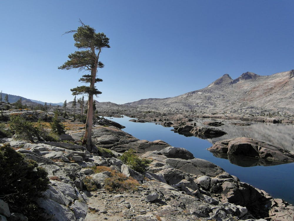
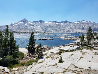
Lake Aloha is especially large and dotted by innumerable islands of polished granite. It’s so complex that you really can’t see the full expanse of the lake from any one point. Scramble up to an elevated perspective to more fully appreciate its scale.
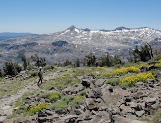
The trail then turns away from Lake Aloha and drops downward, passing two smaller lakes and a waterfall before going uphill once more, beginning the trudge to Dick’s Pass. The steep climb rewards with lofty views of the valleys you just traversed, and at the pass comes a vantage over the next. Moving north past Dick’s Lake and Velma Lakes, the trail transitions again into a heavily forested landscape, where water sources are fewer. Traveling mostly in the shade of conifers but occasionally in the clearings of flower-filled meadows, the trail rolls on past the wilderness boundary to Richardson Lake. From there it climbs gradually to the road and trailhead at Barker Pass.
Sources: https://tahoerimtrail.org/maps-trail-info/ https://tahoerimtrail.org/wp-content/uploads/2017/04/MapBrochELtoBP.pdf https://en.wikipedia.org/wiki/TahoeRimTrail
Difficult
Hiking trails where obstacles such as rocks or roots are prevalent. Some obstacles can require care to step over or around. At times, the trail can be worn and eroded. The grade of the trail is generally quite steep, and can often lead to strenuous hiking.

The path is on completely flat land and potential injury is limited to falling over.

Away from help but easily accessed.
6 m away
Stroll along a portion of the Tahoe Rim Trail beside large alpine lakes.
Easy Hiking
13 m away
Miles 1092.3-1124.8 of the northbound PCT: Through the Desolation Wilderness near Lake Tahoe, packed with alpine lakes and prime camping within polished granite basins.
Moderate Hiking
5.5 km away
Short hike to a stunning alpine lake with the amenities of day-use or overnight kayak and cabin rentals at Angora Lakes Resort.
Moderate Hiking
5.6 km away
Ascend steeply through intimidating cliff bands to reach a high saddle on Echo Peak, then drop down into a granite basin of sparkling lakes in the Desolation Wilderness.
Difficult Hiking
5.7 km away
Easy hike past waterfalls, lakes, and a historic springs resort that leads to more strenuous trails in the Desolation Wilderness, including a way to the top of Mount Tallac.
Moderate Hiking
6.3 km away
Explore a patchwork of forests, meadows, and lakes in the Upper Truckee River Basin south of Lake Tahoe.
Difficult Hiking
8.6 km away
Very steep and direct route to the highest peak in the Desolation Wilderness.
Difficult Hiking
9.3 km away
Climb to the summit of the tallest mountain peak in the Lake Tahoe region.
Difficult Hiking
9.8 km away
Stroll through the forest past alpine lakes, then tackle a strenuous climb to the top of the proudest peak on Lake Tahoe's shore.
Difficult Hiking
9.9 km away
Short trail from Fallen Leaf Lake Campground with views of the lake and Taylor Creek.
Easy Hiking

8 routes · Hiking

14 routes · Hiking
4 routes · Hiking

5 routes · Alpine Climbing · Hiking

72 routes · Hiking