124 m away
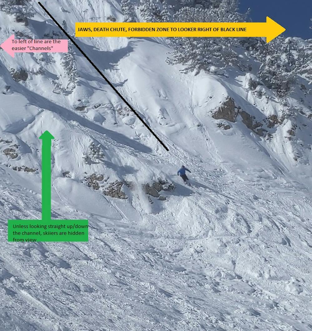
Death Chute (Shot 15)
A cliff drop to straight line
Extreme Freeride Skiing
- Distance
- 40 m
- Ascent
- 0 m
- Descent
- 24 m
Before getting to the chutes that require a 10ft+ drop there are a number of relatively wide channels that most advanced skiers can navigate.
Freeride Skiing Difficult

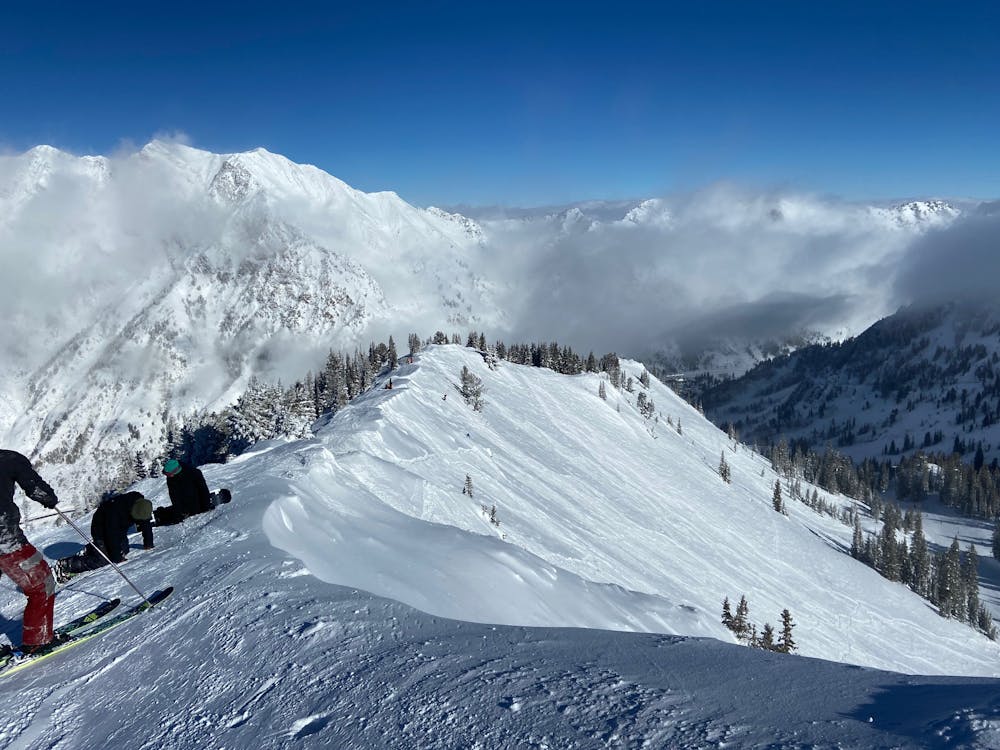
After passing the open terrain of the "Upper Cirque" there are a number of channels that accumulate deep snow. The channels are about 15-30ft wide with highly visible exposed rocks on either side. If you're looking to ride a chute but aren't ready for the prime time Death Chute/Forbidden Zone, this is the place to be. Traverse across the upper cirque area and right before you make it to the trees that rest above the more gnarly chutes, you can drop down. Make sure you communicate with your partner as the walls of the channels hide you from most other terrain.
Difficult
Serious gradient of 30-38 degrees where a real risk of slipping exists.

As well as the slope itself, there are some obstacles (such as rock outcrops) which could aggravate injury.
Away from help but easily accessed.
124 m away
A cliff drop to straight line
Extreme Freeride Skiing
156 m away
A steep and tight chute with rocks
Extreme Freeride Skiing
159 m away

A short, tight straight line
Extreme Freeride Skiing
198 m away

Steep technical skiing in the Forbidden Zone.
Extreme Freeride Skiing
224 m away

A popular double cliff air
Extreme Freeride Skiing
307 m away

A very steep and rocky way into Great Scott
Severe Freeride Skiing
307 m away

Secret gate that takes you just other side of rope line
Difficult Freeride Skiing
372 m away

A short but fun Macaroni shaped chute
Difficult Freeride Skiing
844 m away

A steep, wide open chute
Difficult Freeride Skiing
881 m away

Steep chutes that are rarely open
Severe Freeride Skiing