13 m away
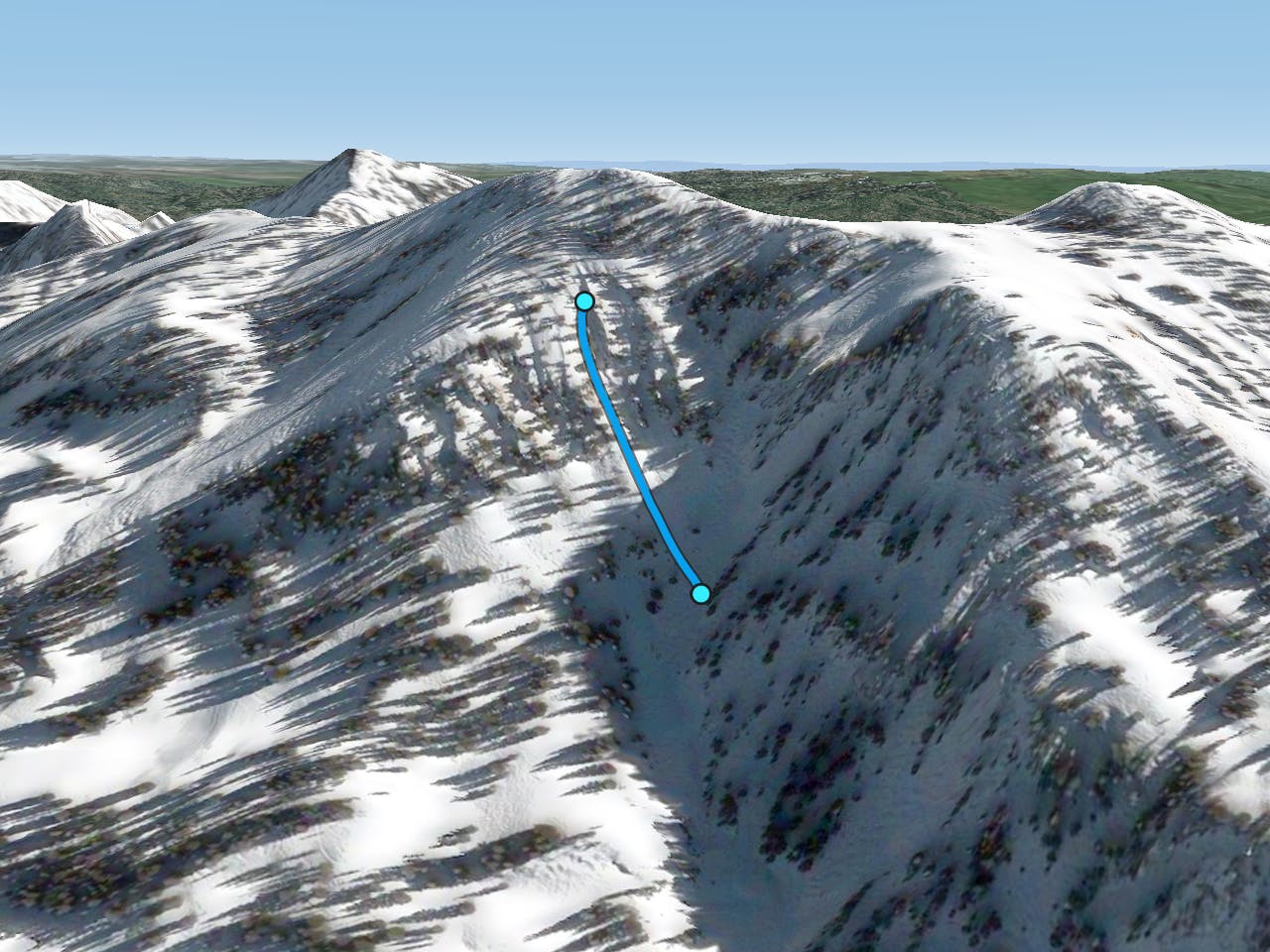
Spinny Left

Skinny chute skiing
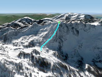
Difficult Freeride Skiing
- Distance
- 149 m
- Ascent
- 0 m
- Descent
- 102 m
A short and steep chute
Freeride Skiing Severe
This is a popular freeride skiing route which is generally considered to be severe. It's remote, it features medium exposure (e2) and is typically done in an unknown time of year. From a low point of 3 km to the maximum altitude of 3.2 km, the route covers 167 m, 0 vertical metres of ascent and 118 vertical metres of descent.
Skier's right of Spinny Left, this chute sometimes does not go through and you need to jump over rocks to exit. Make sure that you scope the line before entering and know what you are getting into. This area is known for being rocky and full of snags in low snow years.
Severe
Steep skiing at 38-45 degrees. This requires very good technique and the risk of falling has serious consequences.

As well as the slope itself, there are some obstacles (such as rock outcrops) which could aggravate injury.
Away from help but easily accessed.
13 m away
Skinny chute skiing
Difficult Freeride Skiing
1.2 km away

A long steep powder run
Difficult Freeride Skiing
1.3 km away

A steep technical line that is very rarely skied
Extreme Freeride Skiing
1.3 km away
Long steep powder skiing
Difficult Freeride Skiing
1.7 km away

A long steep chute off the Pioneer Ridge
Severe Freeride Skiing
1.7 km away

A steep, semi tree-d run on the west side of Mount Millicent
Severe Freeride Skiing
1.7 km away

A steep, rocky chute running down the middle of Mount Millicent. For experts only.
Severe Freeride Skiing
1.9 km away

An exciting area with a variety of cliff and chute options
Difficult Freeride Skiing
2 km away

Cliff area just past the ski area boundary on Milly Bowl
Severe Freeride Skiing
2.1 km away

A tough hike with glorious views at the top.
Moderate Freeride Skiing