PCT: Highway 36 to Warner Valley
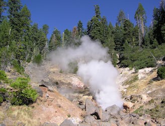
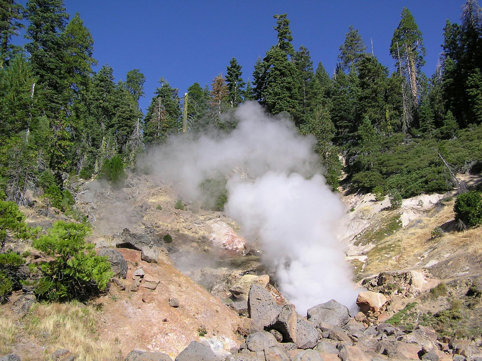
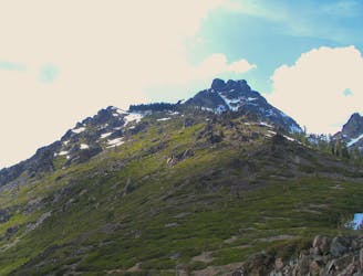
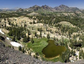
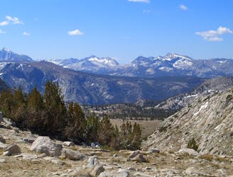
Miles 1331.1-1350.1 of the northbound PCT: Entering Lassen Volcanic National Park for a taste of hydrothermal features that are rare outside of Yellowstone.
Moderate Hiking
- Distance
- 30 km
- Ascent
- 1 km
- Descent
- 831 m
Go hiking in California with curated guides of the best hikes across the region. With over 1098 3D trail maps in FATMAP, you can easily discover and navigate the best trails in California.
No matter what your next adventure has in store, you can find a guide on FATMAP to help you plan your next epic trip.
Get a top hiking trail recommendation in California from one of our 79 guidebooks, or get inspired by the 1098 local adventures uploaded by the FATMAP community. Start exploring now!
Miles 1331.1-1350.1 of the northbound PCT: Entering Lassen Volcanic National Park for a taste of hydrothermal features that are rare outside of Yellowstone.
Moderate Hiking

Miles 1287-1331.3 of the northbound PCT: A lengthy incline through the scar of the Dixie Fire, and reaching the midpoint of the trail between Mexico and Canada.
Difficult Hiking
Miles 1267.9-1287 of the northbound PCT: Up and over a lofty plateau, then abruptly down into a river gorge, within the burn scar of the Dixie Fire.
Difficult Hiking
Miles 1234.8-1267.9 of the northbound PCT: Through the burn zone of a 2020 wildfire, on a rolling ridgewalk punctuated by a sharp dip into a river gorge.
Moderate Hiking
Miles 1195.4-1234.8 of the northbound PCT: A big climb from the river to the crest, then a stroll along ridges and forest mosaic to the edge of an extensive burn area.
Moderate Hiking
A meandering course over consecutive ridges and valleys, with no shortage of vast views or comfortable camps.
Moderate Hiking
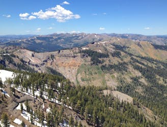
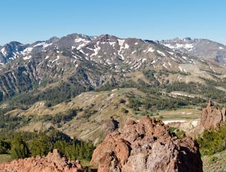
Miles 1124.8-1153.4 of the northbound PCT: Tracing a line across the sky above Lake Tahoe, on a bald crest of craggy peaks.
Difficult Hiking
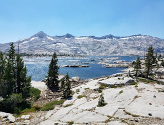
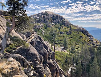
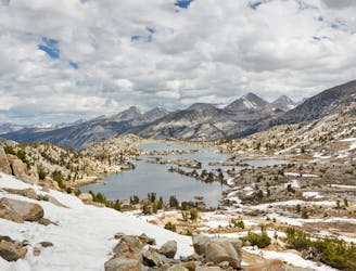
Miles 1092.3-1124.8 of the northbound PCT: Through the Desolation Wilderness near Lake Tahoe, packed with alpine lakes and prime camping within polished granite basins.
Moderate Hiking
Miles 1048.8-1092.3 of the northbound PCT: Approaching Lake Tahoe through a mosaic of volcanic peaks and granite mounds, with mountainside meadows and alpine lakes around every turn.
Moderate Hiking
Miles 1016.9-1048.8 of the northbound PCT: Through the stark geology of the Carson-Iceberg Wilderness, to the crossing of a remote highway on the Sierra crest.
Moderate Hiking
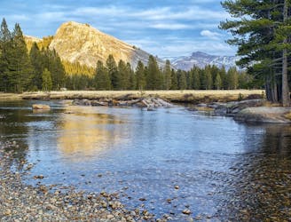
Miles 942.5-1016.9 of the northbound PCT: Continuing through the northern reaches of Yosemite National Park, among a labyrinth of granite far removed from the park’s crowded areas.
Moderate Hiking
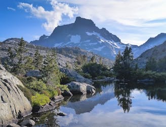
Miles 906.7-942.5 of the northbound PCT: From Devils Postpile National Monument to Yosemite National Park, through the photo-famous landscape of Ansel Adams Wilderness.
Moderate Hiking
Miles 878.7-906.7 of the northbound PCT: Over the seventh of nine major passes in the central Sierra, and reaching the outskirts of Mammoth, CA near Devils Postpile.
Moderate Hiking
Miles 857.7-878.7 of the northbound PCT: Crossing over Selden Pass, between two opportunities for resupply in the remote expanse of the central Sierra.
Moderate Hiking

Miles 831-857.7 of the northbound PCT: Climbing along lakes and falls to Muir Pass, rolling through sky-high meadows of Evolution Basin, then descending through yet another waterfall gorge of the central Sierra Nevada.
Difficult Hiking
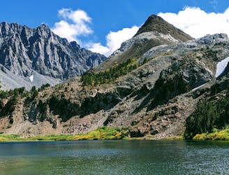
A linkup of lakes around a multicolored mountain, requiring mild scrambling and some route finding.
Moderate Hiking