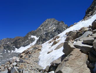
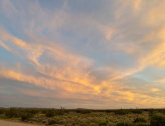
Miles 788.9-831 of the northbound PCT: Crossing over three high passes and through deep gorges between, surrounded by grandiose peaks of the High Sierra.
Severe Hiking
- Distance
- 68 km
- Ascent
- 2.6 km
- Descent
- 3.1 km
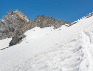
Miles 767-788.9 of the northbound PCT: Cresting the highest elevation anywhere on the 2,650-mile trail, at the 13,200-foot Forester Pass.
Difficult Hiking
- Distance
- 35 km
- Ascent
- 1.5 km
- Descent
- 1.5 km
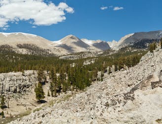
Miles 750.2-767 of the northbound PCT, and the end of CA Section G: Forging higher into the Sierra and joining with the John Muir Trail near Mount Whitney.
Moderate Hiking
- Distance
- 26 km
- Ascent
- 861 m
- Descent
- 972 m
Miles 702-750.2 of the northbound PCT: From Kennedy Meadows South, along a stretch of the Sierra Crest, to a trail junction near the road that leads to Lone Pine.
Difficult Hiking
- Distance
- 76 km
- Ascent
- 3 km
- Descent
- 1.4 km
Miles 652-702 of the northbound PCT, and the start of CA Section G: A journey of ups and downs to finally escape the desert and get into high country, reaching the gateway to the Sierra at Kennedy Meadows.
Difficult Hiking
- Distance
- 79 km
- Ascent
- 2.9 km
- Descent
- 2.7 km
California Section F of the PCT: A procession of parched hills leading into the Sierra Nevada.
Moderate Hiking
- Distance
- 135 km
- Ascent
- 4.3 km
- Descent
- 3.9 km
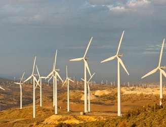
Miles 517.6-566.5 of the northbound PCT: Following "The Aqueduct" and rows of windmills through the Mojave Desert.
Moderate Hiking
- Distance
- 78 km
- Ascent
- 1.9 km
- Descent
- 1.7 km
Miles 485.7-517.6 of the northbound PCT: A highland traverse overlooking the Mojave, then a quick descent to face the desert.
Moderate Hiking
- Distance
- 49 km
- Ascent
- 1.7 km
- Descent
- 1.7 km
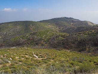
Miles 454.5-485.7 of the northbound PCT: Beginning California Section E, with meandering miles through the desert hills.
Moderate Hiking
- Distance
- 50 km
- Ascent
- 1.6 km
- Descent
- 1.4 km
Miles 342-369.4 of the northbound PCT: Tracing a line across the sky above Los Angeles.
Difficult Hiking
- Distance
- 135 km
- Ascent
- 4.1 km
- Descent
- 5.6 km
Miles 342-369.4 of the northbound PCT: A long and waterless ascent into the San Gabriel Mountains.
Difficult Hiking
- Distance
- 43 km
- Ascent
- 2.1 km
- Descent
- 793 m
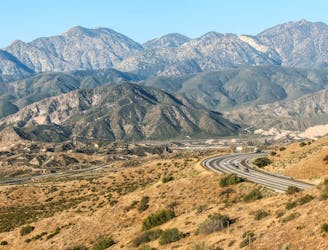
Miles 329-342 of the Northbound PCT: Finishing up Section C to meet the interstate at Cajon Pass.
Moderate Hiking
- Distance
- 21 km
- Ascent
- 453 m
- Descent
- 570 m
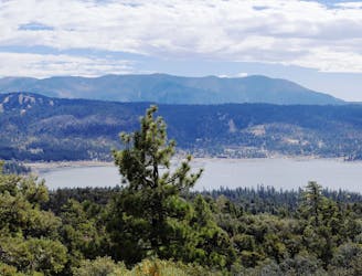
Miles 266.1-329 of the northbound PCT: Descending from the mountains through a gorge flowing with water, into a desert basin with a picturesque reservoir.
Moderate Hiking
- Distance
- 98 km
- Ascent
- 2 km
- Descent
- 3 km
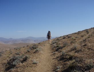
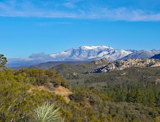
Miles 209.5-266.1 of the northbound PCT: A long ascent from the low desert into the highlands, through a mountainous wilderness to a bustling resort town.
Difficult Hiking
- Distance
- 87 km
- Ascent
- 3.8 km
- Descent
- 2.1 km
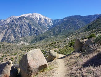
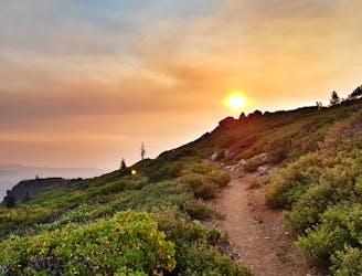
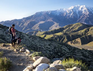
Miles 179.4-209.5 of the northbound PCT: Traversing precipitous slopes of the San Jacintos, then descending aggressively to the desert floor.
Severe Hiking
- Distance
- 45 km
- Ascent
- 904 m
- Descent
- 3 km
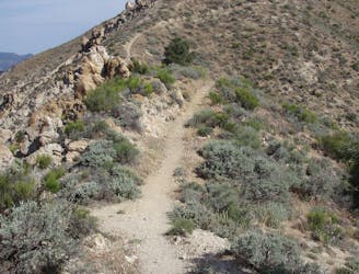
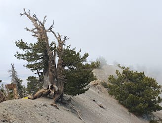
Miles 151.9-179.4 of the northbound PCT: A long climb into the San Jacinto Mountains, reaching potentially treacherous terrain at the higher elevations.
Severe Hiking
- Distance
- 42 km
- Ascent
- 2.2 km
- Descent
- 1.2 km
