An epic off piste run, mostly in well spaced larch trees. The route finding is very tricky though so going with an instructor or guide who knows the area well is preferable.
Moderate Freeride Skiing
- Distance
- 2.9 km
- Ascent
- 57 m
- Descent
- 1.1 km

A wide open line for less experienced off piste riders. Particularly good in spring snow conditions.
Difficult Freeride Skiing
- Distance
- 697 m
- Ascent
- 2 m
- Descent
- 213 m

Steep SE facing lines that come into their own in perfect spring snow.
Difficult Freeride Skiing
- Distance
- 1.2 km
- Ascent
- 1 m
- Descent
- 354 m

Often wind affected, this slope, while short, can provide perfect conditions on its day and takes some time to get tracked out.
Difficult Freeride Skiing
- Distance
- 1 km
- Ascent
- 18 m
- Descent
- 381 m

A variation on the classic Grand Couloir
Severe Freeride Skiing
- Distance
- 333 m
- Ascent
- 0 m
- Descent
- 254 m

Excellent, gentle terrain for less advanced off piste skiers and snowboarders.
Moderate Freeride Skiing
- Distance
- 563 m
- Ascent
- 37 m
- Descent
- 161 m

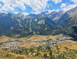
Cruisy skiing and breathtaking scenery in a nature reserve that is entirely outside the resort’s boundary.
Difficult Freeride Skiing
- Distance
- 1.5 km
- Ascent
- 1 m
- Descent
- 418 m
Physical climb for a fantastic downhill with stunning views
Difficult Mountain Biking
- Distance
- 7.3 km
- Ascent
- 572 m
- Descent
- 537 m

Easy tree line that goes through the mountain lodges
Easy Freeride Skiing
- Distance
- 1.5 km
- Ascent
- 2 m
- Descent
- 411 m
Une course en montagne mélangeant glacier facile, crêtes et hors sentiers au travers du massif des Arves.
Difficult Trail Running
- Distance
- 25 km
- Ascent
- 2.3 km
- Descent
- 2.3 km
Balade dans la forêt et le vallon du Tabuc
Moderate Hiking
- Distance
- 5.6 km
- Ascent
- 359 m
- Descent
- 359 m
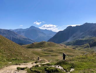
Belvédère en boucle au dessus de Monêtiers les bains
Moderate Hiking
- Distance
- 7.7 km
- Ascent
- 486 m
- Descent
- 486 m
Easy but steep way up for a technical way down with many tight hairpins turns in the forest
Severe Mountain Biking
- Distance
- 16 km
- Ascent
- 900 m
- Descent
- 900 m

Fort de la Croix-de-Bretagne and Fort de La Grande Maye
Moderate Mountain Biking
- Distance
- 46 km
- Ascent
- 1.6 km
- Descent
- 1.6 km
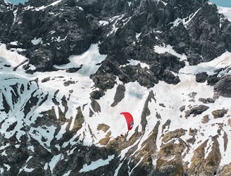
Combination of alpine climbing, Ebike and flying down. WARNING : don't follow our descent track as it is a paragliding track in the air
Severe Alpine Climbing
- Distance
- 18 km
- Ascent
- 2.2 km
- Descent
- 2.9 km

Test - 12
Moderate Road Biking
- Distance
- 170 km
- Ascent
- 4.9 km
- Descent
- 4.3 km