Black Mountain Crest Trail
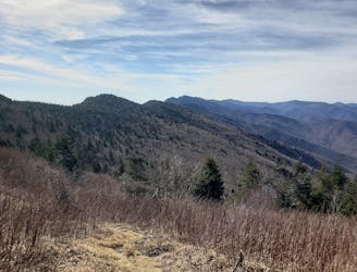
A rite of passage trail run not to be taken lightly.
Severe Trail Running
- Distance
- 18 km
- Ascent
- 1.6 km
- Descent
- 572 m
The most epic and hidden gem trail runs along I-40 to add to your next cross-country road trip.
Hiking, Trail Running Easy, Moderate, Difficult, Severe, Extreme
Also in Arizona, United States of America • Arkansas, United States of America • California, United States of America • New Mexico, United States of America • North Carolina, United States of America • Texas, United States of America
There will come a point in any coast-to-coast road trip where you feel miles from anywhere worth stopping. Traveling east to west along the I-40 corridor, the steep and rugged Appalachians transition into rolling farms and cotton fields before converging on the Mississippi River. Continue west, and the bright green landscape will slowly transition to shades of red and brown, with a backdrop of wind turbines flashing in synchrony across the high plains. While the landscape looks desolate, you might be surprised at the number of hidden gem trail runs you can find if you take a brief detour from the 60 – 80mph freeway that has put your mind in a trance. From east to west, these are the top trail running picks along Interstate 40 worth stopping for – or planning a road trip around.
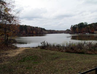
From the east, there’s no better start to this list than William B. Umstead State Park. This 5,500-acre green space is the local hub for trail runners. Long before logging and agriculture dominated the landscape, this area was home to elk, bison, bobcats, and even wolves at one time. “Poor cultivation practices and one-crop production however led to depletion and erosion of the soil,” according to this source. Surrounded by the urban sprawl of Raleigh and Durham, the park's claim to fame in the trail running world is largely due to two of its annual trail races, the Umstead 100 and Umstead Trail Marathon. This mapped route roughly follows the same course as the marathon route, which is run as an out-and-back from Lake Sycamore. This version begins and ends at the visitor center instead, where restrooms and water are available year-round.
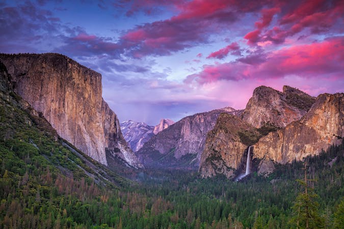
A few hours west, the highway climbs up through a mountain pass before descending into Asheville, also known as “Beer City USA.” Surrounded by Pisgah National Forest, the immediate area is home to over 1,500-miles of singletrack spread over 500,000 acres—but that’s just the National Forest. Factor in state parks, nature preserves, state forests, greenways, game lands, etc., and that number can quickly double or triple by some metrics.
The centerpiece of Pisgah National Forest, the Art Loeb Trail is the “graduation run” for aspiring ultrarunners in the region. Totaling 31 miles (50k) with 8,000+ feet of climbing, the trail connects Canton to Brevard via Shining Rock Wilderness and Black Balsam Knob before circling around Cedar and John Rock. Though some of the fastest known times are in the 5 – 6-hour window, plan at least 10 – 12 hours on the trail, pack plenty of water, and bring a filter so you can refill along the way. As a point-to-point, two vehicles are required to complete this hike, or you could inquire with local outfitters about shuttle services. Based near Brevard, both White Dot Adventures and Pura Vida Adventures offer services for trail runners and thru-hikers.
A bit shorter than the Art Loeb, the Shut In Trail is a historic path that connects the Biltmore Estate to Mount Pisgah. George Vanderbilt built and maintained the trail, which allowed access between his massive estate and hunting lodge below the summit of Mount Pisgah. The start of the trail is near the entrance to the NC Arboretum, and the trail crosses the Blue Ridge Parkway countless times as it climbs to the ridge. A quick look at a map and you can surmise a few different loop ideas, or you could opt for a simple out-and-back following the “white dots” as long as you wish.
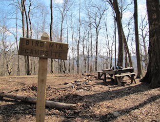
Widely considered one of the most epic ridgeline traverses east of the Mississippi, it would be an injustice to leave the Black Mountain Crest Trail out of this guidebook. A bit further from Interstate 40 than other stops on this list, the roughly 12-mile trail connects the small town of Burnsville, NC to the top of Mount Mitchell – the highest peak in the east! Water can be scarce during the summer, while ice and snow can blanket the peaks in the winter. If there isn’t time for the run or you can’t arrange the shuttle, you absolutely must not leave without hiking to the observation deck. The 360-degree views will take your breath away!
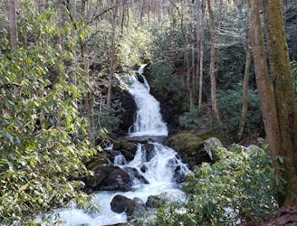
Arguably one of the most scenic stretches of I-40, the Great Smoky Mountains National Park is no stranger to trail runners. Just a 10-minute detour from the Waterville exit along the TN/NC line, the Mount Sterling Loop is a spectacular 16+ mile run through remote backcountry with epic views from a fire tower at 5,850’. It is one of the best long runs in the Smokies and includes stands of lush spruce and fir trees, an ecosystem reminiscent of New England and Eastern Canada. If you’re short on time and have a high-clearance vehicle such as an SUV or truck, consider a detour up to the iconic Max Patch on the Appalachian Trail. The views are incredible, and the grassy summit draws in an abundance of campers during the summer months.
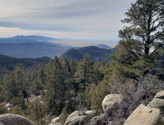
Heading west to Knoxville, you will notice an exit sign on the highway for Frozen Head State Park. If you have heard the name but don’t know where, it's because Frozen Head is home to the infamous Barkley Marathons, a 100+ mile trail race that had only 15 finishers in its first 30 years! In case that has not quite processed in your mind, that is a staggering average of 1 finisher every 2 years since 1986! Named after the snow-capped peaks in the winter, this long trail run tours the park’s main summits, including the observation deck on Frozen Head that was erected in 2006 to replace the historic fire tower.
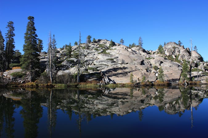
As you head west, there is a long stretch after Tennessee that seems to drag on for a while. First Nashville, then Memphis, and you are in Arkansas! Once complete, the 220-mile-long Ozark Highlands Trail parallels Interstate 40 as you head northwest of Little Rock. There are several access points within a short drive of the highway, with Lake Fort Smith State Park serving as the westernmost terminus for the trail. Out-and-back runs are common, though some sadistic trail runners are likely already dreaming of a full run – or even a shot at the FKT (Fastest Known Time) on the trail.
Sadly, there is not much reason to stop and run in Oklahoma other than Oklahoma City itself. Though it is not included in this guidebook, there is a paved 10-mile circuit around Lake Hefner that is popular among local road runners. There are some nice views of the lake along the way, as well as water fountains and restrooms at certain trailheads. Those staying in OKC will enjoy the run, but it is not a route worth planning an entire road trip around—simply a great opportunity to stop and stretch out the legs.
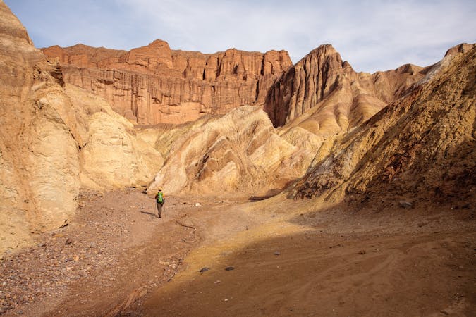
Possibly the most underrated stop on this list, Palo Duro Canyon State Park is one of Texas’ best-kept secrets. As you near Amarillo, the wind turbines flashing in synchrony and tumbleweeds blowing across the asphalt will likely have you begging for a change in scenery. Just 30 minutes south, though, there is a massive hole in the ground that holds the title of second-largest canyon in the US. If you’re not sure where to start, this 8-mile loop tours some of the park’s best singletrack along the floor of the canyon. For other adventures in Palo Duro, including classic hikes and mountain bike rides, check out this guidebook instead.
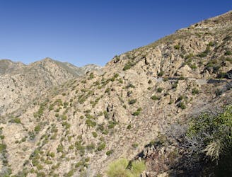
Continuing west, Albequerque is the next benchmark on the interstate. The Whitewash Loop is an epic trail run in the southern portion of the Sandia Mountains that includes a summit of a nearly 9,800’ peak. There are several trailheads to access the loop, including some that are friendly to larger vehicles or trailers. Despite the proximity to the city, the views from this run are unparalleled. Even better, there are multiple breweries just a short drive from the trailhead waiting to refuel you after a long day on the trail.
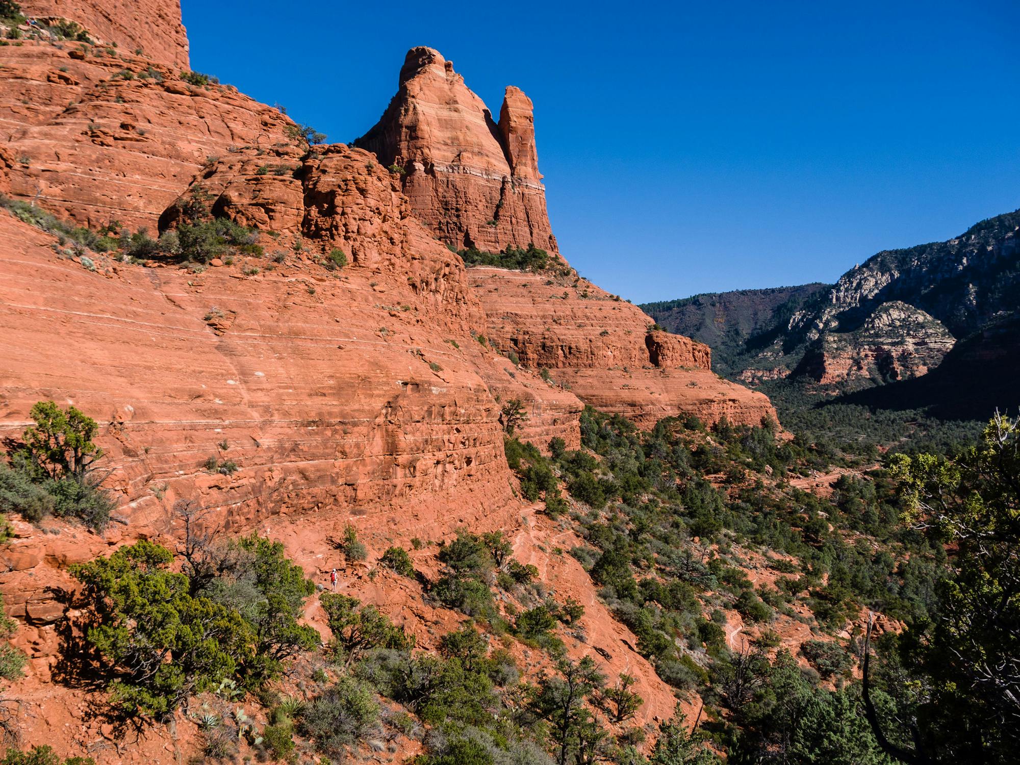
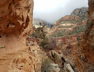
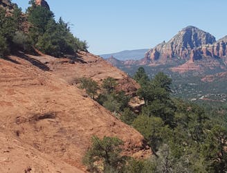
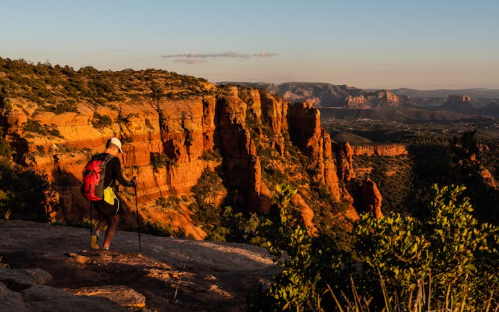
Crossing into Arizona, Flagstaff comes next. Though “Flag” is home to an elaborate network of singletrack in town, it can be difficult to navigate for first-time visitors. Just to the south, though, the red-rock landscape of Sedona is one of the most spectacular places you will ever go for a run. If you’re not afraid of heights and are comfortable running along exposed cliffs, then the Hangover Trail may be in your wheelhouse. Just watch how much you drink the night before—this exposed slickrock loop is tight, technical, steep, and not the kind of run you want to want to attempt hungover.
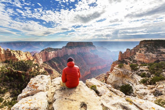
North of Flagstaff, there isn’t a trail runner on the planet who hasn’t dreamed of running the iconic R2R2R in the Grand Canyon. Beginning at the South Rim, this epic 40+ mile route drops to the Colorado River, through Phantom Ranch, and begins a long and steady climb towards the North Rim. After a final steep push to the top (which sits about 1000-feet higher than where you began), you get to turn around and do it all over again. For those seeking a sightly shorter run instead, and one that will have you done by lunch, consider this version of the Rim to Rim run that begins and ends at the South Rim. It can be shuttled with a vehicle or by utilizing the bus, or looped when paired with the South Rim Trail
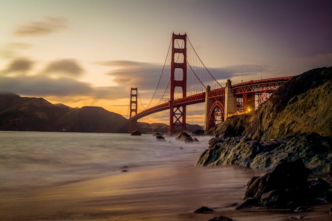
Interstate 40 abruptly ends in the small town of Barstow, California, almost 2,600 miles from its eastern terminal in Wilmington, NC. Head about an hour further, and you will be at the course start for the Angeles Crest 100! This epic east/west crossing of the San Gabriel Mountains is an annual race that caps out at 150 participants each year and offers a hefty 33-hour time cut-off due to its difficulty. “According to FATMAP, the standard AC100 gains 18,000 feet of elevation and loses over 22,500 feet along its length,” and those elites who can cross the finish line in under 24 hours “receive a solid sterling silver belt buckle as their reward.”
The final and westernmost route to make this hitlist does not meet the main qualification of being along Interstate 40. Instead, the Backbone Trail is located in the heart of the Santa Monica Mountains – due west of Los Angeles. As I4-0 is a major thoroughfare to LA, it seemed fitting to make this list. Trail runner Ian Macnairn boasts this run as “one of my favorite runs that I have done in the US, hands down.” If you are short on time, consider an out-and-back from Will Rogers State Historic Park to sample a beautiful stretch of this 66-mile trail.
A rite of passage trail run not to be taken lightly.
Severe Trail Running
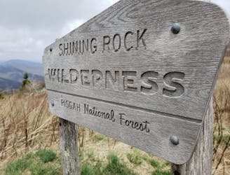
A iconic and scenic trail running route best known for its traverse through Shining Rock Wilderness.
Difficult Trail Running
A historic and iconic portion of the MST well-known in the trail running world.
Difficult Trail Running
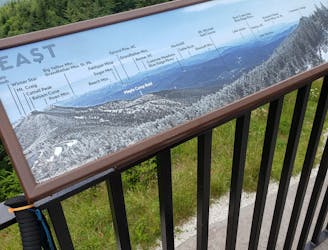
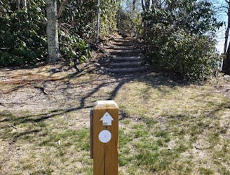
An easy, paved path to the observation platform on Mount Mitchell.
Easy Hiking
An internationally-recognized trail run through the United State's largest canyon.
Severe Trail Running
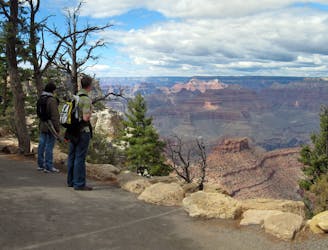
An easy trail traversing the South Rim of the Grand Canyon.
Moderate Trail Running

A epic trail run that can be shuttled or completed as a loop utilizing the South Rim Trail.
Difficult Trail Running
An epic backcountry trail run to an abandoned mountain top fire tower resting at 5,850'.
Difficult Trail Running
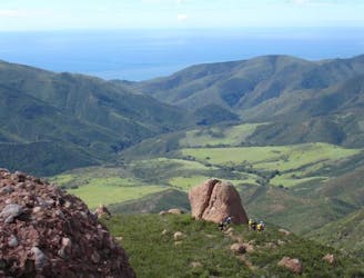
A complete traverse of the Santa Monica Mountains outside of Los Angeles along the Backbone Trail with terminuses at Will Rogers State Park and Ray Miller Trailhead
Difficult Trail Running
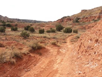
An intermediate 8-mile trail run highlighting some of the best trails in Palo Duro Canyon.
Moderate Trail Running
Cross the San Gabriel mountain range in one single push during the Angeles Crest 100.
Extreme Trail Running
An epic trail run into the southern portion of the Sandia Mountain Wilderness.
Severe Trail Running
A long, mostly-gravel run through William B. Umstead State Park that follows trails used in both the Umstead Trail Marathon and Umstead 100.
Difficult Trail Running
An epic, high-exposure trail run with incredible views and extremely technical slickrock singletrack.
Severe Trail Running
A long trail running tour of Frozen Head State Park, home of the infamous Barkley Marathons.
Difficult Trail Running
The Ozark Highlands Trail is an epic 164-mile long trail across northern Arkansas in the Ozark Mountains.
Moderate Trail Running

This section routes runners across the tallest point on the OHT and also through a designated scenic area.
Moderate Trail Running

23 routes · Mountain Biking · Hiking

8 routes · Hiking
12 routes · Hiking
6 routes · Mountain Biking · Hiking

58 routes · Hiking
14 routes · Hiking
13 routes · Hiking
14 routes · Hiking
6 routes · Hiking
11 routes · Hiking