Hotel Pustertalerhof - Irenberger - Issinger Weiher

Schöne Wanderung von Kiens
Easy Hiking
- Distance
- 7.7 km
- Ascent
- 306 m
- Descent
- 306 m
Go hiking in Bozen with curated guides of the best hikes across the region. With over 171 3D trail maps in FATMAP, you can easily discover and navigate the best trails in Bozen.
No matter what your next adventure has in store, you can find a guide on FATMAP to help you plan your next epic trip.
Get a top hiking trail recommendation in Bozen from one of our 23 guidebooks, or get inspired by the 171 local adventures uploaded by the FATMAP community. Start exploring now!
Schöne Wanderung von Kiens
Easy Hiking
The Alta Via delle Dolomiti n. 1 winds along a path of 125 km and 7,300 m of altitude gain, consisting of 12 stages, which connects Lake Braies (BZ) with Belluno.
Difficult Hiking
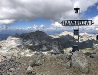
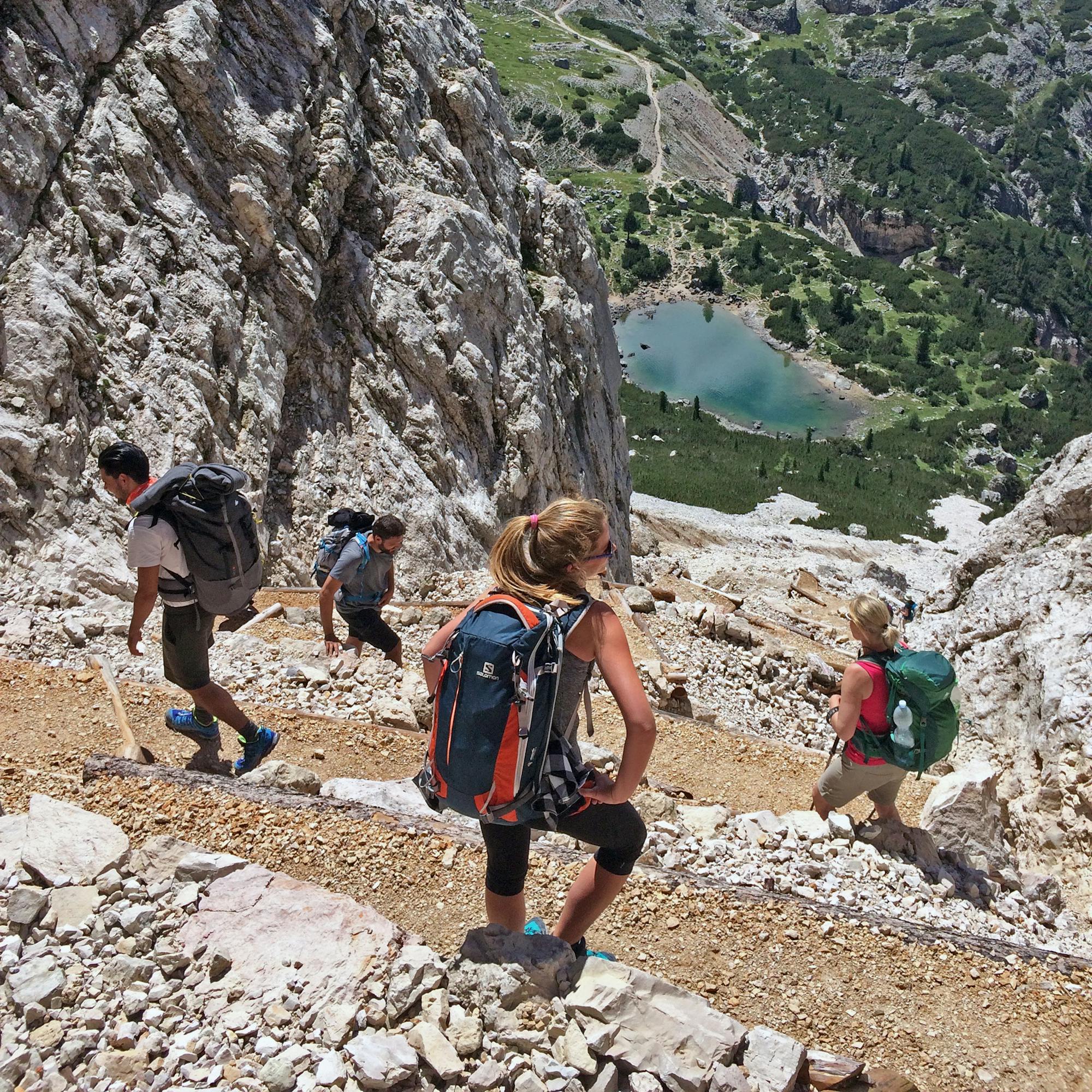
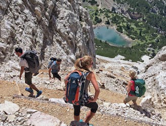
Dal Rifugio La Crusc a La Capanna Alpina toccando le cime Sas dla Crusc, Cima dieci, Piz Lavarela e Piz Conturines
Difficult Hiking
A three days hike in the hearth of Val Gardena, in the Dolomites
Difficult Hiking

Terenten über Tiefrastenhütte zur Eidechsspitze
Moderate Hiking
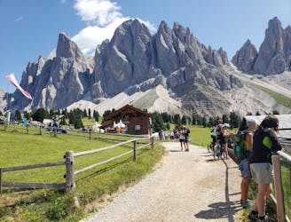
Zanser Alm, Villnöss auf Tullen
Moderate Hiking
Sarentino, attraverso Sarnerscharte , Corno del Renon a Soprabolzano
Difficult Hiking

Alberto Ferrin
Difficult Hiking
A long but pleasant hike reaching Malga Ra Stua.
Moderate Hiking
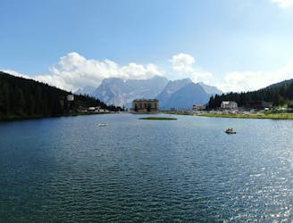
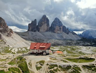
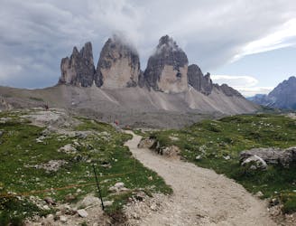
The third stage of the “Cortina Dolomiti Ultra Trekking” route brings you to the famous peaks Tre Cime di Lavaredo and the shores of Lake Misurina.
Moderate Hiking
Loop hike to rifugios and a park with stunning scenery
Moderate Hiking
Epic look hike with a stop at Rifugio Lavaredo
Difficult Hiking
The famous Tappeinerweg / Tappeiner promonade is an easy, family friendly, pushchair friendly walk any time of year with great views of the city and plenty of refreshments along the way.
Easy Hiking
Feuerstein to Almrissalm
Easy Hiking