345 m away
Western Face

The western flanks of Kosciuszko, the steepest skiing on the mountain other than the areas beneath the cornice
Moderate Freeride Skiing
- Distance
- 1.2 km
- Ascent
- 0 m
- Descent
- 280 m
Involving a kilometre of fairly flat skiing to the south, the run then drops down the sheltered southern side of Kosciuszko.
Freeride Skiing Moderate

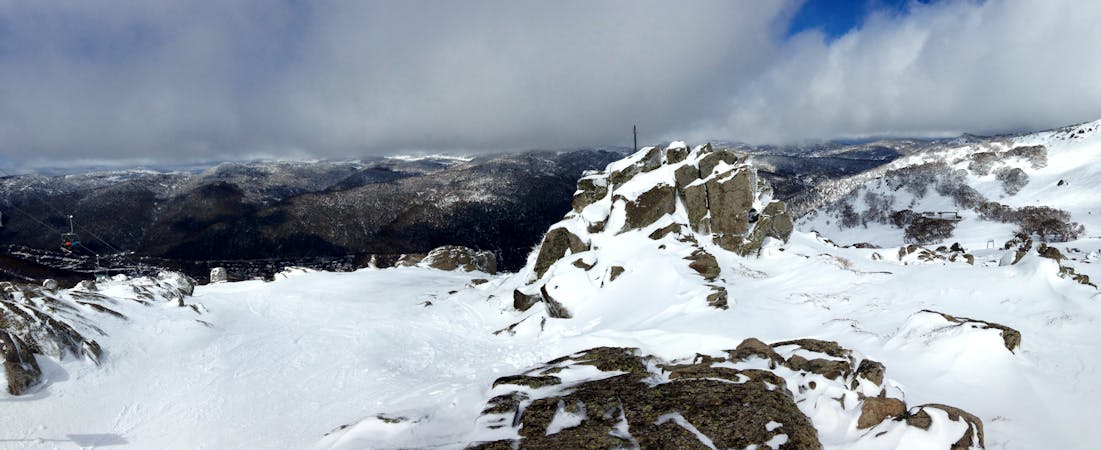
After skiing/skinning along the ridgeline to the south of Kosciuszko for about a kilometre, avoiding the large cornice to the skiers left, the southern face then drops down fairly steeply to Rawson Creek and on to Cootapatamba Hut. The corniced rocky ridge line to the west provides shelter from the elements compared to the extremely exposed summit of Kosciuszko, thus granting some nice fresh snow at times as well as spring corn. This area is really easy to navigate and fills in quickly and early in the season, it also acts as a great way to get back out towards the Ramshead. Afterwards, to get back to the summit, simply skin back up the way you came.
Moderate
Slopes become slightly steeper at around 25-30 degrees.

As well as the slope itself, there are some obstacles (such as rock outcrops) which could aggravate injury.

Little chance of being seen or helped in case of an accident.
345 m away
The western flanks of Kosciuszko, the steepest skiing on the mountain other than the areas beneath the cornice
Moderate Freeride Skiing
345 m away

The mellow eastern face of Kosciuszko
Moderate Freeride Skiing
345 m away

The north eastern face of Australia's highest peak, Mt Kosciuszko, this lee slope is one of the earliest skiable slopes in Australia.
Moderate Freeride Skiing
3.2 km away

Steep and rocky, leading into a more open bowl down to Leatherbarrel Creek
Severe Freeride Skiing
3.6 km away

Starting on the summit of the Ramshead and heading the major drainage gully to the north, dropping down to Leatherbarrel Creek
Difficult Freeride Skiing
3.7 km away

A relatively featureless and faceless area, providing a nice gentle pitch rolling into steeper terrain towards Leatherbarrel creek
Moderate Freeride Skiing
3.7 km away

Your choice of one of two gullies heading east from Simkin Peak
Moderate Freeride Skiing
3.7 km away

The most vertical you will find in the valley, following the western spur from the Ramshead.
Moderate Freeride Skiing
4 km away

A local favourite, dropping 400 vertical metres not too far from Thredbo dropping down to Dead Horse Gap car park.
Moderate Freeride Skiing
4.1 km away

Heading west off the summit of Townsend this drops into the bowl left towards Abbott Peak
Moderate Freeride Skiing

10 routes · Freeride Skiing
34 routes · Freeride Skiing · Ski Touring
4 routes · Freeride Skiing · Hiking · Ski Touring