1 m away
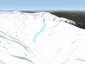
South Sentinel Ridge

Often loaded with snow, consistent fall lines and about 400 metres of vertical down into James Macarthur Creek
Difficult Freeride Skiing
- Distance
- 713 m
- Ascent
- 0 m
- Descent
- 314 m
Both a hike and a run and nothing beats the view.
Freeride Skiing Difficult
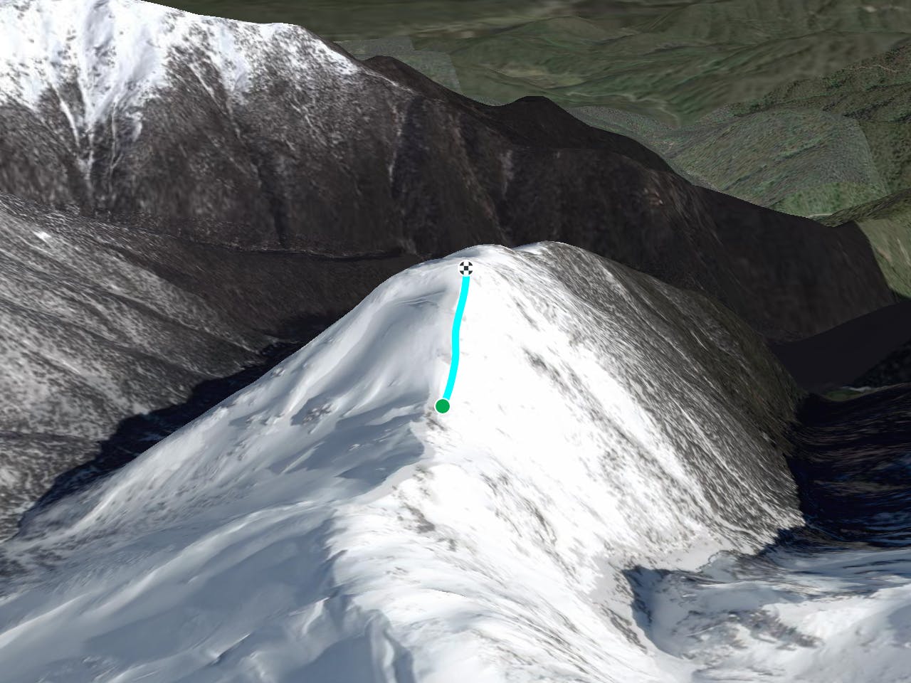
This is an access point to the runs off the Sentinel peak, yet the run back down from the peak, if things are looking too dicey up there or if you go purely for the view, is actually a really nice ride. Short and of course not much vertical, but gives a nice gradient with an absolutely incredible backdrop. Simply follow the ridge line up and down just take care if you are doing this after some weather, as the exposed summit can be absolutely treacherous. Cornices can form along the ridge line, and there are some significant crags on the way up, just take care, don't skin up, boot pack your way up and ski the way down, whichever route you take.
Difficult
Serious gradient of 30-38 degrees where a real risk of slipping exists.

As well as the slope itself, there are some obstacles (such as rock outcrops) which could aggravate injury.

Little chance of being seen or helped in case of an accident.
1 m away
Often loaded with snow, consistent fall lines and about 400 metres of vertical down into James Macarthur Creek
Difficult Freeride Skiing
183 m away

Seriously steep, rugged terrain out here with changeable conditions
Severe Freeride Skiing
184 m away

Amazing views with a consistent steep fall line from the peak of The Sentinel down to James Macarthur Creek
Severe Freeride Skiing
487 m away

Some of the most unforgiving lines on the continent.
Extreme Freeride Skiing
1.1 km away
Dropping down into Watsons Creek, keeping skiers left of the creek
Difficult Freeride Skiing
1.1 km away

Dropping South West of Tenison Woods Knoll, this provides a fairly open face with a variety of lines on offer leading down to Strzelecki Creek
Difficult Freeride Skiing
1.2 km away

Falling away to the west of Tenison Woods Knoll, it acts as the western boundary of The Avalanche Face, heading steeply down to Strzelecki Creek
Severe Freeride Skiing
1.2 km away

Strzelecki Creek drops sharply granting an absolutely breathtaking view of the Sentinel before plunging westwards into some of the best terrain in Australia.
Difficult Freeride Skiing
1.3 km away

One of the most picturesque lines you will ever do.
Moderate Freeride Skiing
1.4 km away

Providing some of the gnarliest terrain in the Main Range, this hidden area can provide some steep relatively hazard free skiing, or some of the most intense lines you can find in Australia.
Extreme Freeride Skiing
16 routes · Freeride Skiing · Ski Touring