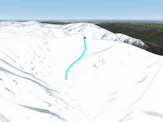
1 m away
Up to Sentinel

Both a hike and a run and nothing beats the view.
Difficult Freeride Skiing
- Distance
- 184 m
- Ascent
- 54 m
- Descent
- 0 m
Often loaded with snow, consistent fall lines and about 400 metres of vertical down into James Macarthur Creek
Freeride Skiing Difficult
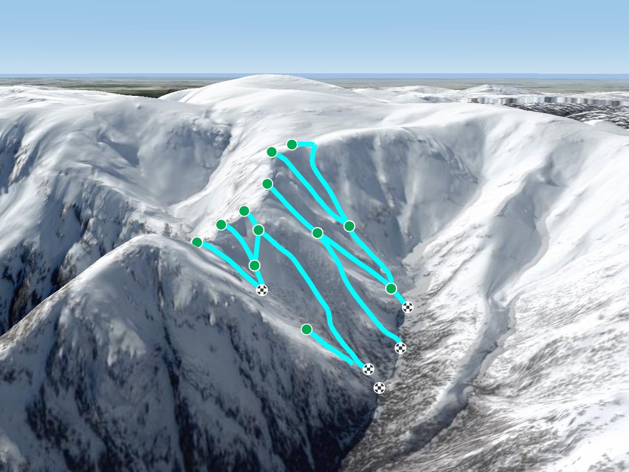
South Sentinel Ridge holds the snow incredibly well, resulting in a wide canvas for skiers and boarder to choose any line of their choosing. Running off anywhere on the south face of the ridge out to The Sentinel, this can be accessed by heading South West from Tenison Woods Knoll, and the obvious ridgeline out to The Sentinel's peak soon comes into view. The southern faces are often loaded with snow late into spring, and are one of the most commonly ridden areas close to The Sentinel. As a result, there are often many lines on offer, with those further south more craggy than those which start further along the ridge to The Sentinel. All of the lines on this side of the ridge hold a pitch of over 30 degrees, and as a result they can sometimes slide, so again take some real time to assess conditions. The snow on this side is also pretty well preserved, so freshies aren't out of the question a few days after a storm. There are three main gullies stemming from Sentinel Ridge, all of which possess some incredible skiing, and all of which are fairly easy to pick a line and negotiate. The easiest way to get back up, is to boot pack up to the saddle between The Sentinel and up towards the shoulder of Twynam. Enjoy this fantastic area.
Difficult
Serious gradient of 30-38 degrees where a real risk of slipping exists.

As well as the slope itself, there are some obstacles (such as rock outcrops) which could aggravate injury.

Little chance of being seen or helped in case of an accident.
1 m away
Both a hike and a run and nothing beats the view.
Difficult Freeride Skiing
184 m away

Seriously steep, rugged terrain out here with changeable conditions
Severe Freeride Skiing
184 m away

Amazing views with a consistent steep fall line from the peak of The Sentinel down to James Macarthur Creek
Severe Freeride Skiing
486 m away

Some of the most unforgiving lines on the continent.
Extreme Freeride Skiing
1.1 km away
Dropping down into Watsons Creek, keeping skiers left of the creek
Difficult Freeride Skiing
1.1 km away

Dropping South West of Tenison Woods Knoll, this provides a fairly open face with a variety of lines on offer leading down to Strzelecki Creek
Difficult Freeride Skiing
1.2 km away

Falling away to the west of Tenison Woods Knoll, it acts as the western boundary of The Avalanche Face, heading steeply down to Strzelecki Creek
Severe Freeride Skiing
1.2 km away

Strzelecki Creek drops sharply granting an absolutely breathtaking view of the Sentinel before plunging westwards into some of the best terrain in Australia.
Difficult Freeride Skiing
1.3 km away

One of the most picturesque lines you will ever do.
Moderate Freeride Skiing
1.4 km away

Providing some of the gnarliest terrain in the Main Range, this hidden area can provide some steep relatively hazard free skiing, or some of the most intense lines you can find in Australia.
Extreme Freeride Skiing
16 routes · Freeride Skiing · Ski Touring