92 m away
Ant Ridge

Falling away to the west of Tenison Woods Knoll, it acts as the western boundary of The Avalanche Face, heading steeply down to Strzelecki Creek
Severe Freeride Skiing
- Distance
- 985 m
- Ascent
- 0 m
- Descent
- 507 m
Dropping down into Watsons Creek, keeping skiers left of the creek
Freeride Skiing Difficult

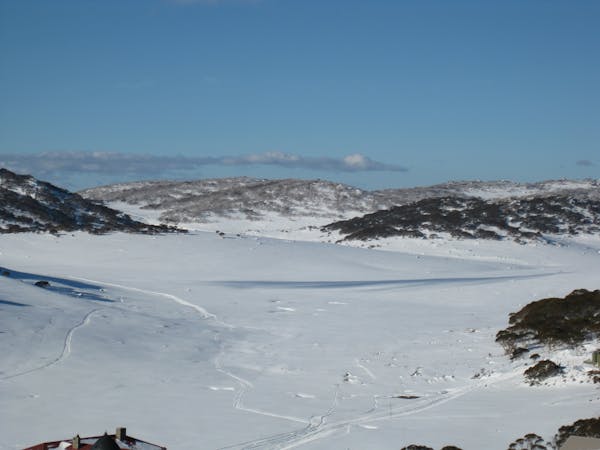
This run is essentially a permutation of Watsons Creek Run A, but rather than dropping into the bowl before Tenison Woods Knoll, you drop in within one hundred metres along the ridge to the north. Be careful not to overshoot as the ridge line after that point holds a pretty sizeable cornice, and unless you plan on launching off it, your only safe option is 500 metres down the ridge. In heavy snow years, or after fresh falls, do not try the cornice, as the amount of snow can be completely underestimated, with chunks as big as school buses being seen on more than one occasion. Through traversing further down towards the ridge line which separates Watsons Creek Catchment and Siren Song Catchment, you can find steeper lines which give you a bit more of an adrenaline rush. If you follow the ridge line, be aware that there are some serious rocky faces which should be avoided midway down, again probably best to scope from a run down the creek line before hucking and hoping. The best exit for this run is again straight up Watsons Creek back to the saddle between Twynam and Tenison woods knoll.
Difficult
Serious gradient of 30-38 degrees where a real risk of slipping exists.

As well as the slope itself, there are some obstacles (such as rock outcrops) which could aggravate injury.

Little chance of being seen or helped in case of an accident.
92 m away
Falling away to the west of Tenison Woods Knoll, it acts as the western boundary of The Avalanche Face, heading steeply down to Strzelecki Creek
Severe Freeride Skiing
148 m away

Dropping South West of Tenison Woods Knoll, this provides a fairly open face with a variety of lines on offer leading down to Strzelecki Creek
Difficult Freeride Skiing
413 m away

Strzelecki Creek drops sharply granting an absolutely breathtaking view of the Sentinel before plunging westwards into some of the best terrain in Australia.
Difficult Freeride Skiing
426 m away

One of the most picturesque lines you will ever do.
Moderate Freeride Skiing
470 m away

Featuring a large, steep rugged outcrop on the West slopes, steep long lines down to Strzelecki Creek
Severe Freeride Skiing
471 m away

Beginning north west of Tenison Woods Knoll, this area drops down steeply into Siren Song Creek catchment.
Difficult Freeride Skiing
537 m away

Providing some of the gnarliest terrain in the Main Range, this hidden area can provide some steep relatively hazard free skiing, or some of the most intense lines you can find in Australia.
Extreme Freeride Skiing
641 m away

The most common run into the Watsons Creek Bowl
Difficult Freeride Skiing
882 m away

Some of the most unforgiving lines on the continent.
Extreme Freeride Skiing
1.1 km away

Often loaded with snow, consistent fall lines and about 400 metres of vertical down into James Macarthur Creek
Difficult Freeride Skiing
16 routes · Freeride Skiing · Ski Touring