1 m away
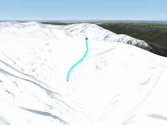
Siren Song

Beginning north west of Tenison Woods Knoll, this area drops down steeply into Siren Song Creek catchment.
Difficult Freeride Skiing
- Distance
- 851 m
- Ascent
- 1 m
- Descent
- 389 m
Featuring a large, steep rugged outcrop on the West slopes, steep long lines down to Strzelecki Creek
Freeride Skiing Severe

First of all you will need to traverse approximately five hundred metres to the west – north west of Tenison Woods Knoll along the relatively flat ridge. From that point, you will have an incredible view of Watson's Crags further on to the north west. From this point, drop down following the fall line to the west, keeping mind of the rocky outcrop which should be kept on the skiers left, unless you are keen to drop either straight through the outcrop (requiring a lot of skill, and snow depths) or head to the skiers left of the rock, which drops into a continuous fall line facing west for the whole run down to Strzelecki Creek. The first option however is the most forgiving of the runs, and is good to use to assess conditions on a questionable day, you will feed into a bowl-like gully (Walter's Gully), which turns south west about half way down, away from the cornice and spur (The Awesome Spur) which marks it's boundary. This area is a great place to find fresh snow after a fall, and also corns up fantastically in spring. However the top half of this run is exposed, and can become incredibly icy, thus it is commonly best to use the more forgiving line first to assess conditions. The best return route is to boot pack or skin up Walter's Gully.
Severe
Steep skiing at 38-45 degrees. This requires very good technique and the risk of falling has serious consequences.

As well as the slope itself, there are some obstacles (such as rock outcrops) which could aggravate injury.

Little chance of being seen or helped in case of an accident.
1 m away
Beginning north west of Tenison Woods Knoll, this area drops down steeply into Siren Song Creek catchment.
Difficult Freeride Skiing
99 m away

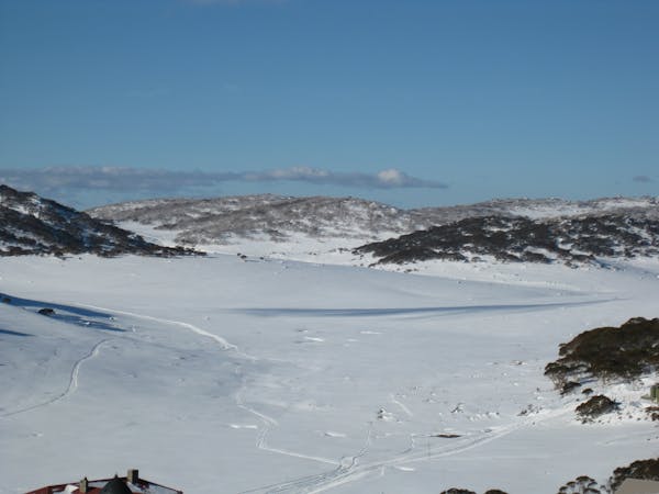
Providing some of the gnarliest terrain in the Main Range, this hidden area can provide some steep relatively hazard free skiing, or some of the most intense lines you can find in Australia.
Extreme Freeride Skiing
381 m away

Falling away to the west of Tenison Woods Knoll, it acts as the western boundary of The Avalanche Face, heading steeply down to Strzelecki Creek
Severe Freeride Skiing
470 m away
Dropping down into Watsons Creek, keeping skiers left of the creek
Difficult Freeride Skiing
606 m away

Dropping South West of Tenison Woods Knoll, this provides a fairly open face with a variety of lines on offer leading down to Strzelecki Creek
Difficult Freeride Skiing
855 m away

Strzelecki Creek drops sharply granting an absolutely breathtaking view of the Sentinel before plunging westwards into some of the best terrain in Australia.
Difficult Freeride Skiing
865 m away

One of the most picturesque lines you will ever do.
Moderate Freeride Skiing
1 km away

The most common run into the Watsons Creek Bowl
Difficult Freeride Skiing
1.3 km away

Some of the most unforgiving lines on the continent.
Extreme Freeride Skiing
1.4 km away

Often loaded with snow, consistent fall lines and about 400 metres of vertical down into James Macarthur Creek
Difficult Freeride Skiing
16 routes · Freeride Skiing · Ski Touring