299 m away
Schlegeis

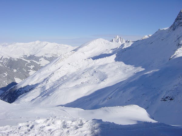
An easily accessible route down to the Schlegeis chairlift
Difficult Freeride Skiing
- Distance
- 1.2 km
- Ascent
- 0 m
- Descent
- 375 m
A short route which is easily accessible.
Freeride Skiing Difficult

This route is not that spectacular, but on bad days on top of the glacier, this is the best spot you can find. When you get to the top with the Gletscherbus 3 you will see the race pistes in front of you. Go straight to them and you will notice some metal gates leading to the side, limiting the race pistes. Go through the gap of the barriers and you will enter a nice hill behind. You can have a descent of 500 metres here, at the second half, there the hill is getting a bit tighter, because of some rocks on the right hand, but just follow the hill/channel here and you won't get in any troubles. At the end you will come back to the slope you left on the beginning and here you can head to the Gefrorene Wand T-Bar and head for the next run.
Difficult
Serious gradient of 30-38 degrees where a real risk of slipping exists.

As well as the slope itself, there are some obstacles (such as rock outcrops) which could aggravate injury.

Close to help in case of emergency.
299 m away
An easily accessible route down to the Schlegeis chairlift
Difficult Freeride Skiing
613 m away

A breathtaking route here in Hintertux, the biggest and longest adventure in these parts.
Severe Freeride Skiing
615 m away

A short but impressive route on a wide glacier hill.
Difficult Freeride Skiing
1.5 km away

A sunny line, recommended in Spring
Difficult Freeride Skiing
1.6 km away

A short but intense line
Difficult Freeride Skiing
1.8 km away

A sunny, nice ride with a small channel at the end.
Difficult Freeride Skiing
4.2 km away

An easy route with a short hike which is nice on busy days
Difficult Freeride Skiing
4.6 km away

A short hike for long and joyful descent
Difficult Freeride Skiing
4.6 km away

This route is a classic line here in Hintertux. Easy accessible, there is only a short hike needed.
Difficult Freeride Skiing

7 routes · Freeride Skiing
7 routes · Freeride Skiing

10 routes · Freeride Skiing

10 routes · Freeride Skiing