299 m away
Gefrorene Wand

A short route which is easily accessible.
Difficult Freeride Skiing
- Distance
- 708 m
- Ascent
- 0 m
- Descent
- 219 m
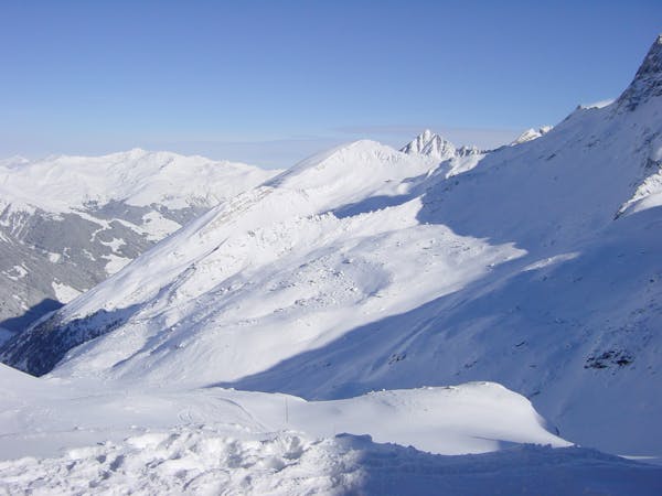
An easily accessible route down to the Schlegeis chairlift
Freeride Skiing Difficult

The route is easy accessible and you can choose your line when riding the Schlegeis chairlift. When you exit the Gletscherbus 3 at the highest point of the glacier you need to follow the slope number 5 and before it gets steep you need to pass the metal gates on the left side of the slope. Beside the slope there is a small channel you need to follow for 300 metres until you can enter the south hill to the left. Pay attention to rocks when there is not much snow. Stay on the left at the first part for 200 metres and enjoy the snow on this long run, until you see a depression on your right. Here you need to stay on the left about 50 metres away from the chairlift. Now you can follow a wide channel, where you can cross the chairlift line. Follow this channel, until it leads over a small hill. From here you can ski the last metres down to the bottom station of the lift. When there is enough snow it is also possible to enter the route when you exit the Schlegeis chairlift and shift over to the right side. For this route you need a lot snow, because the ground are rocks and if you go there in November, the chance of destroying your beloved skis is very high. In spring it is even more fun, when it is sunny and you have some firm snow.
Difficult
Serious gradient of 30-38 degrees where a real risk of slipping exists.

As well as the slope itself, there are some obstacles (such as rock outcrops) which could aggravate injury.

Close to help in case of emergency.
299 m away
A short route which is easily accessible.
Difficult Freeride Skiing
707 m away

A breathtaking route here in Hintertux, the biggest and longest adventure in these parts.
Severe Freeride Skiing
709 m away

A short but impressive route on a wide glacier hill.
Difficult Freeride Skiing
1.2 km away

A sunny line, recommended in Spring
Difficult Freeride Skiing
1.4 km away

A short but intense line
Difficult Freeride Skiing
1.6 km away

A sunny, nice ride with a small channel at the end.
Difficult Freeride Skiing
4.3 km away

An easy route with a short hike which is nice on busy days
Difficult Freeride Skiing
4.7 km away

A short hike for long and joyful descent
Difficult Freeride Skiing
4.7 km away

This route is a classic line here in Hintertux. Easy accessible, there is only a short hike needed.
Difficult Freeride Skiing

7 routes · Freeride Skiing
7 routes · Freeride Skiing

10 routes · Freeride Skiing

10 routes · Freeride Skiing