1.7 km away
Geisleger

A classic Albona long wide open run finishing in the town of Stuben.
Moderate Freeride Skiing
- Distance
- 3.9 km
- Ascent
- 50 m
- Descent
- 1 km
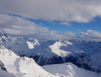
Beautiful run facing west from Wirt.
Freeride Skiing Difficult

This route is a great alternative from our Peischelkopf route: https://fatmap.com/routeid/2738569/peischelkopf?fmid=cp
Instead of dropping at Peischelkopf, you stay short of reaching the peak of Peischelkopf and ski passing Wirt (short second ascent). This gives you access to a beautiful run facing west.
At some stage drop left, the standard run takes you just below St. Christoph, at the end of a road gallery. There is a trail next to it, walk up into the village from here to re-enter into the resort. You can also ski down all the way to Wagner Huette which has a bus stop. The bus intervals are long though, taxi might be a better option back to St. Anton in this case. Fun run.
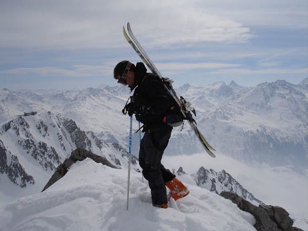
Difficult
Serious gradient of 30-38 degrees where a real risk of slipping exists.

As well as the slope itself, there are some obstacles (such as rock outcrops) which could aggravate injury.
Away from help but easily accessed.
1.7 km away
A classic Albona long wide open run finishing in the town of Stuben.
Moderate Freeride Skiing
2 km away

An Arlberg classic run for experienced skiers and riders.
Difficult Freeride Skiing
2.7 km away

An enjoyable south facing run over St.Christoph.
Moderate Freeride Skiing
2.8 km away

A great run in powder and spring snow.
Difficult Freeride Skiing
3.9 km away

Superb long run with often deep powder.
Difficult Freeride Skiing
4.5 km away

Challenging terrain for the experienced on leeside slopes.
Severe Freeride Skiing
4.5 km away
Freeride tour for skiers & split-boarders
Difficult Freeride Skiing
6.2 km away

A superb wide open run with great views. A classic Zurs freeride.
Difficult Freeride Skiing
6.3 km away

A nice moderate open run down to Zurs-worth the traverse.
Moderate Freeride Skiing
6.4 km away

A good run for dry powder in the Zurs front country.
Moderate Freeride Skiing
10 routes · Freeride Skiing