6 m away
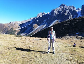
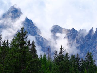
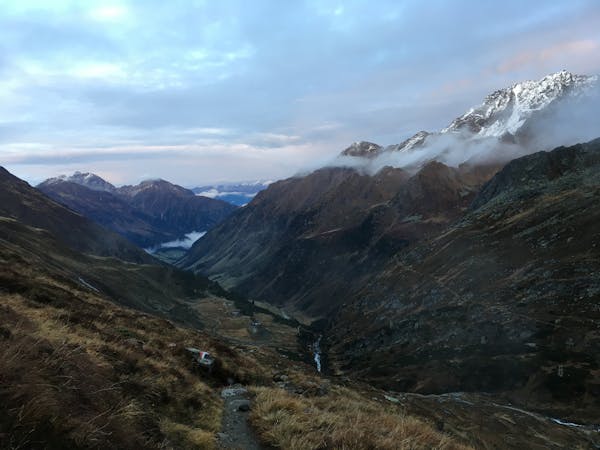
Crossing the Kalkkögel
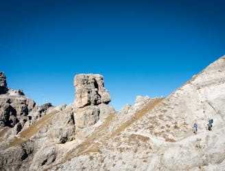
An atmospheric and wild-feeling hike through Tirol's finest mountains.
Difficult Hiking
- Distance
- 9.1 km
- Ascent
- 383 m
- Descent
- 1.4 km
A brilliant short hike via the Hochtennbodensteig which takes you through some of the finest rock architecture in Austria in return for minimal physical effort!
Hiking Difficult

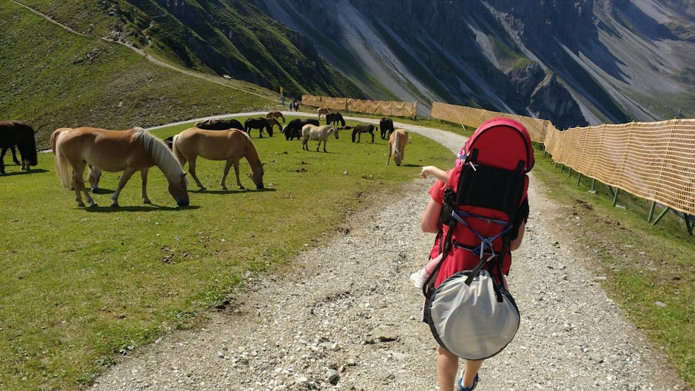
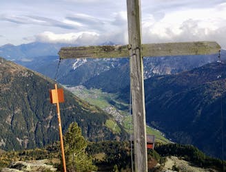
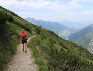
The route starts and finishes at the Axamer Lizum carpark. In winter this is crowded with skiers all hunting the famous powder runs and freeride lines of "The Lizum" but in summer it is relatively quiet and remote-feeling. It is only a 30 minute drive from Innsbruck city centre but it feels like a different world!
Axamer Lizum has been the scene of many Olympic events in the past (Innsbruck held the Winter Olympics in 1964 and 1976 and Axamer Lizum hosted all of the alpine skiing races in both events) and as such, the main lift of the resort (and the start point for this hike) is called the Olympiabahn.
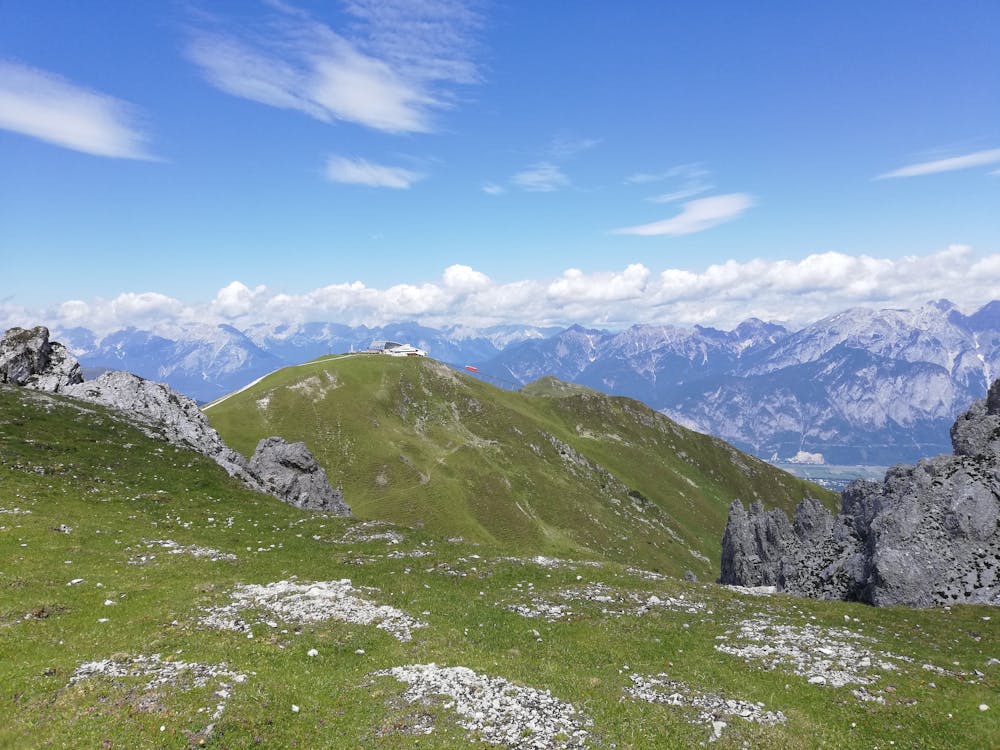
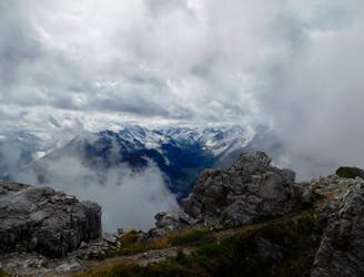
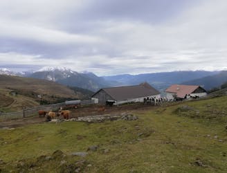
Ride this lift, which is a (now quite antiquated) train to the Hoadlhaus restaurant. Have a drink and soak in the stunning views across the rocky Kalkögel peaks and the distant summits of the Ötztal. Having finished your drink, descend to the Hoadlsattel col (2264 metres). The jeep track turns left but you need to go straight on and then undulate around to the Widdersbergsattel col, on to the Schneiderspitze peak and then finally to the Birgitzköpflhaus restaurant. The path is always clear but it can be steep in places and there are sections of scree to cross too.
Once at the Birgitzköpflhaus restaurant grab a bite to eat and ride the Birgitzköpfl chairlift down.
N.B. The Olympiabahn lift is open every day between July 1st and October 1st but the Birgitzköpflhaus lift is only open on Fridays, Saturdays and Sunday during the summer.
Difficult
Hiking trails where obstacles such as rocks or roots are prevalent. Some obstacles can require care to step over or around. At times, the trail can be worn and eroded. The grade of the trail is generally quite steep, and can often lead to strenuous hiking.

The trail contains some obstacles such as outcroppings and rock which could cause injury.

Little chance of being seen or helped in case of an accident.
6 m away
An atmospheric and wild-feeling hike through Tirol's finest mountains.
Difficult Hiking
1.4 km away
A short but densely packed journey through some fabulous mountain scenery.
Moderate Hiking
4.6 km away
A beautiful summit which is famous for being the first ever Alpine peak climbed by Sir Edmumd Hillary!
Difficult Hiking
5.1 km away

An easy hike with a picturesque lake and mountain view.
Moderate Hiking
7.6 km away

One of the smaller hiking tours in Stubaital to the beautiful Kaserstattalm.
Difficult Hiking
7.7 km away
An incredibly wild-feeling trip through some wonderful scenery.
Difficult Hiking
7.8 km away
Summit a peak in the heart of the Stubaital and visit one of the area's best mountain huts
Severe Hiking
8.5 km away

This route is made for everyone who loves easy ridge hiking.
Difficult Hiking
9.4 km away
An ideal trip for families to a truly unique mountain restaurant.
Easy Hiking
9.9 km away
A wonderful, mid-length, circular hike with impressive scenery through the dramatic peaks of the Stubai Valley.
Difficult Hiking
9 routes · Alpine Climbing · Hiking
4 routes · Hiking

5 routes · Hiking

9 routes · Hiking

25 routes · Hiking
3 routes · Mountain Biking · Hiking
7 routes · Hiking